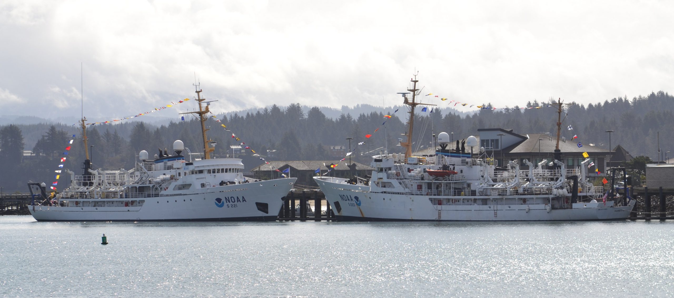
To recognize the successful history of NOAA ships Fairweatherand Rainier, as well as the professional mariners, hydrographers, and commissioned officers who have served aboard these ships for the last 50 years, NOAA hosted a ceremony and public ship tours at the Marine Operations Center – Pacific (MOC-P) in Newport, Oregon.
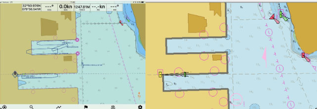
NOAA’s Office of Coast Survey quickly updated NOAA electronic navigational charts (NOAA ENC®) to accurately reflect the 225 foot expansion of a slip in Port Everglades, Florida. Now at a total length of 1,125 feet, the elongated slip allows larger ships to dock with confidence. The Port Everglades Pilots – maritime pilots who maneuver ships through crowded harbors and confined waters – requested the chart update. With ENCs that accurately reflect the slip expansion in their hands, pilots can easily communicate to vessel captains that it is safe to dock their vessels in the slip.
Port Everglades is one of the top three cruise ports in the world, and is among the most active cargo ports in the United States. Every slip is kept in high use, and Coast Survey used a new data process that allowed the most critical and valuable information to be applied quickly and made available to the end user.
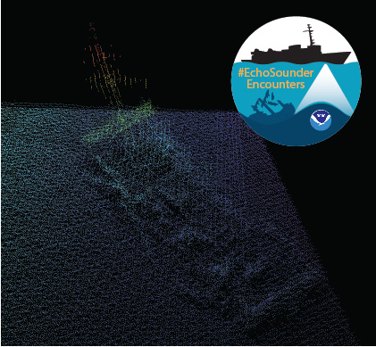
In late spring, while surveying off the coast of Long Island in Kodiak, Alaska, NOAA Ship Rainier found an uncharted shipwreck. Although rocks around the shipwreck were previously charted, this sunken vessel is a new feature. What made the find unique was how the top of wreck’s mast resembled a yellow light at the water’s surface. The Rainier crew fondly nicknamed it “ET’s finger.”
Mast of the sunken vessel found during the survey of Kodiak Island, AK, OPR-P136-RA-17. It was discovered by HAST Michael Bloom while on the NOAA Ship Rainier, in May 2017.
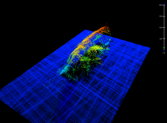
During the survey, Rainier was able to sail close enough to get multibeam echo sounder data over the shipwreck and record a shoal depth.
Multibeam echo sounder data depicting the shipwreck found off the coast of Long Island in Kodiak, Alaska.
Long Island was once the home ofFort Tidball, a World War II coastal fort established in 1941 and abandoned in 1946. NOAA received permission from the Alaska State Historic Preservation Office to share information about this shipwreck and is currently working to identify the ship.
Why is NOAA surveying around Kodiak Island? The area of Chiniak Bay supports the second busiest and third richest fisheries port in Alaska. In 2015, the Port of Kodiak was responsible for 514 million pounds of fish and $138 million of product. Chiniak Bay is the gateway to Kodiak and has a survey vintage of 1933. This area has seen many groundings and near misses due to the number of dangers to navigation and pinnacles that exist in this area. The navigation of this area is further complicated by the number vessels trying to enter and exit the Port of Kodiak via a choke point located at the channel entrance buoy. In recent years, a number of groundings in and around the area have occurred, the most famous being a 174-foot Army landing craft that was outbound to deliver goods to a remote village in western Alaska in 2012.
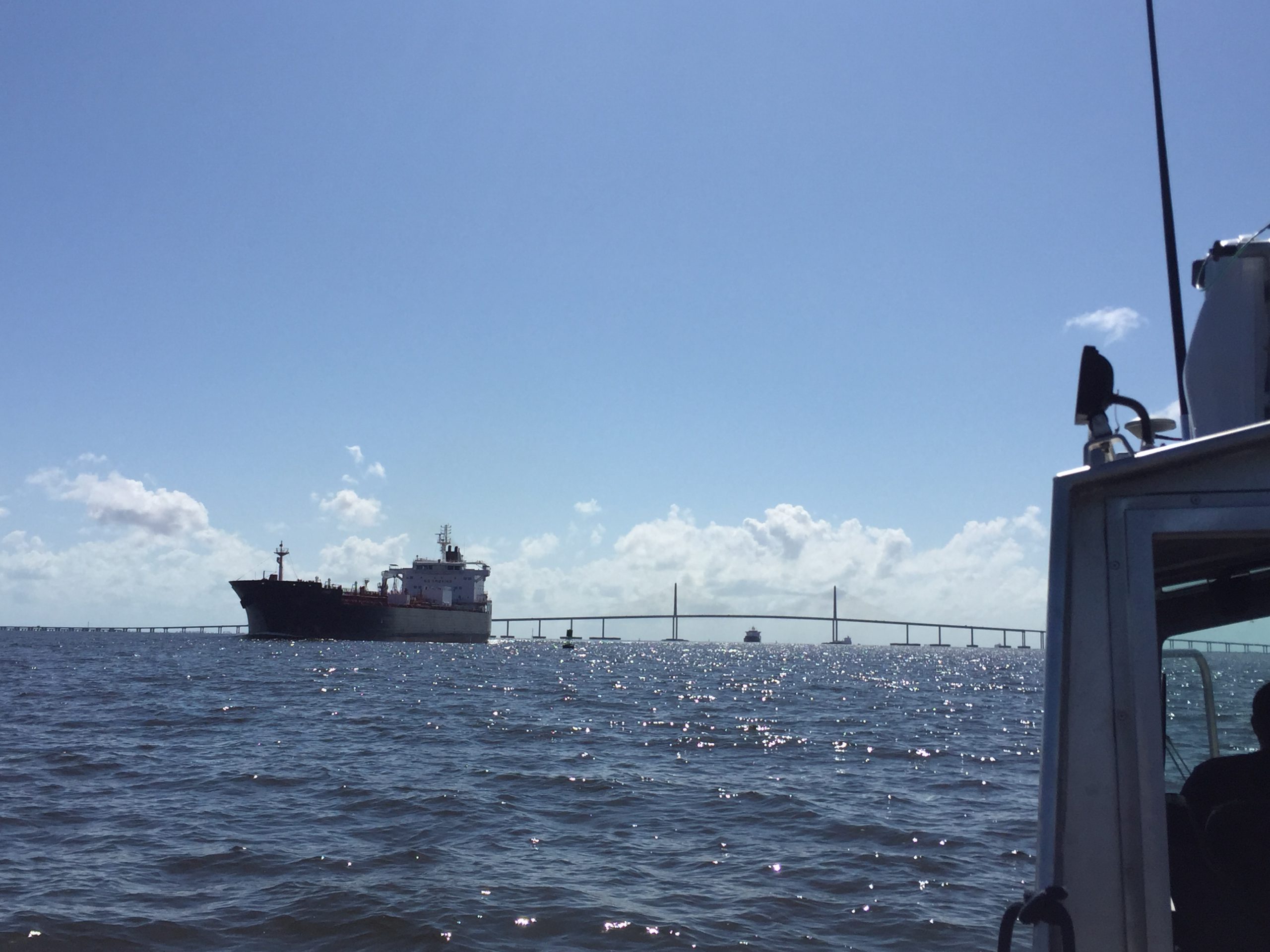
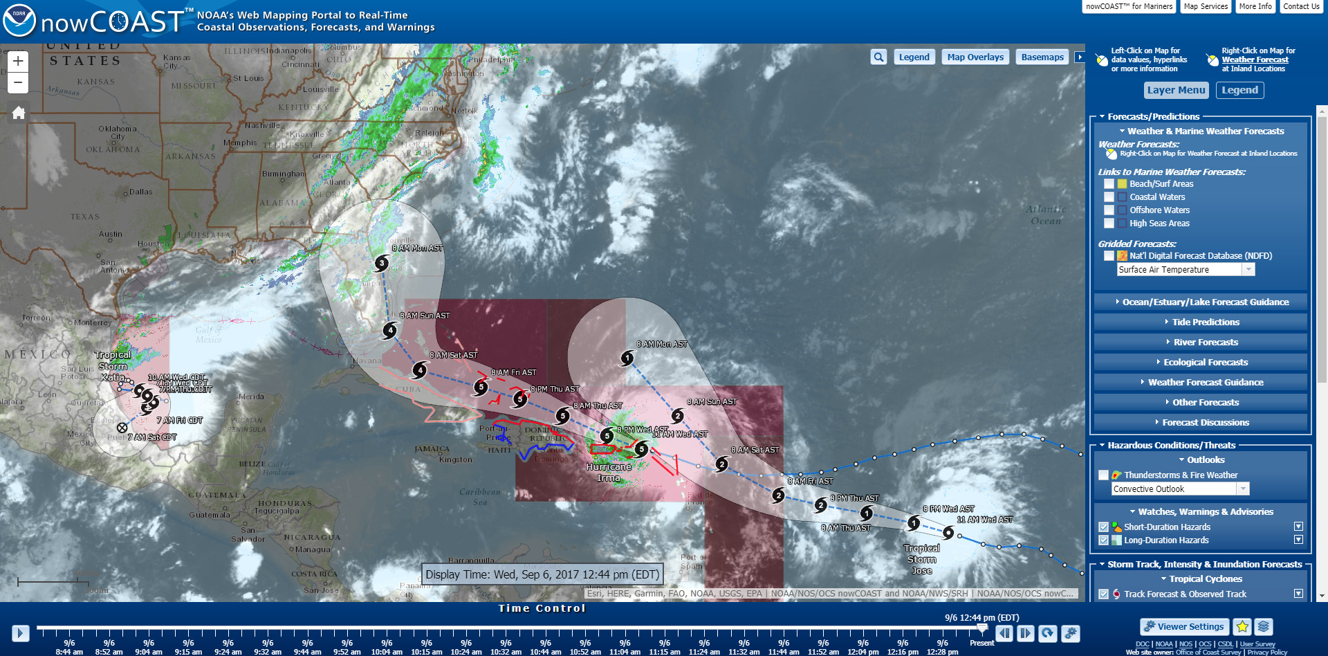
Hurricane Maria struck the U.S. Virgin Islands (USVI) and Puerto Rico on Wednesday, September 21, as a strong Category 4 hurricane. The storm brought sustained winds of 150 mph and dropped over 18 inches of rain in some areas. Although these islands have seen their fair share of hurricanes and tropical storms, the last storm of this intensity to hit Puerto Rico was the San Felipe Segundo hurricane in 1928. The widespread flooding, winds, and storm surge from Hurricane Maria devastated the islands leaving them without power and their critical ports paralyzed as debris, shoaling, and damaged infrastructure prevents large vessels from entering safely.
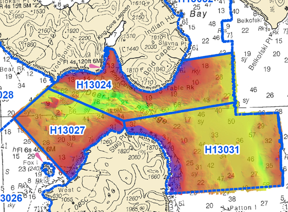
NOAA Ship Rainierhas been diligently surveying Deer Passage in the vicinity of Cold Bay and King Cove, Alaska, for the past month.
This navigationally significant area between Unga Strait and Sanak Island provides the only protected route for vessels transiting between the Gulf of Alaska, the very busy Unimak Passage, and the Bering Sea beyond. Deer Passage is heavily trafficked by fishing vessels, coastal freight traffic, and Alaska Marine Highway System ferries, and serves as an alternate route for deep-draft vessels on Trans-Pacific routes between North America and Asia. While in the area, Rainier observed particularly heavy use of the waterway by vessels engaged in local and Bering Sea fisheries, and towing vessels supporting remote Alaskan communities with barge service.
For the NRTs, this meant traveling hundreds of miles with a survey vessel in tow, facing challenges such as locating fueling stations, finding available lodging, and finding opportunities to rest. For the mobile integrated survey team(MIST), which is available to travel anywhere in the U.S. when hydrographic survey assistance is needed by the U.S. Coast Guard (USCG) or U.S. Army Corps of Engineers (USACE), this meant finding transportation to a disaster area and a “vessel of opportunity” to survey from once there.
As Hurricane Irma approaches Puerto Rico as a Category 5 storm, NOAA is positioning personnel and hydrographic survey assets to help speed the resumption of shipping post storm. In the wake of a hurricane, NOAA’s personnel and survey assets provide essential information when ports need to quickly but safely re-open, limiting significant economic losses caused by prolonged disruptions to the maritime transportation system.
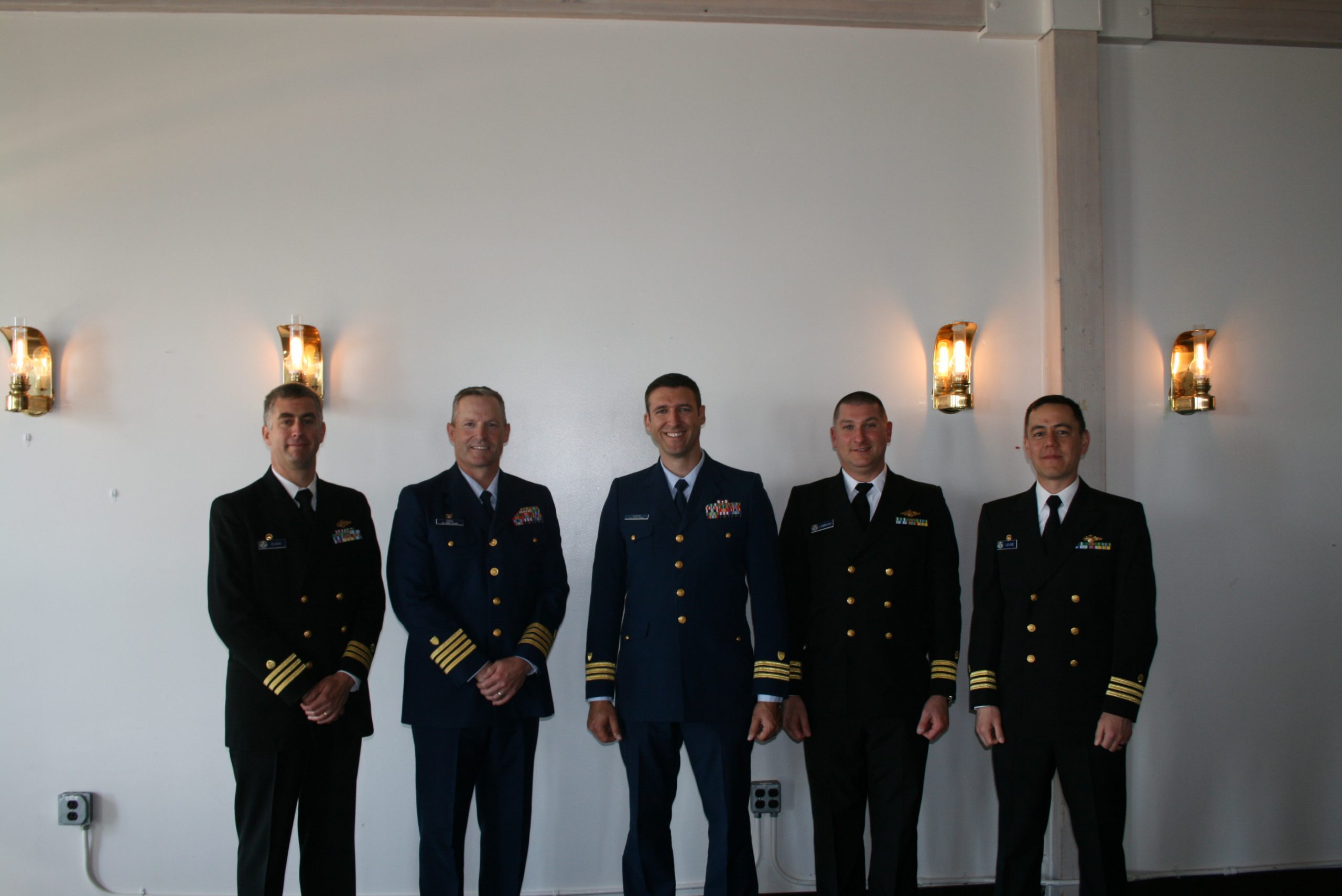
On July 22, 2017, the crew of NOAA Ship Rainier hosted a change of command while at United States Coast Guard Base Kodiak, Alaska.
Commander Benjamin Evans accepted command of Rainier, relieving Commander John Lomnicky in a ceremony led by Captain Keith Roberts, commanding officer of NOAA’s Office of Marine and Aviation Operations (OMAO) Marine Operations Center-Pacific. Distinguished guests included Captain Richard Brennan, chief of NOAA Office of Coast Survey’s Hydrographic Surveys Division, Mr. Greg Kaplan, Military and Veterans Affairs liaison for Senator Lisa Murkowski, Captain Jeffery Good, commanding officer United States Coast Guard (USCG) Base Kodiak, Commander Michael Levine, commanding officer of NOAA Ship Oscar Dyson, and Commander Daniel Rogers, executive officer of United States Coast Guard Base Kodiak. Continue reading “NOAA Ship Rainier holds change of command ceremony”