NOAA welcomes local and international attendees at 2018 Nautical Cartography Open House

RDML Tim Gallaudet (Navy, ret.) with Sean Leger of Coast Survey

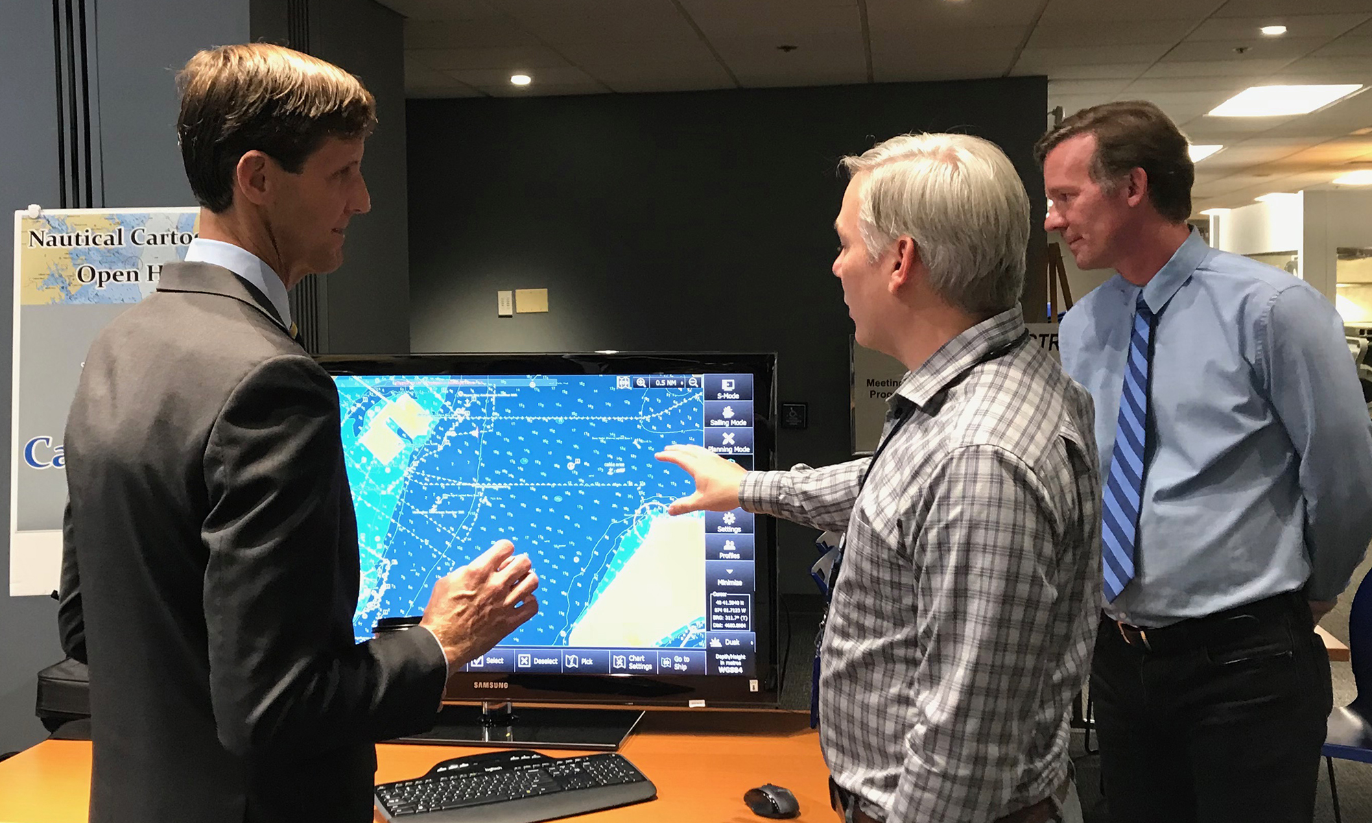
Last week NOAA Coast Survey welcomed approximately 170 attendees representing 17 countries to the 2018 Nautical Cartography Open House. Industry partners, members of the public, and other government agencies attended, including the Bureau of Ocean Energy Management, Naval Hydrographic and Oceanic Service (SHOM) from France, Canadian Hydrographic Service, Dalian Naval Academy, National Taiwan Ocean University, and the Joint Hydrographic Center/Center for Coastal and Ocean Mapping (JHC/CCOM).
Continue reading “NOAA welcomes local and international attendees at 2018 Nautical Cartography Open House”

NOAA hosts 2018 Chart Adequacy Workshop

On July 23, NOAA Coast Survey hosted a three-day Chart Adequacy Workshop that included participants from 13 countries. This is the fourth Chart Adequacy Workshop held at NOAA’s Silver Spring, Maryland campus.

The participants of the 2018 Chart Adequacy Workshop.
Participants and instructors of the 2018 Chart Adequacy Workshop.

The main goal of the workshop is to provide training for professional cartographers and hydrographers on techniques for assessing nautical chart adequacy using publicly-available information, such as satellite images and maritime automatic identification system (AIS) data. The participants received an overview on Coast Survey datasets, processes, and requirements for nautical charts. They also learned about preprocessing hydrographic data, such as loading charts, uploading imagery, and applying electronic navigation charts (ENCs) and AIS point data. Through a series of lab units, the attendees practiced performing the concepts they learned. Continue reading “NOAA hosts 2018 Chart Adequacy Workshop”

First U.S. federal channel using USACE survey data receives improved quality classification from NOAA

By Rachel Medley

The U.S. federal channel in the Delaware Bay is vital to maritime commerce, leading deep draft vessel traffic to and from the major ports of Wilmington, Delaware,  Philadelphia, Pennsylvania, and Camden, New Jersey. To navigate this federally maintained waterway safely and efficiently, mariners rely on the surveyed depths displayed on nautical charts. The U.S. Army Corps of Engineers (USACE) Philadelphia District regularly surveys this area, utilizing sophisticated techniques and equipment to map the depths of the seafloor. NOAA’s Office of Coast Survey, in turn, adds quality classifications to these channel depths and displays them on the nautical chart.
The portion of the federal channel from Newbold Channel Range down to the mouth of the Delaware Bay is the first waterway in the U.S. to have an improved quality classification assigned to USACE survey data—category of zone of confidence (CATZOC)  A2. Improving survey quality and upgrading the CATZOC classification allows operators to accommodate smaller margins of error while still ensuring that navigating maritime approaches and constrained environments remain safe. These decreased tolerances allow ships to maximize their loads, ultimately increasing inbound and outbound cargoes.
Continue reading “First U.S. federal channel using USACE survey data receives improved quality classification from NOAA”

Poster symposium marks milestone for inaugural class of the NOAA certification program in nautical cartography

NOAA’s Christie Ence (left), Megan Bartlett (third from left), and Noel Dyer (right) explain their posters to attendees of the poster symposium at the University of Maryland.

Students of NOAA’s certification program in nautical cartography completed their final projects and presented them along with other Master of Professional Studies in GIS students during a poster symposium at the University of Maryland’s Department of Geographical Sciences. At the event, NOAA students explained their capstone projects and described how their research benefits nautical charting at NOAA. Project topics included:

  • Improving Shoreline Application to NOAA Electronic Navigational Charts, Megan Bartlet
  • An Automated Approach to Generate Nautical Vector Features from Raster Bathymetric Attributed Grid Data, Noel Dyer
  • Developing a Rasterization Procedure for Vector Chart Data, Christie Ence
  • NOAA Chart Discrepancies: A Temporal and Spatial Analysis for Navigation Response Teams, Lt. Cmdr. Matt Forney
  • Airborne Lidar Bathymetry’s Impact on NOAA Charts, Andres Garrido
  • Validating and Refining the Proposed Rescheming of NOAA Electronic Navigational Charts, Colby Harmon
  • High Resolution Bathymetry as an Alternative to Charting Controlling Depths in U.S. Army Corps of Engineers Channels, Craig Winn
  • Satellite Derived Bathymetry: An Alternative Analysis to Nautical Chart Updates, Aleah Worthem

Continue reading “Poster symposium marks milestone for inaugural class of the NOAA certification program in nautical cartography”

NOAA adds grid overlay to chart anchorage areas in Port of New York and New Jersey

A grid overlay of anchorage grounds in the updated Port of New York and New Jersey ENCs, US5NY19M and US5NY1CM

NOAA Coast Survey recently released updates for two NOAA electronic navigational charts (NOAA ENC®) in the Port of New York and New Jersey, which added a permanent grid system overlay to anchorages in Bay Ridge, Graves End, and Stapleton. Coast Survey performed the update at the request of the Harbor Operations Steering Committee and collaborated with the Sandy Hook Pilots Association and U.S. Coast Guard (USCG) Sector New York’s Vessel Traffic Services (VTS). 
Continue reading “NOAA adds grid overlay to chart anchorage areas in Port of New York and New Jersey”

Navigating waters before GPS: Why some mariners still refer to Loran-C

by Nick Perugini
One of the most popular recurring questions received by NOAA’s Office of Coast Survey involves customers – typically fishermen – wanting to obtain a chart with a Loran-C navigation grid on it. Here are a few inquiries from NOAA’s Nautical Inquiry & Comment System:

  • Hello, I was wondering if it is still possible to purchase or locate older editions of Lake Huron charts (14862-3-4) with the LORAN-C overlay. Many older wrecks and reported snags are still in Loran and have not been converted to GPS. Artificial algorithms are difficult to use when plotting grids. Any help you can give me is much appreciated.
  • Is it possible to access Loran-C charts of New England from prior to 2009 when NOAA stopped published with the LORAN-C lines? THANKS!
  • I was wondering if there was a way for me to buy a chart that has LORAN lines and notes on it? I understand that all of the new charts no longer have this information on them. I am most interested in Chart 11520, Cape Hatteras to Charleston. I didn’t know if there might be an archived form of this chart that shows the LORAN features. Any help in finding a chart like this would be greatly appreciated.

Continue reading “Navigating waters before GPS: Why some mariners still refer to Loran-C”

Online NOAA Custom Chart lets boaters create their own charts

NOAA Custom Chart makes it easy for users to create a personalized chart.

A prototype version of a powerful new online tool, NOAA Custom Chart, is now available for boaters and other nautical chart users. The application enables users to define the scale and paper size of custom-made nautical charts centered on a position of their choosing. Once the functionality of this prototype is fully developed, NOAA Custom Chart will be an easy way for boaters to create a paper or digital back-up for the electronic chart system or other GPS-enabled chart display that they are using on board.
Continue reading “Online NOAA Custom Chart lets boaters create their own charts”

NOAA RNC Tile Service displays first ENC-only product

The Merrimack River, located in Massachusetts, is just south of the New Hampshire border.The single chart tile set is named​ 13274K0000_1.

NOAA Office of Coast Survey released its 1:12,000 electronic navigational chart (NOAA ENC®of the Merrimack River, Massachusetts, in the RNC Tile Service. This is the first time a navigational chart—created solely as ENC product—is included in the tile service. The tile service renders a traditional depiction of the nautical chart for use with GPS-enabled electronic chart systems or other “chart plotter” display systems to provide real-time vessel positioning for recreational mariners. This chart is included in the single chart tile sets and the quilted tile sets both in the online and offline versions. Continue reading “NOAA RNC Tile Service displays first ENC-only product”

NOAA surveys for recreational boat traffic safety in Tampa Bay

Multibeam echo sounder coverage. Credit: NOAA

NOAA’s navigation response team 2 (NRT2), homeported in Fernandina Beach, Florida, conducted a survey around the Sunshine Skyway Bridge, which spans Tampa Bay. The U.S. Coast Guard (USCG) and additional members of the Tampa Bay Harbor Safety Committee requested the work and expressed interest in establishing alternate routes for recreational boating traffic. Alternative routes will alleviate increasing congestion where the main ship channel passes beneath the bridge. This area is naturally restrictive to navigation and, as a result, there have been multiple accidents and near accidents here in the past. Continue reading “NOAA surveys for recreational boat traffic safety in Tampa Bay”

Have a question for NOAA Coast Survey? Meet our “Answer Man”

By Nick Perugini

Nick PeruginiAs the nation’s nautical chartmaker, NOAA Office of Coast survey serves a wide range of customers ranging from recreational boaters and operators of cargo ships, to historical chart enthusiasts. Customers throughout the world send us questions, comments, and also chart discrepancy reports, letting us know they found an error on a chart. As the Coast Survey “Answer Man,” I manage this communication, including Coast Survey’s response. Customers submit inquiries through our Inquiry and Discrepancy Management System (IDMS) database. Continue reading “Have a question for NOAA Coast Survey? Meet our “Answer Man””