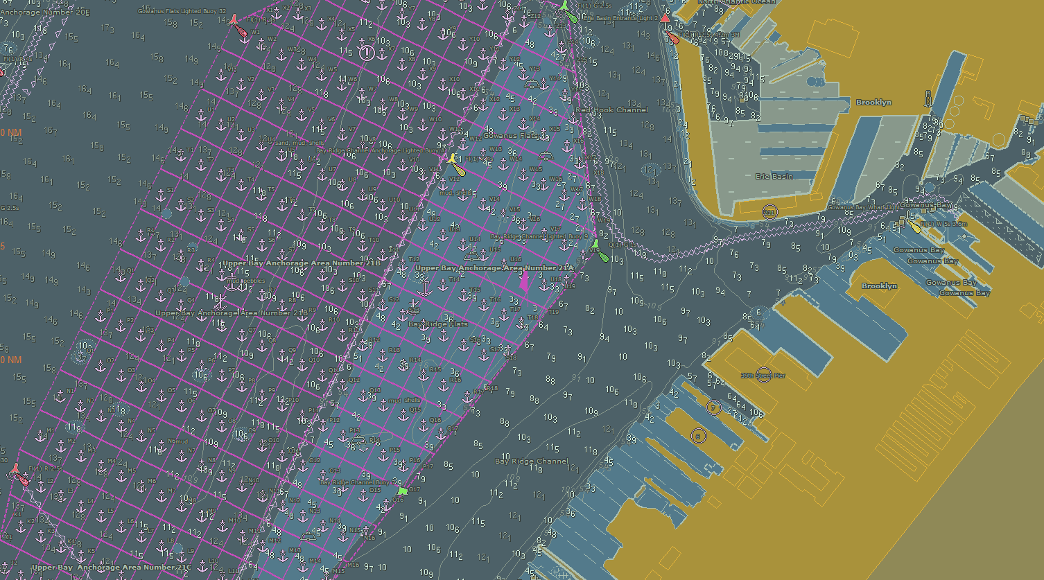
NOAA Coast Survey recently released updates for two NOAA electronic navigational charts (NOAA ENC®) in the Port of New York and New Jersey, which added a permanent grid system overlay to anchorages in Bay Ridge, Graves End, and Stapleton. Coast Survey performed the update at the request of the Harbor Operations Steering Committee and collaborated with the Sandy Hook Pilots Association and U.S. Coast Guard (USCG) Sector New York’s Vessel Traffic Services (VTS).
The overlays, created by the Sandy Hook Pilots, consist of parallel and vertical lines that are labeled and charted over the anchorage areas. The VTS adopted this grid system overlay and uses it to assign specific anchorage locations for ship pilots and captains of tug and barge combinations.

“Incorporating these overlays in an ENC will increase safety and efficiency in the port’s limited anchorage space. VTS will be able to clearly direct a vessel to a specific grid location, and that vessel will be able to see the location on their electronic chart system,” said USCG Capt. M.H. Day, Captain of the Port, Sector New York.
Coast Survey prioritizes new data for chart updates as being either “critical” or “routine” (i.e. “non-critical.”) Critical corrections – items that pose an immediate danger to mariners – are published by the USCG in their weekly Local Notices to Mariners. Mariners who purchased a paper copy of a NOAA chart may hand correct their chart or purchase an updated chart from one of NOAA’s certified print agents. Digital versions of the charts are updated each week with items published in the USCG Local Notice to Mariners. Mariners interested in seeing where both critical and routine corrections fall on a given chart each week can use the Weekly Updates Site. Updates to this site are underway which will provide mariners greater flexibility in viewing an accumulation of changes over a specified date range rather than viewing them week by week.

News and Updates
