NOAA Ship Thomas Jefferson tests innovative DriX unmanned surface vehicle

Drone photo of the DriX underway from the ship with the DDS still in the water.

By Ens. Taylor Krabiel

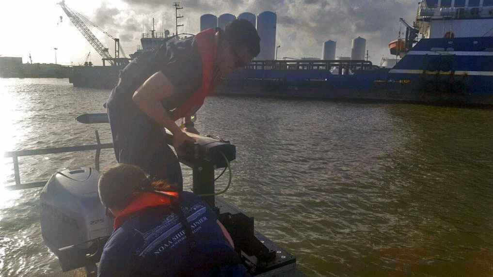
During the month of October, NOAA Ship Thomas Jefferson integrated and operated a DriX, an Unmanned Surface Vessel (USV) created by the French technology company iXblue. The primary goal of the project was to test iXblue’s unique deployment and recovery solution specifically designed for Thomas Jefferson’s on board survey launch davit. Survey launches are limited to daylight operations and deployment and recovery are the most challenging operations the ship undertakes. Utilizing a DriX for continuous survey operations without having to recover and/or service it for up to four days straight would significantly increase the ship’s efficiency.

Continue reading “NOAA Ship Thomas Jefferson tests innovative DriX unmanned surface vehicle”

NOAA responds to bridge damage near Houston following Tropical Depression Imelda

Overview of multibeam and side scan sonar data overlaid on chart 11329.

While many are aware that hurricanes can inflict costly damage when they make landfall, tropical storms and depressions are not to be underestimated. Tropical Depression Imelda moved over the Texas coast in mid-September producing heavy rain and causing extensive flooding. Nine barges broke free from their mooring on the San Jacinto River and two of these barges hit the Interstate 10 bridge in Lynchburg, Texas. At the request of the U.S. Coast Guard Captain of the Port Houston-Galveston, NOAA’s Navigation Response Team (NRT)- Stennis was called in for rapid hydrographic survey response.

Continue reading “NOAA responds to bridge damage near Houston following Tropical Depression Imelda”

NOAA supports safe ferry transit in Puget Sound

NRT-Seattle with the F/V Salish.

By Lt. j.g. Michelle Levano

If you have spent time on the water in Puget Sound, you have probably seen the large, distinct green and white vessels. These vessels move passengers, vehicles, and cargo across Puget Sound to the San Juan Islands and to Victoria, Canada, year round. They are a part of the Washington State Department of Transportation ferry system. The state has been operating ferries since 1951, and intended to run the ferry service until cross Sound bridges could be built.  These bridges were never built, and the state continues to operate the ferries to this day. As of last July, there are 22 state-operated ferries on Puget Sound, with the largest vessel able to carry 2500 passengers and 202 vehicles. 

Continue reading “NOAA supports safe ferry transit in Puget Sound”

Hawaiian island surveys will update nautical charts and support habitat mapping efforts

Three of Rainier’s hydrographic survey launches moored in Kahului Harbor, Maui.

By Ens. Lyle I. Robbins

For more than 50 years, NOAA Ship Rainier and its hydrographic survey launches have surveyed the Pacific seafloor. During this time, Rainier sailed thousands of miles, including the entire U.S. west coast, Alaska, and Hawaii. This year, Rainier expands on its traditional role of hydrographic survey and is supporting dive operations in the Northwest Hawaiian Islands and in the Papahānaumokuākea Marine National Monument. While Rainier is sailing these remote coral atolls, the survey launches — that are usually in its davits and deployed directly from the ship — are tasked to their own surveys around the islands of Maui, Moloka’i, and O’ahu.

Continue reading “Hawaiian island surveys will update nautical charts and support habitat mapping efforts”

NOAA Ship Rainier successfully field tests autonomous hydrographic survey launch

Autonomous survey launch.

By Lt. j.g. Airlie Picket

NOAA Ship Rainier field tested a new hydrographic survey platform this season. Last winter, one of the ship’s hydrographic survey launches was converted into a semi-autonomous vessel, allowing it to be operated remotely.  Hydrographic surveying is, by nature, dangerous. Autonomous systems have the potential to augment traditional surveying methods, improving efficiency and decreasing (or eliminating) risk to the surveyors themselves. As such, this technology is an exciting step toward fully-autonomous hydrographic survey systems.

Continue reading “NOAA Ship Rainier successfully field tests autonomous hydrographic survey launch”

Saildrone launched with seafloor mapping capabilities in the Gulf of Mexico shows promise for remote Arctic mapping

Rear Adm. Shep Smith, Richard Jenkins, and Brian Connon in front of a Saildrone.

NOAA’s Office of Coast Survey, the University of Southern Mississippi (USM), and Saildrone accomplished a key milestone in the research and testing of unmanned technology that can lead to enhanced seafloor mapping capabilities with the launch of the first Saildrone — a wind-driven and solar-powered unmanned surface vehicle (USV) — equipped with multibeam echo sounder technology in the Gulf of Mexico. NOAA anticipates the success of this mission and technical achievement will lead to mapping projects in the Arctic.

Continue reading “Saildrone launched with seafloor mapping capabilities in the Gulf of Mexico shows promise for remote Arctic mapping”

NOAA completes hydrographic surveys following Hurricane Barry

Lt. j.g. Patrick Lawler and Lt. j.g. Michelle Levano remove the side scan sonar from the water.

By Lt. j.g. Michelle Levano

Seven tropical cyclones in the Atlantic Ocean have been named Barry, with the first storm making landfall in 1983. In 2019, Hurricane Barry reached Category 1 status on July 13, becoming the first hurricane of the 2019 season. 

On July 11, Office of Coast Survey’s Gulf Coast Navigation Manager, Tim Osborn, received requests from U.S. Coast Guard, U.S. Army Corps of Engineers, and local ports for resources to confirm navigational depths in Louisiana waters. Once a navigation manager receives requests for hydrographic surveys, Coast Survey formulates logistics to complete these requests. In the case of Hurricane Barry, Coast Survey’s navigation response team (NRT)- Stennis mobilized to respond to Port Fourchon, Louisiana’s southernmost port. Port Fourchon supports significant petroleum industry traffic coming in from the Gulf of Mexico, furnishing about 18% of the U.S. oil supply

Continue reading “NOAA completes hydrographic surveys following Hurricane Barry”

From historic air disasters to hurricane response, NOAA uses cutting edge science to survey the seafloor

NOAA ships Rude and Whiting's search limits off Martha’s Vineyard.

By Christine Burns

Hydrographic surveying continually evolves to improve safety, efficiency, and accuracy in data collection. From using side scan sonar equipment during hydrographic survey response efforts following air disasters in the late 1990s, to recent hurricane response efforts to re-open ports to maritime commerce, our science always strives to be cutting edge.

Continue reading “From historic air disasters to hurricane response, NOAA uses cutting edge science to survey the seafloor”

Coast Survey spotlight: Meet Kurt Mueller

Kurt Mueller and survey technicians

Ever wonder what it’s like to be a member of the NOAA Coast Survey team? We use the Coast Survey spotlight blog series as a way to periodically share the experiences of Coast Survey employees as they discuss their work, background, and advice.


Kurt Mueller, physical scientist

“The hydrographic data we acquire and review adds to the scientific knowledge of the seafloor and is valuable to other agencies to simulate sea level effects on coasts, identify sensitive marine habitats, and select alternative energy sites, among many other uses.”

Continue reading “Coast Survey spotlight: Meet Kurt Mueller”