Storms, particularly hurricanes, can be unpredictable. Therefore, NOAA’s hydrographic survey response teams that aid in the reopening of ports following storms, are designed to be flexible, proactive, and are on call 24/7 should the need arise to identify dangers to navigation.
Continue reading “NOAA searches for dangers to navigation following Hurricane Dorian”NOAA completes hydrographic surveys following Hurricane Barry
By Lt. j.g. Michelle Levano
Seven tropical cyclones in the Atlantic Ocean have been named Barry, with the first storm making landfall in 1983. In 2019, Hurricane Barry reached Category 1 status on July 13, becoming the first hurricane of the 2019 season.
On July 11, Office of Coast Survey’s Gulf Coast Navigation Manager, Tim Osborn, received requests from U.S. Coast Guard, U.S. Army Corps of Engineers, and local ports for resources to confirm navigational depths in Louisiana waters. Once a navigation manager receives requests for hydrographic surveys, Coast Survey formulates logistics to complete these requests. In the case of Hurricane Barry, Coast Survey’s navigation response team (NRT)- Stennis mobilized to respond to Port Fourchon, Louisiana’s southernmost port. Port Fourchon supports significant petroleum industry traffic coming in from the Gulf of Mexico, furnishing about 18% of the U.S. oil supply.
Continue reading “NOAA completes hydrographic surveys following Hurricane Barry”From historic air disasters to hurricane response, NOAA uses cutting edge science to survey the seafloor
By Christine Burns
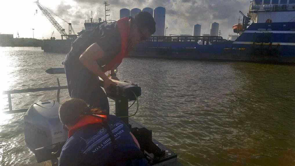
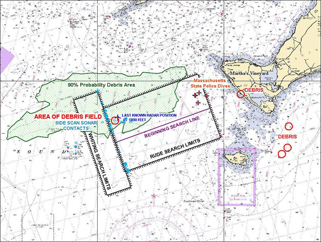
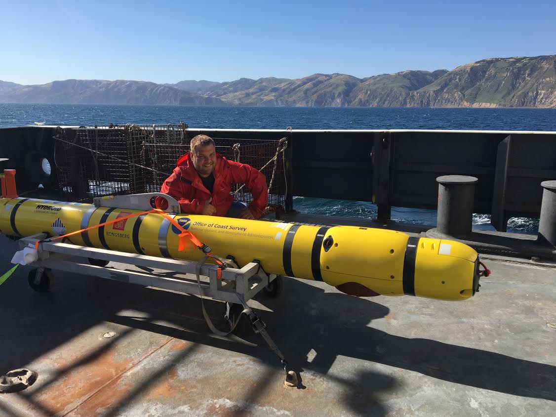
Hydrographic surveying continually evolves to improve safety, efficiency, and accuracy in data collection. From using side scan sonar equipment during hydrographic survey response efforts following air disasters in the late 1990s, to recent hurricane response efforts to re-open ports to maritime commerce, our science always strives to be cutting edge.
Continue reading “From historic air disasters to hurricane response, NOAA uses cutting edge science to survey the seafloor”Coast Survey spotlight: Meet Tim Wilkinson

Ever wonder what it’s like to be a member of the NOAA Coast Survey team? We use the Coast Survey spotlight blog series as a way to periodically share the experiences of Coast Survey employees as they discuss their work, background, and advice.
Tim Wilkinson, navigation response team member
“Our nation’s waterways are constantly changing and the technology we’re using to chart them is becoming increasingly more accurate. My position and my counterparts on the other teams are integral to developing accurate charts to ensure safer navigation. We also act as emergency responders to situations such as hurricanes and ship groundings.”
Continue reading “Coast Survey spotlight: Meet Tim Wilkinson”
Coast Survey spotlight: Meet John Doroba
Ever wonder what it’s like to be a member of the NOAA Coast Survey team? We use the Coast Survey spotlight blog series as a way to periodically share the experiences of Coast Survey employees as they discuss their work, background, and advice.
John Doroba, physical scientist
“Once I saw the mission I was hooked. It was the best job a recent graduate who loved being in the field could ask for, especially when you get to travel all around the country. Where else could I practice my love for science, utilize my education, solve real world problems that serve a purpose, and directly impact people in a positive way?”
NOAA Ship Thomas Jefferson tests drone use for shoreline mapping

By, Lt. j.g. Matt Sharr, NOAA, and Lt. Charles Wisotzkey, NOAA
NOAA’s Office of Coast Survey and the National Geodetic Survey (NGS) recently conducted operational tests of small unmanned aerial systems — or drones — on board NOAA Ship Thomas Jefferson in support of survey operations conducted along the south coast of Puerto Rico. The tests show the potential of imagery from low-cost off-the-shelf drones to meet NOAA survey specifications for near-shore and shoreline feature mapping. This could replace traditional shoreline verification and mapping techniques used by NOAA hydrographic survey field units. Potential benefits of using drones for shoreline mapping include: improved data collection efficiency compared to data collection from small skiffs; more accurate feature investigation than traditional techniques; and, most importantly, removal of personnel from potentially dangerous situations (i.e. survey in close proximity to features being mapped). Continue reading “NOAA Ship Thomas Jefferson tests drone use for shoreline mapping”
NOAA and Coast Guard survey shallow channels in eastern Chesapeake Bay to update aids to navigation
By Lt j.g. Patrick Debroisse
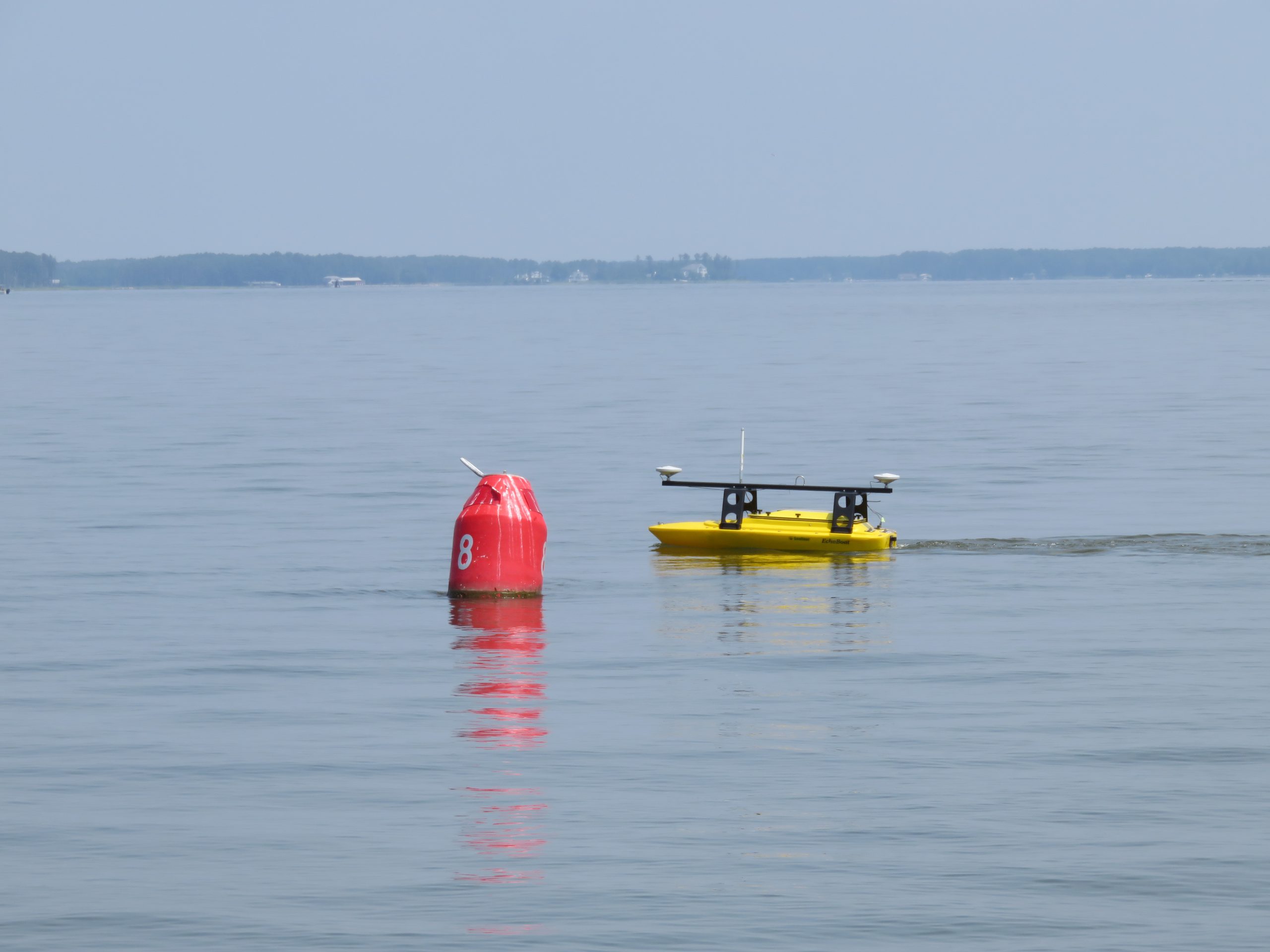
The area of the Chesapeake Bay along the Eastern Shore of Maryland is one of our nation’s treasures. Home to unique underwater grasses, fish, and shellfish, this complex transition from river to sea is also home to millions of tons of sediment delivered annually from eroding land and streams. Recreational boaters, fisherman, and cruising vessels are keenly aware of the shifting sands and sediment deposits in these shallow waters and rely on aids to navigation (ATON) — a system of beacons and buoys — to travel safely to and from the harbors and docks along the shoreline.
Continue reading “NOAA and Coast Guard survey shallow channels in eastern Chesapeake Bay to update aids to navigation”
NOAA surveys Lake Champlain for improved flood modeling and mitigation strategies
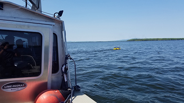
At the request of the NOAA Great Lakes Environmental Research Lab (GLERL), NOAA’s Office of Coast Survey deployed a survey team and a new autonomous surface vehicle (ASV) to gather hydrographic data in and around the narrow causeway inlets that dot the Lake Champlain basin in Vermont. GLERL will use the data to improve flood forecast models and analyze flood mitigation strategies in the Lake Champlain-Richelieu River system as part of a U.S. and Canada study led by the International Joint Commission.
Continue reading “NOAA surveys Lake Champlain for improved flood modeling and mitigation strategies”
Coast Survey prepares to serve nation during 2018 hurricane season
“But, sir, what does the country want in the coast survey? They want a very useful work done, a very important work done, and they want it done in the best manner.” – U.S. Senator John Davis (MA), 1849, explaining the importance of the coast survey to safety and the U.S. economy during the 30th Congress, 2nd Session
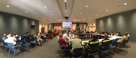
As the nation’s nautical chartmaker, NOAA Coast Survey provides critical emergency response information to coastal communities and waterways. Each year, Coast Survey prepares for hurricane season in order to perform the work in—as the late Senator Davis put it—“the best manner.” Last year’s string of powerful hurricanes underscored the importance of coordinated efforts for storm preparation, response, and recovery. With the official start of the 2018 hurricane season just around the corner, Coast Survey’s regional navigation managers spent the large part of April and May meeting with U.S. Coast Guard (USCG), port authorities, NOAA National Weather Service, and communities to prepare emergency response capabilities. Continue reading “Coast Survey prepares to serve nation during 2018 hurricane season”
NOAA mobile integrated survey team prepares for hurricane season
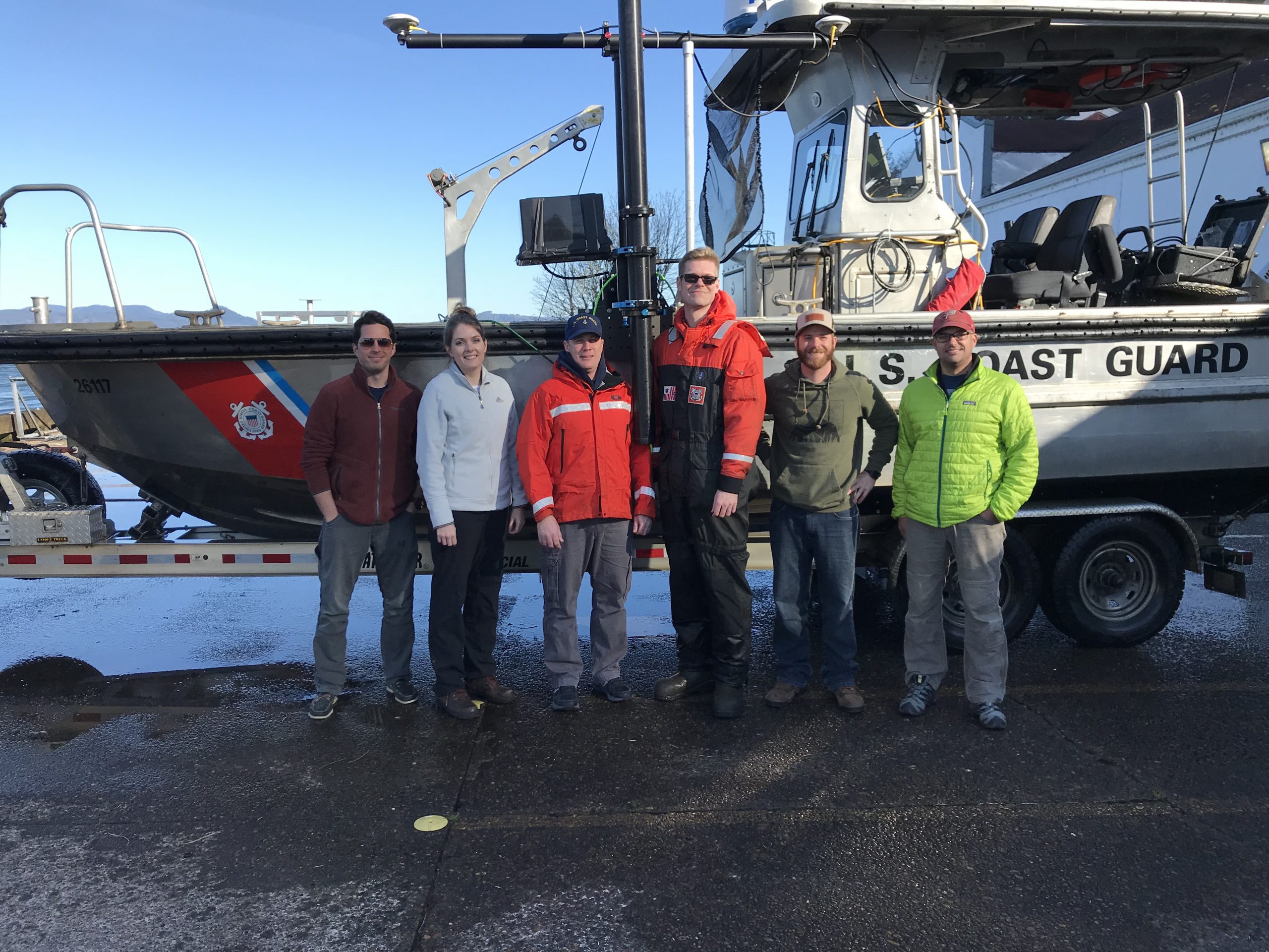
NOAA’s Office of Coast Survey is the federal leader in emergency hydrographic response. Consecutive strong storms during the 2017 hurricane season made response efforts challenging, and emphasized the importance of having a well-trained and versatile staff. Coast Survey’s regional navigation managers, navigation response teams (NRTs), and mobile integrated survey team (MIST) worked with partners before and after the storms to quickly and safely reopen ports and waterways.
The MIST equipment is a mobile, quick-install side scan and single beam sonar kit that can be quickly set up on a vessel of opportunity. Recently, Coast Survey sent the MIST team to Astoria, Oregon to conduct a hydrographic survey of the Mott Basin area, which the U.S. Coast Guard (USCG) requested to confirm charted depth and obstruction data. Continue reading “NOAA mobile integrated survey team prepares for hurricane season”