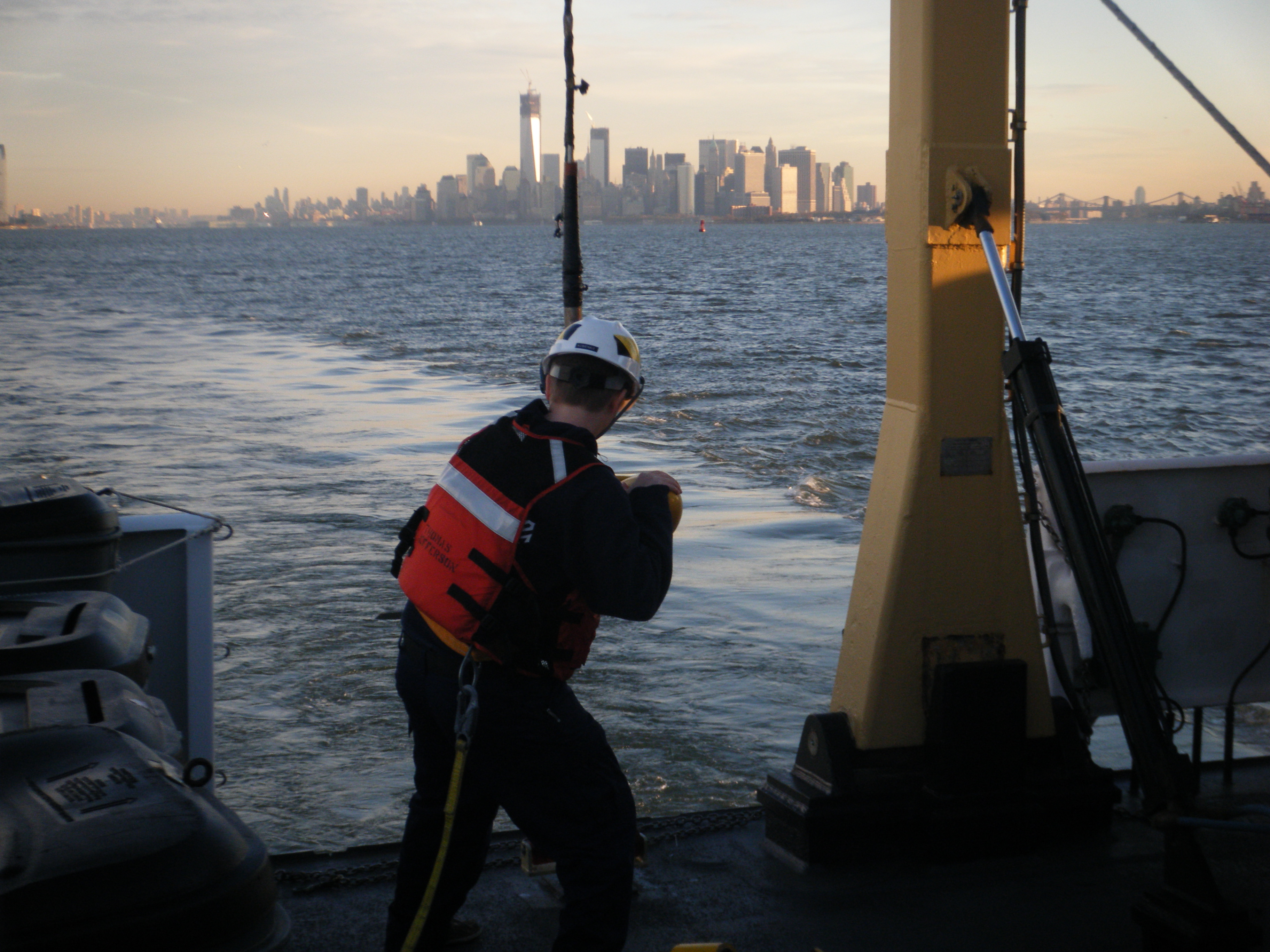
Even before Sandy hit the New Jersey shore, NOAA’s Office of Coast Survey was mobilizing to respond to the emergency, preparing vessels, personnel, and equipment to conduct hydrographic surveys of hard-hit areas, searching for the underwater debris and shoaling that can paralyze shipping at the nation’s ports.
Continue reading “Thomas Jefferson night work gives go-ahead for fuel barge delivery into New York – New Jersey”
Post-SANDY navigation response in full swing
Continue reading “Post-SANDY navigation response in full swing”
NOAA deploys personnel and survey assets to speed resumption of shipping after Sandy – Update 29 Oct

As conditions go downhill, NOAA is deploying personnel and hydrographic survey assets to help speed the resumption of shipping after SANDY clears out.
Coast Survey has deployed navigation managers from outside Hurricane Sandy’s areas of impact, supplemented with headquarters personnel, moving them to areas expected to be hit hard. Navigation managers are now at U.S. Coast Guard Incident Command Centers for New York – New Jersey and for Delaware Bay. We are also working with Coast Guard Captains of the Port for Virginia, Baltimore, and New England. NOAA’s navigation managers are working with the Coast Guard and the Army Corps of Engineers to coordinate deployment of NOAA’s navigation response teams (NRT) for rapid maritime response. They are also identifying vessels of opportunity, for potential use with Coast Survey’s mobile survey team (MIST).
Continue reading “NOAA deploys personnel and survey assets to speed resumption of shipping after Sandy – Update 29 Oct”
NOAA pre-positions survey assets for SANDY maritime response

As Hurricane SANDY heads north along the Atlantic coast, NOAA’s Office of Coast Survey is deep into preparations for maritime rapid response. Two objectives stand out: move navigation response personnel and assets into position to move quickly once SANDY moves out; and batten down survey vessels, to protect them from storm damage.
Coast Survey regularly responds to requests for quick navigation surveys after storms and other damaging events, pulling vessels from their normal survey schedules and deploying them to ports that need hydrographic surveys before they can resume full-fledged shipping.
Continue reading “NOAA pre-positions survey assets for SANDY maritime response”
NOAA survey teams wrap up response to Hurricane Isaac, return to normal duties to protect ships and people
As Gulf ports in the path of Hurricane Isaac bring operations back up to normal, Coast Survey’s navigation response team has finished its hydrographic surveys at Port Fourchon and is heading back to its regularly scheduled 2012 survey of the sea floor in the Port of Houston and Galveston Bay navigational areas.
Port Fourchon started allowing ships to enter the port yesterday, after NRT4 found only minor shoaling and no underwater debris that would pose a danger to navigation.

Continue reading “NOAA survey teams wrap up response to Hurricane Isaac, return to normal duties to protect ships and people”
NOAA navigation response team has a harrowing start to a successful afternoon of surveying at Port Fourchon
Coast Survey navigation response teams know the meaning of “rapid” in Rapid Maritime Response, as their ongoing response following Hurricane Isaac demonstrates.
As we explained in yesterday’s post (NOAA looks for dangers to navigation at Port Fourchon), getting a navigation response team (NRT) into the water at the port, to search for underwater debris and shoaling ‒ ASAP ‒ was Coast Survey’s highest priority. It was also a priority for port authorities, who know more than anyone how important it is to resume maritime operations quickly at “The Gulf’s Energy Connection.”
Continue reading “NOAA navigation response team has a harrowing start to a successful afternoon of surveying at Port Fourchon”
NOAA looks for danger to navigation at Port Fourchon, the “Gulf’s Energy Connection,” helps port resume operations
A rapid maritime response by NOAA’s Office of Coast Survey will likely pay dividends to the U.S. economy, as a high-tech survey team today began surveying the channels of Port Fourchon, the “Gulf’s Energy Connection,” to search for dangers to navigation caused by Hurricane Isaac.

“Time literally means money for U.S. consumers when it comes to navigation through many of the Gulf of Mexico ports,” said Rear Adm. Gerd Glang, Office of Coast Survey director. “In this case, when a port can’t service offshore oil rigs, everyone — and most especially consumers — gets hit in the wallet.”
Continue reading “NOAA looks for danger to navigation at Port Fourchon, the “Gulf’s Energy Connection,” helps port resume operations”
Ready, set…
Coast Survey’s Rapid Maritime Response assets for Hurricane Isaac are now in place, and are ready to move in when the storm moves on.
The teams will search for underwater debris and other dangers to navigation in port areas, to speed the resumption of shipping in areas impacted by the storm. A rapid response — that gives Coast Guard officials vital information on the condition of ship channels — reduces economic losses in maritime trade, reduces potential disruptions in energy supplies when ports are serving energy providers and oil rigs, and keeps mariners safe. (For more, see Coast Survey Prepares Rapid Maritime Response for Tropical Storm Isaac.)
Continue reading “Ready, set…”
Update on Coast Survey pre-positioning for Rapid Maritime Response to Tropical Storm Isaac
As NOAA’s National Weather Service adjusts the track of Tropical Storm Isaac, so Coast Survey adjusts pre-response planning and deployment. (BTW, the New Orleans/Baton Rouge NWS Tropical Weather Briefing is a great resource for maritime observations, as is nowCOAST.) Based on updates in the hurricane models, and after multiple briefings with Coast Guard officials, Coast Survey is moving to pre-position two of the navigation response teams closer to the expected impact areas. (See response asset graphic, below.)
Major ports along in Alabama, Mississippi, and Louisiana will likely be closed later today, if they aren’t already. With over $153 billion in ocean-going trade through New Orleans annually, and another $31 billion a year in and out of Mobile, it is essential to get shipping channels cleared for the resumption of traffic as soon as possible after a storm. Just as important, the Gulf produces 23 percent of total U.S. crude oil production and 7 percent of natural gas production, according to the U.S. Energy Information Administration. The resumption of operations at ports serving the energy industry is essential to keeping supplies flowing.
Continue reading “Update on Coast Survey pre-positioning for Rapid Maritime Response to Tropical Storm Isaac”
Coast Survey prepares Rapid Maritime Response for Tropical Storm Isaac
With the approach of Tropical Storm Isaac, headed toward the state of Florida, Coast Survey navigation managers and navigation response teams have moved into Rapid Maritime Response preparations. Coast Survey is often called upon to speed the resumption of ocean shipping — slowed or shut down by hurricane damage — by searching for submerged debris or other dangers to navigation in port areas or shipping lanes. After navigation response teams survey the areas, ports can resume operations safely and efficiently.
Our navigation managers work with port representatives, and state and federal officials in the area, to coordinate their requests for NOAA data and services, and our manager for Florida is already fielding requests from port officials and the U.S. Coast Guard in Florida.

Coast Survey deploys six navigation response teams, at all times, to conduct long-term hydrographic projects in critical maritime areas. While surveying, the teams remain on alert to respond to emergencies anywhere on the nation’s coasts. The teams are three-person crews who can transport the hydrographic equipment and 28’ survey boats to coastal locations where submerged debris or shoaling would cause a danger to navigation.
Continue reading “Coast Survey prepares Rapid Maritime Response for Tropical Storm Isaac”
