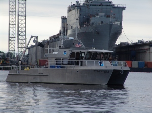
As Hurricane SANDY heads north along the Atlantic coast, NOAA’s Office of Coast Survey is deep into preparations for maritime rapid response. Two objectives stand out: move navigation response personnel and assets into position to move quickly once SANDY moves out; and batten down survey vessels, to protect them from storm damage.
Coast Survey regularly responds to requests for quick navigation surveys after storms and other damaging events, pulling vessels from their normal survey schedules and deploying them to ports that need hydrographic surveys before they can resume full-fledged shipping.
As of this morning, this is the position of navigation response teams, survey vessels, and equipment available to search for underwater dangers to navigation and to detect shifting seafloor bottoms. Coast Survey’s Navigation Services Division is putting out orders now to move some of these assets, as well as pre-positioning navigation managers.
The navigation response teams (NRTs), mobile integrated survey teams (MIST) that use vessels of opportunity, autonomous underwater vehicle (AUV), and Bay Hydro II are all Coast Survey response assets. Additionally, NOAA Ship Thomas Jefferson is surveying in Long Island Sound and will be deployed if she is needed. (Update 10/28: Bay Hydro II moved from Solomons to Norfolk.)

News and Updates
