
By Lt j.g. Patrick Debroisse
The area of the Chesapeake Bay along the Eastern Shore of Maryland is one of our nation’s treasures. Home to unique underwater grasses, fish, and shellfish, this complex transition from river to sea is also home to millions of tons of sediment delivered annually from eroding land and streams. Recreational boaters, fisherman, and cruising vessels are keenly aware of the shifting sands and sediment deposits in these shallow waters and rely on aids to navigation (ATON) — a system of beacons and buoys — to travel safely to and from the harbors and docks along the shoreline.
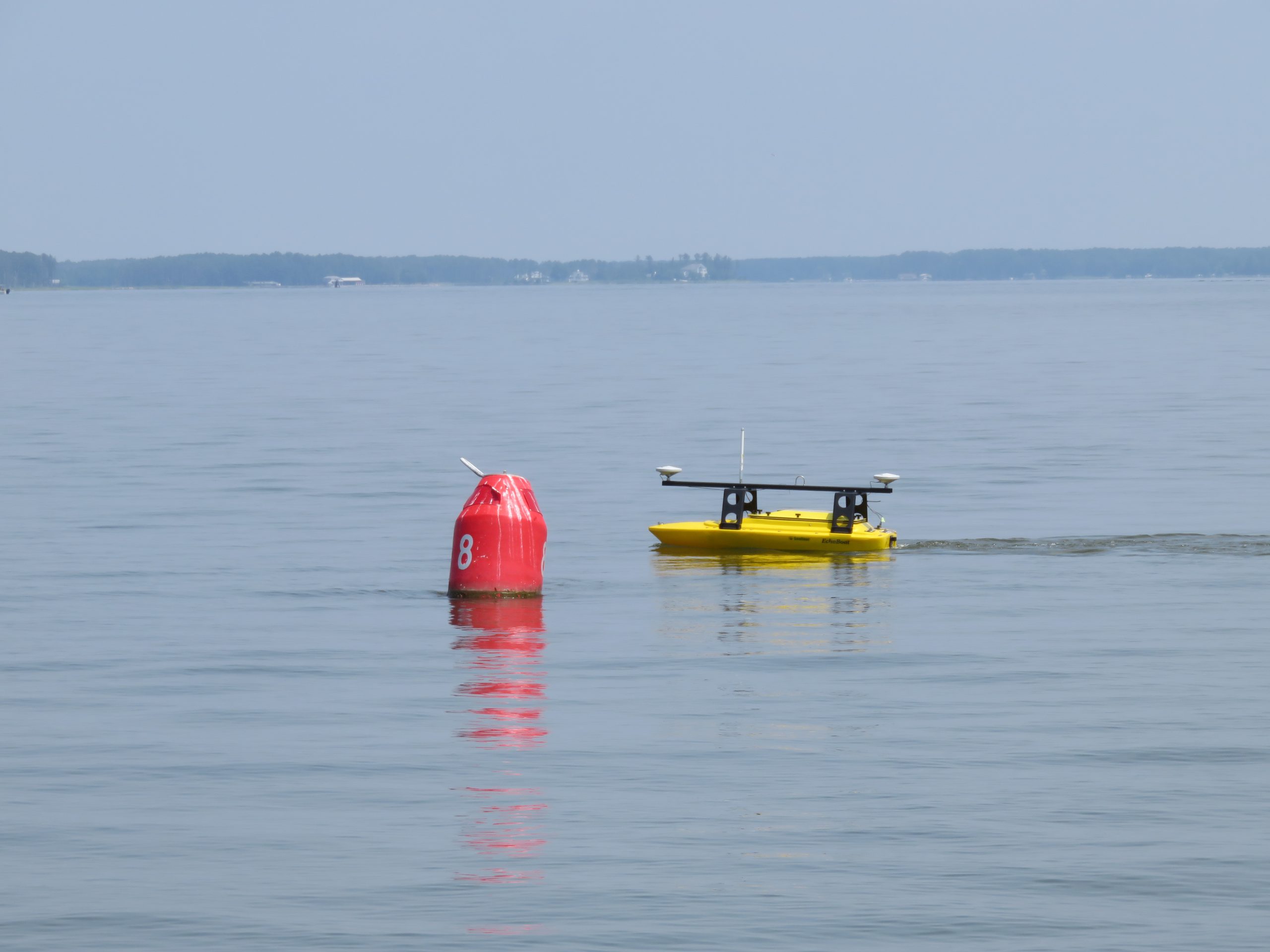
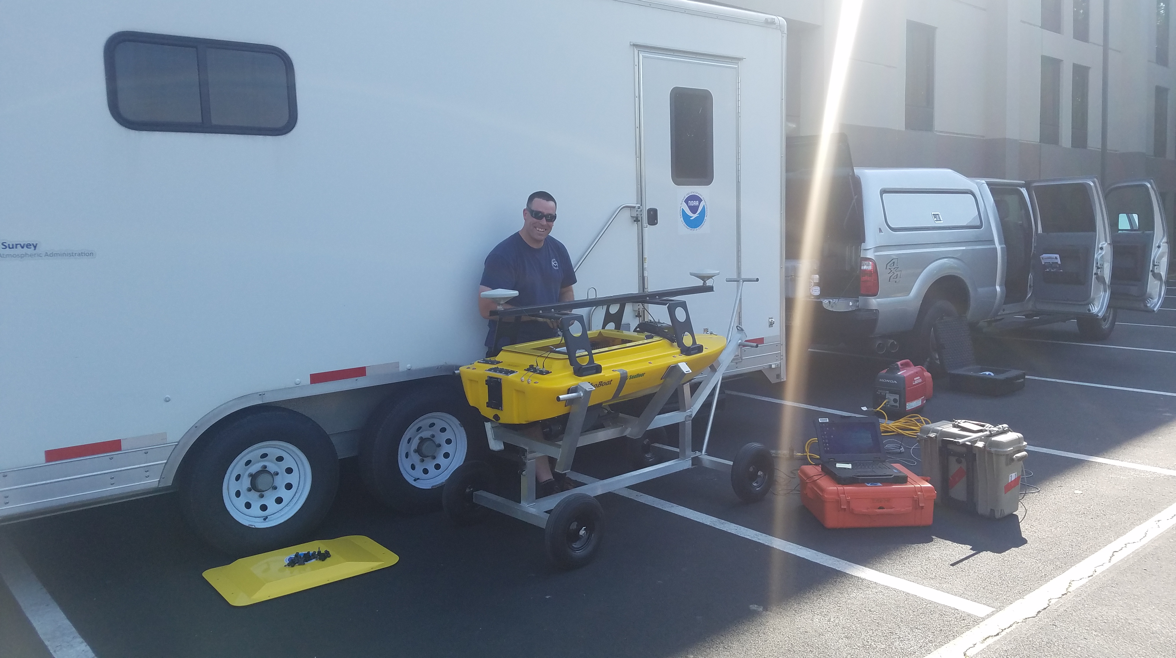
U.S. Coast Guard (USCG) Aids to Navigation Team (ANT) from Crisfield, Maryland, recently requested the assistance of NOAA’s Office of Coast Survey to help identify areas where ATON were in need of repair, relocation, or removal due to the shifting sediment of these nearshore areas. Crew from NOAA research vessel Bay Hydro II and from navigation response team (NRT) 1 (homeported in Stennis, Mississippi) operated an Echoboat autonomous surface vehicle (ASV) from a USCG vessel to survey these shallow waters.
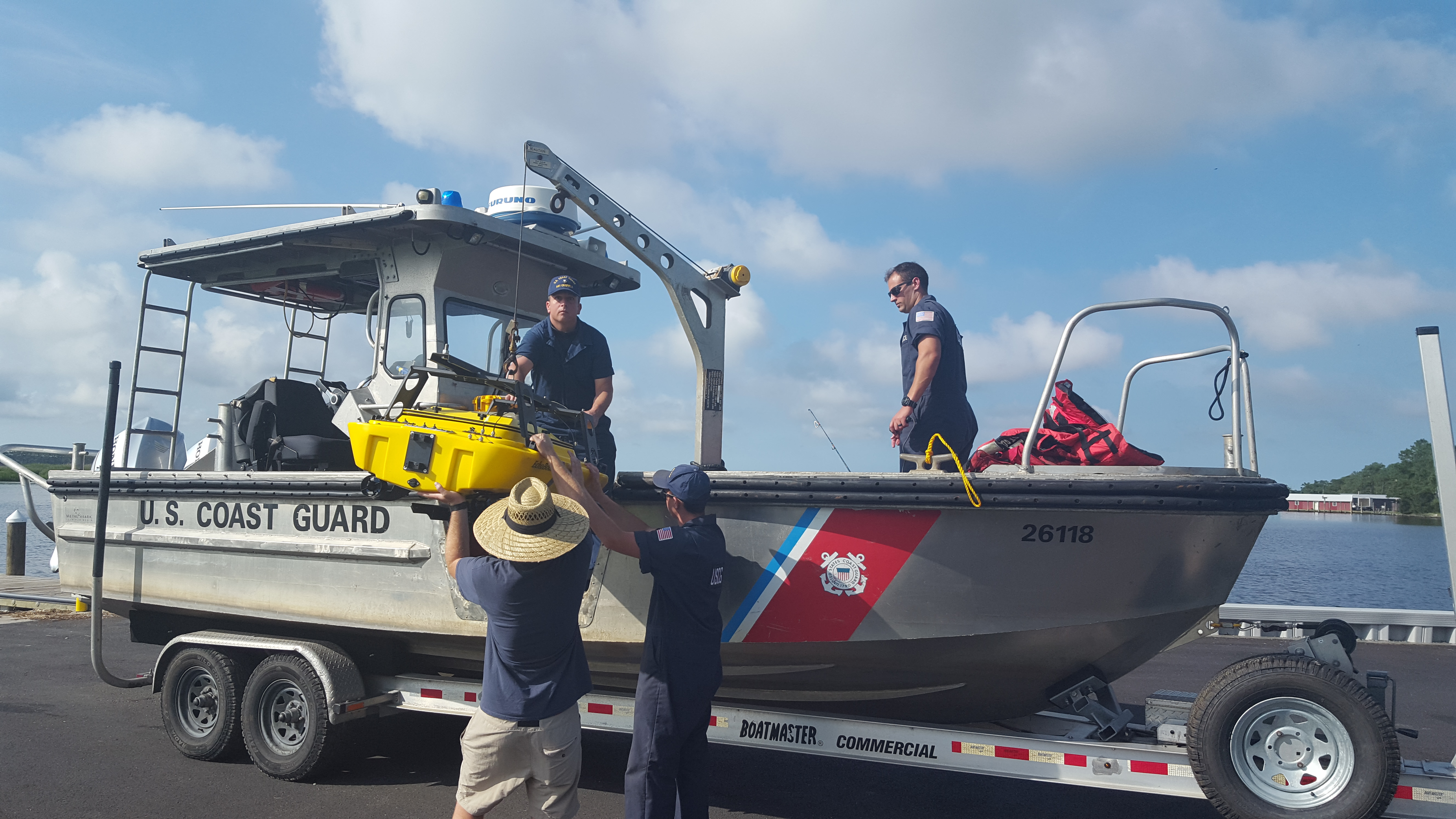
The team first visited Slaughter Creek, near Taylor’s Island, where the USCG believed sediment in the channel was shifting, requiring potential ATON relocation. The second area was in Pocomoke River, east of Smith Island, where shoaling in the already shallow channel was of concern, as well as the existence of unused ATON anchors. The ASV, equipped with side scan sonar to search for underwater objects, and a multibeam echo sounder to check the contours of the channels, surveyed both areas.
Once the survey data is processed and delivered to the USCG ANT, they can make informed decisions about ATON maintenance. Finding old ATON anchors and recycling them back into service is a potential cost savings for the USCG. NOAA and the USCG plan to operate the Echoboat ASV in this area again, surveying the waters for a possible wreck in Fishing Bay and for old ATON moorings replaced by a day shape.


Coast Survey recently surveyed the waters of Lake Champlain using the Echoboat ASV. This portable unit provides flexibility and allows survey teams to further develop procedures and to train more individuals in its use for future operations around the country.
Nice posting, Patrick! It was a pleasure to join you last week and take the ASV for a ride. Pass on my thanks to Sarah, Alex and Rob. The Bay Hydro and NRT1 are a terrific team!
Rear Admiral Tim Gallaudet, Ph.D., USN (ret)
Deputy NOAA Administrator/Acting NOAA Administrator
Will there be surveys of the S. California coast near-shore at popular surfing beaches such as Windansea, La Jolla (San Diego)?
Thank you for your question. This year, Coast Survey does not plan to survey the La Jolla and San Diego area. Please find our current year survey plans here: https://nauticalcharts.noaa.gov/data/current-year-survey-plans.html