Office of Coast Survey
National Oceanic and Atmospheric Administration
U.S. Department of Commerce
Office of Coast Survey
National Oceanic and Atmospheric Administration
U.S. Department of Commerce
April 12, 2023
From 27 February to 2 March, the International Hydrographic Organization (IHO) Hydrographic Surveys Working Group held their fourth meeting. This was a virtual only meeting and included 86 attendees from member states and expert contributors from industry. Topics of discussion included proposed changes for S-44, liaison updates from other IHO working groups—data quality working group and S-100—and two full days of break out discussions from the Manual on Hydrography and Satellite Derived Bathymetry Project Teams. The Satellite Derived Bathymetry Best Practice Guide (B-13) is finalized and will go in front of the Hydrographic Services and Standards Committee in June for review and approval. For more information, please contact Megan.Greenaway@noaa.gov.
On March 14-16, Precision Marine Navigation Program Manager Darren Wright, presented the Precision Marine Navigation program at the National Hurricane Center's Mariner Hazardous Weather Workshop. Florida, Puerto Rico, and U.S. Virgin Islands Navigation Manager Nicolás Alverado, was also in attendance virtually and was recognized by the Western Florida USCG Captain of the Port for engaging and explaining Coast Survey's role and ability to survey after major storm events. The workshop was primarily focused on hazardous weather for mariners and products that are currently available. The National Weather Service gave a future glimpse of warning polygons at sea and how they will feed into precision navigation via the international standards: S-411 Ice Hazards, S-412 Warning Polygons, S-413 Graphics and Gridded Data, and S-414 Observations. Mariners are excited at the direction NOAA is going with the consolidation of NOAA’s navigational information in the international S-100 standard format so it can be easily accessed and utilized by electronic navigation system manufacturers and others to provide to mariners. For more information, contact Darren.Wright@noaa.gov.
The US/Canada Hydrographic Commission (USCHC), chaired by Coast Survey's Deputy Hydrographer John Nyberg, met on March 16 and 17 for its 46th meeting in Mobile, Alabama. The meeting brought together approximately 25 participants including representatives from the United States, Canada, United Kingdom, and the International Hydrographic Organization (IHO) Secretariat. In addition to routine items, the meeting participants discussed the IHO Strategic Plan, Seabed 2030 and regional mapping campaigns, and implications of the S-100 services for the USCHC. Two agreements were signed to facilitate hydrographic survey work on the US/Canada border (Pacific). The agenda and meeting materials can be found on the IHO USCHC-46 webpage. For more information, contact Jonathan.Justi@noaa.gov.
Between March 27-March 30, Julia Powell, CDR Briana Hillstrom, Heather Gilbert, Amanda Phelps and representatives from the Center for Operational Oceanographic Products and Services and the National Ocean Service, attended the American Association of Port Authorities 2023 Legislative Summit. The Summit brings together senior port executives from around the nation with federal government leadership to discuss issues important to one of the most critical national industries. As part of the meeting, Coast Survey presented on 2023 survey plans to the Harbors and Navigation Committee meeting and met with representatives of ports from around the country. For more information, contact Julia.Powell@noaa.gov.
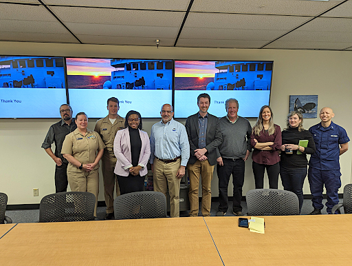
In March, Coast Survey's regional representatives gathered in Silver Spring for the navigation managers annual meeting. This was the first in-person meeting since 2019 and provided an opportunity for some members of the Customer Affairs Branch to finally meet face-to-face. The first day of the meeting was a facilitated workshop focused on customer engagement. This second and third days focused on updates from Coast Survey and National Ocean Service leadership, and reports from the navigation managers on topics and issues from their areas of responsibility. A number of key takeaways resulted from this meeting, including the continued requirement for consistent messaging and the need to improve our feedback loop with our stakeholders. For more information, contact Lucy.Hick@noaa.gov.
After over a year of collaboration, Coast Survey and NOAA's National Centers for Environmental Information (NCEI), the International Hydrographic Organization, and Aqua Map—a popular mobile marine navigation application—recently introduced the option to send depth data in real time to the IHO Data Centre for Digital Bathymetry, significantly enhancing NOAA's crowdsourced bathymetry effort. Crowdsourced bathymetry efforts like these are filling data gaps and contributing to the global goals of mapping the seafloor by 2030. This collaboration has the potential to vastly increase the number of active crowdsourced bathymetry contributors, and will improve the accuracy and timeliness of nautical chart updates. The collaboration began when Coast Survey was able to update several Intracoastal Waterway charts, using information from Aqua Map and its 18,000 boating enthusiasts. These updates spurred a discussion with Aqua Map about crowdsourced bathymetry, resulting in NCEI leading the project. Coast Survey is committed to improving navigation data for the benefit of all boaters and this is an exciting step toward catalyzing awareness and contributions of crowdsourced bathymetry. For more information, contact Kyle.Ward@noaa.gov.

As part of an internal review period with the Office of Coast Survey, the draft version of the Hydrographic Surveys Specifications and Deliverables (HSSD) was made available last month for a NOAA-only review and comment. There were over 80 form submissions providing feedback to the draft HSSD "revamp"! Thanks so much to everyone who provided feedback. Now we are looking through the form submissions and will follow up with more updates. Later in the year, there will be field beta testing, an external review period, and the availability of the draft HSSD for public comment. The new HSSD is expected to replace the current version in 2024. For more information, please contact Matthew.Wilson@noaa.gov.
On April 6, NOAA's Deputy Under Secretary for Operations Benjamin Friedman and Policy Advisor Dr. Jeanette Davis visited NOAA's Western Regional Center in Seattle and held a joint meeting with the Office of Response and Restoration, Pacific Hydrographic Branch, and Navigation Response Team-Seattle. Pacific Hydrographic Branch Chief James Miller discussed Coast Survey's strategic goals and data-driven approach to supporting safe navigation and the Blue Economy, with an emphasis on initiatives such as the National Bathymetric Source, Precision Marine Navigation, and support of critical ports and harbors such as LA/Long Beach. Navigation Response Team-Seattle presented on their recent and upcoming projects, including the emergency response effort to locate a downed floatplane in Mutiny Bay, Washington in September 2022 and several upcoming surveys in Lake Quinault and the Columbia River in support of tribal stakeholders. Benjamin Friedman touched on topics including funding and staffing updates, as well as goals of creating a more diverse workforce and becoming more environmentally sustainable across NOAA. The visit concluded on April 7 with the navigation response team hosting Benjamin Friedman and Dr. Jeanette Davis for a system demonstration and vessel tour on Lake Washington. For more information, please contact Jessica.Murphy@noaa.gov.
Weekly Hydro Ship Activity Report—February 26 through March 4, 2023
Weekly Hydro Ship Activity Report—March 5 through March 11, 2023
Weekly Hydro Ship Activity Report—March 12 through March 18, 2023
Weekly Hydro Ship Activity Report—March 19 through March 25, 2023
Weekly Hydro Ship Activity Report—March 26 through April 1, 2023
Weekly Hydro Ship Activity Report—April 2 through April 8, 2023

Coast Survey's Pacific Hydrographic Branch (PHB) in Seattle, Washington won the "All-for-One Award" and trophy for the 2022 Combined Federal Campaign (CFC) of Cascadia. PHB had the highest participation rate at 93% in the Small Agency category, raising 103% of their goal and generously donating $4,650 to CFC charities. Priscilla Haskell and Brooke Maser have been leading the CFC campaign at PHB over the past several years and attribute its success to team communication and inclusion. Thanks for your generosity and congratulations PHB!
Hydrographic Surveys Division Operations awarded a $5.6 million task order in Southwest Chesapeake Bay (project manager and COR: Dan Garatea) and a $6.0 million task order in Albemarle Sound, North Carolina (project manager and COR: Doug Wood). You can learn more about these projects from the 2023 NOAA Hydrographic Survey Projects StoryMap or by reaching out directly to the project manager.
Christina Belton and Starla Robinson returned to Hydrographic Surveys Division Operations from details to the Office of Ocean Exploration and Research and Office of Marine and Aviation Operations, respectively—operations is excited to have them both back!
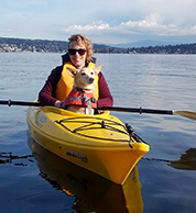
Tyanne Faulkes was selected as the Streamlining Team Lead at the Pacific Hydrographic Branch, starting April 9. Tyanne is an accomplished physical scientist with over a decade of experience in hydrographic surveys. She started her career as a contractor in 2008 before obtaining a full-time federal position in 2010. Tyanne worked at both the Pacific and Atlantic Hydrographic Branches, where she proved an invaluable member of the team. In this new role, Tyanne will champion innovation within Hydrographic Surveys Division, while ensuring faster and more efficient throughput of hydrographic data to Coast Survey's products and services. She is also excited about mentoring others who are interested in advancing their careers in the hydrographic community. Outside work, Tyanne is an avid outdoor enthusiast and an amateur artist. She is often accompanied by her trusty dog, Chance, and enjoys a wide range of activities, including mountaineering, camping, cycling, skiing, paddleboarding, kayaking, knitting, and costume design. Tyanne's diverse interests and passion for the outdoors inform her work and inspire her to push the boundaries of what is possible in the hydrographic surveying community.

Kathy Carpenter recently joined the Customer Affairs Branch in NSD to help with ASSIST tickets and to provide support to NOAA's Regional Navigation Managers. She was most recently working as a cartographer in MCD's Production Branch C (New York to Maine). Prior to that she worked as a contractor in the Coast Pilot Branch. Kathy graduated from the University of Maryland with a Bachelor's in GIS. She enjoys spending time with her family, cooking, fitness, consuming anything with matcha in it, being out in nature, and going to cafes whenever possible.

Anna Miller is joining Coast Survey, supporting the National Bathymetric Source Project. Her current position as a Geospatial Specialist started in January as a contractor with ERT, Inc. She grew up in North Carolina, and studied at the University of North Carolina Wilmington where she received her Bachelor’s in Environmental Science with concentrations in GIS and offshore surveying, and her Master’s in Marine Science with a concentration in physical science. During her studies, she conducted research projects to map sediment movement and shipwrecks offshore southeast North Carolina. Anna previously worked as an intern for the National Weather Service to study coastal erosion during extreme weather events and as an intern for the USACE-Wilmington District’s Geospatial Department. She has previous experience in the geospatial industry, as well as experience working with land and hydrographic surveying technologies. Outside of work, Anna enjoys spending time outside, whether hiking, going on runs with her dog, spending time at the beach, or gardening.
Dr. Monica Schwehr is an employee with Spatial Front Inc., working on the National Bathymetric Source project. Monica is a geophysical oceanographer with over 15 years of experience, previously at SubCom—a global subsea fiber optic data communications company—and at the Naval Oceanographic Office as a civilian hydrographer. She has a doctorate from the University of New Hampshire, where her research focused on modeling the physical structure and seismic behavior of oceanic transform faults. She completed a post doctorate at the Monterey Bay Aquarium Research Institute, where she helped develop and test the Institute’s Low-Altitude Survey System. The system, fielded on a remotely operated vehicle, simultaneously collects co-located 5-cm multibeam bathymetry, 1-cm lidar bathymetry, and 2-mm stereo mosaics. Her interests include marine hazards and tectonics, furthering the applicability of bathymetric mapping, and encouraging the next generation of marine scientists.
Kayla Maurer recently started a four month detail as project manager in the Operations Branch of HSD. Previously, Kayla was a cartographer in MCD's Production Branch C for three years where she worked on the regridding and National Bathymetric Source projects. Prior to working in PBC, she worked for IIC Technologies as a contractor for MCD. Originally from Pennsylvania, she received a Bachelor of Science in Environmental Science and certificate in GIS from the University of Pittsburgh. Outside of the office, Kayla enjoys traveling, baking, going on runs with friends, drinking tea, and tending to her houseplants.
Maura Barron is a contractor with Lynker, who is working on the National Bathymetric Source project as a software developer. Previously, she worked as a contractor with the Department of Defense writing and maintaining software for estimating performance degradation and casualties due to chemical and biological weapons. She was formerly a high school science teacher and specialized in mentoring independent science research projects that employed machine learning techniques across a variety of scientific disciplines. Outside of work, she enjoys playing bassoon, painting miniatures, playing Dungeons and Dragons, and attending renaissance festivals.
did you know?
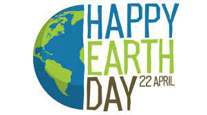
In honor of Earth Day on April 22, Coast Survey staff are encouraged to get your hands dirty and clean up the world around you. What to do? Engage in an activity the week of April 17-22, submit a photo of what you did, and earn 59 minutes of administrative leave. Ideas of what you could do: planting trees or flowers, participating in a community clean up, or just collecting trash in your neighborhood–be creative! Send your photos to ocs.di.committee@noaa.gov by April 28 and they will be displayed during the May All Hands!
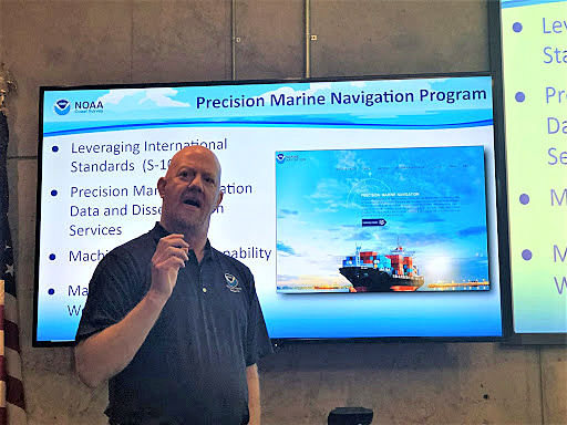 Darren Wright during his presentation at the Mariner Hazardous Weather Workshop held at the National Hurricane Center.
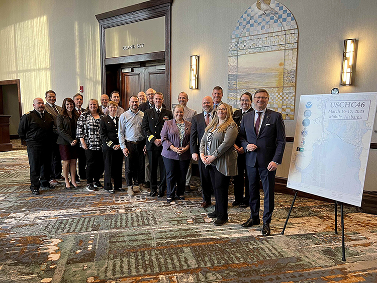 Group image of several members of the USCHC during their meeting in Mobile, Alabama.
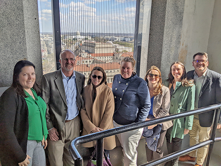 NOS representatives at the Old Post Office building during the American Association of Port Authorities legislative summit. Pictured from left to right are: Heather Gilbert (OCS), Brent Ache (CO-OPS), Amanda Phelps (OCS), Julia Powell (OCS), Courtney Barry (CO-OPS), Chrissy Hayes (NOS) and Chris DiVeglio (CO-OPS).
 A group image of participants in the navigation managers meeting held in March 2023. From left to right: Tim Osborn, Nicolas Alvarado, Kyle Ward, Colleen Roche, Quentin Stubbs, LCDR Hadley Owen, Ryan Wartick, Lucy Hick, Darren Wright, Jeffrey Ferguson, Tom Loeper, Steve Soherr, Kathy Carpenter, and Julia Powell.
 A group image of the Western Regional Center visit in April 2023. From left to right: Andrew Mason (OR&R), CDR Faith Knighton (OR&R), LTJG Kyle Vincent (OR&R), Dr. Jeanette Davis, Benjamin Friedman, James Miller (PHB), Doug Helton (OR&R), Jessica Murphy (PHB), Annie Raymond (NRT-Seattle), LTJG Patrick Faha (NRT-Seattle)