Office of Coast Survey
National Oceanic and Atmospheric Administration
U.S. Department of Commerce
Office of Coast Survey
National Oceanic and Atmospheric Administration
U.S. Department of Commerce
May 11, 2022
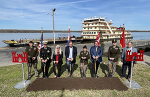 An image showing the groundbreaking ceremony held by the Army Corps of Engineers Memphis District in Caruthersville, Missouri.
In early April, Office of Coast Survey Director RDML Benjamin Evans participated in his first Mississippi River Commission trip. Over the course of the week, RDML Evans saw first hand how critical the Mississippi River and tributaries system is to maritime transportation and the economic security of the United States. NOAA is a critical partner in the operation and management of the system, and our navigation products and services enable connection of these inland waterways to coastal waters and beyond. The Mississippi River Commission was established by Congress in 1879 to foster navigation, promote commerce, and prevent destructive floods on the Mississippi River and its tributaries. The commission is led by the U.S. Army Corps of Engineers. For more information, contact Heather.Gilbert@noaa.gov.
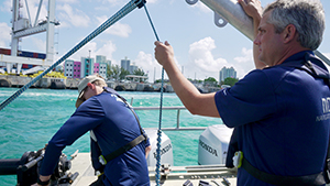 Howard Meyers (left) and James Kirkpatrick (right) during surveying operations in the Port of Miami. (Credit: Nicolas Alvarado)
James Kirkpatrick and Howard Meyers of Navigation Response Team Fernandina Beach were joined by Florida Navigation Manager Nicolas Alvarado in the Port of Miami over Easter weekend. The team launched early Sunday morning at dawn and was on site by daylight. They successfully surveyed targets of interest that were requested by the Key Biscayne Pilots Association. The response team surveyed the waters around the port and the many docks and facilities that support a large part of South Florida's economy. Several images and videos captured on this ride along will be shared with a local Tampa Bay news program, interested in highlighting NOAA's coastal mapping program for an upcoming hurricane special. The video footage will also be highlighted in a future blog post! For more information, contact Nicolas.Alvarado@noaa.gov.
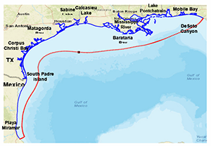 The blue and red lines on the map above combine to delineate the Northern Gulf of Mexico Operational Forecast System model grid boundary. The red line represents the model's open ocean boundary.
A new report published in the NOAA Institutional Repository titled, NOAA'S upgraded northern Gulf of Mexico operational forecast system: model development and hindcast skill assessment, was authored by Zizang Yang, Philip Richardson and Edward Myers of the Coast Survey Development Lab. The report describes technical details on the development and evaluation of the upgraded version of NOAA/National Ocean Service’s Northern Gulf of Mexico Operational Forecast System. The system uses the finite volume community ocean model as the core hydrodynamic model. The model’s domain encompasses both the combined three existing operational forecast systems in the area and extends coverage to Lake Pontchartrain, the lower Mississippi River, and coastal embayments of Texas, among others. The report presents in detail the results of a comprehensive evaluation of the new version through the skill assessment of a constant density simulation, tidal forcing only simulation, a one-year hindcast simulation, and multiple runs investigating difference-model configurations. For more information, contact Neil.Weston@noaa.gov.
 Julia Powell looks on as CDR Briana Hillstrom drives the harbormaster vessel through the Port of Mobile, Alabama.
In the last week of April, Coast Survey’s RDML Benjamin Evans, Julia Powell and CDR Briana Hillstrom visited the Central Gulf Coast, their first major stakeholder engagement visit since the beginning of the pandemic. Leadership visited key stakeholders, federal partners and Congressional staff to discuss NOAA's Precision Marine Navigation products and services in three key port areas – Mobile, Alabama; Gulfport, Mississippi; and New Orleans, Louisiana. In Mobile, they highlighted the need for NOAA's navigation services to expand, as the U.S. Army Corps of Engineers completes a major dredging project to deepen the navigation channels. In Gulfport, they were briefed by the Port of Gulfport and the University of Southern Mississippi and their partnerships on technology incubation and ocean science education. In New Orleans, they met with all three pilot associations which serve the ports of the lower Mississippi River and were able to see river commerce first hand while riding an outbound merchant ship loaded with corn. They also met with the Maritime Pilots Institute training center where they are using Coast Survey’s prototype S-102 high resolution bathymetry to assess navigation risk and to improve models of the hydrodynamic interaction of ships and the seafloor. Leadership also met with colleagues at the Naval Oceanographic Office, and visited their Fleet Survey Team. This is a region with a high concentration of NOAA navigation services equities, and the trip was a chance to refresh and rebuild relationships with critical partners and demonstrate the commitment and value of NOAA and Coast Survey to our coastal economies and communities. For more information contact Julia.Powell@noaa.gov.
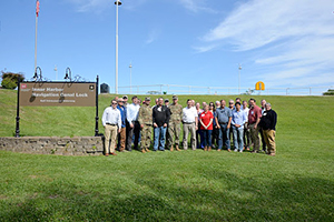 Group photo of the USACE Inland Waterways Board Members, federal observers and USACE Staff at the New Orleans Inner Harbor Navigation Canal Lock.
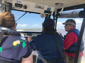
NOAA Senior Advisor to the U.S. Committee on the Marine Transportation System Heather Gilbert recently attended the 96th Meeting of the Inland Waterways Users Board from April 18-20 in New Orleans, Louisiana on behalf of RDML Evans. The meeting focused on the Inland Waterways System and consisted of a trip out to Bayou Sorrel Lock and a tour of the New Orleans Inner Harbor Navigation Channel. As the NOAA federal observer to the board, Heather highlighted NOAA’s Precision Navigation program, the future of NOAA charts, and RDML Evan’s recent trip and meeting with the Mississippi River Commission, illustrating how NOAA’s work complements the Inland Waterways. For more information contact Heather.Gilbert@noaa.gov.
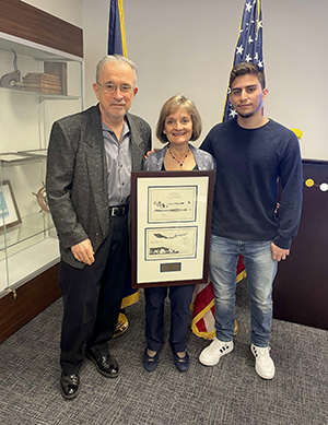 Katie at the retirement celebration holding a framed set of Whistler prints flanked by her husband and son.
Thank-you to everyone who joined in Katie Ries's retirement celebration. It was a huge success with an excellent turn out! We send her off with well wishes in her future endeavors.
 CDR Bill Winner
Bill Winner was recently promoted to Commander on May 1 – congratulations Bill!
did you know?

Be sure to check out the Spring edition of the NOS Wavelengths newsletter that came out on Thursday April 28. Read about NOS HQ updates, stories from OCM, IOOS, and NGS, and the latest training opportunities.