Office of Coast Survey
National Oceanic and Atmospheric Administration
U.S. Department of Commerce
Office of Coast Survey
National Oceanic and Atmospheric Administration
U.S. Department of Commerce
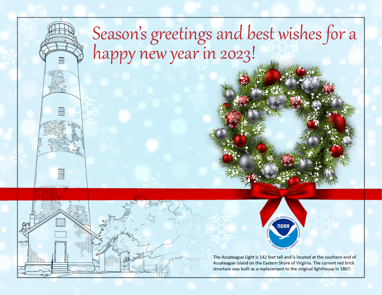
December 14, 2022

Working with the state of Alaska, NOAA's Integrated Ocean and Coastal Mapping team organized and hosted the virtual 2022 Alaska Coastal and Ocean Mapping Summit. A total of 185 participants and 57 presenters, including many from Coast Survey, attended the summit to share the latest information regarding efforts to advance the Alaska Coastal Mapping Strategy and the National Strategy for Ocean Mapping, Exploring, and Characterizing the United States Exclusive Economic Zone. Both days of the summit featured remarks from local leaders and focused on mapping updates and plans, collaboration methods, technology advancements, and opportunities to progress Alaska's mapping goals. A summary report of the proceedings is anticipated to be released in early 2023 and will be posted to the NOAA Institutional Repository. For more information, contact Meredith.Westington@noaa.gov.
The United States, represented by the Office of Coast Survey, the U.S. Navy, and the National Geospatial-Intelligence Agency, hosted the 23rd meeting of the Meso American-Caribbean Sea Hydrographic Commission (MACHC) from November 29 to December 2 in St. Louis, Missouri. The meeting was chaired by Vice Admiral Renato Arruda of Brazil. The first in person meeting of the MACHC since 2019 gathered approximately 75 participants representing almost 30 nations, industry, inter-governmental organizations, and academia. There was an online option via the webinar and translation service Interactio, which hosted additional virtual participants. The week began with a seminar focused on hydrographic governance and marine spatial data infrastructure. The MACHC-23 plenary and working groups focused on ensuring seamless regional electronic navigational chart coverage, increasing capacity to provide the best quality navigation products and services, and making invaluable, authoritative charting data available for many other non-navigation purposes. Other major topics included International Hydrographic Organization and MACHC developments and policies, S-100 products and services, and Seabed 2030. For more information, contact John.Nyberg@noaa.gov.
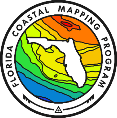
Continuing the busy fall season of regional mapping campaigns, NOAA's Integrated Ocean and Coastal Mapping team helped to organize and host the 2022 Florida Coastal Mapping Summit at the end of November. The Florida Coastal Mapping Program brings together federal and state agencies, academia, and the private sector to coordinate the collection and sharing of Florida coastal seafloor data. The program and the regional approach to mapping are key mapping goals in the National Strategy for Ocean Mapping, Exploring, and Characterizing the United States Exclusive Economic Zone. At the summit, participants discussed a wide range of topics, including bathymetric lidar specifications, crowdsourced bathymetry, state mapping data acquisition plans, and Hurricane Ian response. A number of NOAA programs provided updates on their work, including the Office of Coast Survey, National Geodetic Survey, National Centers for Coastal Ocean Science, and NESDIS's National Centers for Environmental Information. For more information, contact Ashley.Chappell@noaa.gov.
The 2022 Navigation Technology Conference was held in Seattle, Washington on December 6 and 7. The conference focused on developments in best practices for marine navigation, data collection and dissemination, new technologies, and regulations. Manufacturers of navigation hardware and software were also present displaying their latest capabilities. Coast Survey's Miya Pavlock and Darren Wright presented on the data collection and dissemination panel – Miya briefing on the National Bathymetric Source and Darren describing and discussing the Precision Marine Navigation Program. Central Gulf Coast Navigation Manager Tim Osborn was also present and representing the navigation managers. Miya, Darren and Tim had many great discussions and interactions with conference attendees made up primarily of mariners. Please contact Darren.Wright@noaa.govfor more information.
Recent graduates from the Class of 2022 were awarded Category B certificates for the Marine Cartography Graduate Program on December 12. The graduates included three cartographers from Coast Survey's Marine Chart Division, Irenosen Okojie, Kathryn Smith, and William Stanus, and from the National Geodetic Survey's Remote Sensing Division, LTJG Julia Waldsmith. The program is recognized by the International Board on Standards and Competence as meeting the requirements prescribed in the International Hydrographic Organization S8-B Standards of Competence for Category Nautical Cartographers. This is the program's fifth class and the second class to be conducted entirely online with a combination of in-house content presented by Coast Survey senior cartographers and other subject matter experts, and graduate courses presented by the University of Maryland. All were happy to hold this graduation ceremony in person at Coast Survey headquarters for the first time in three years.
Weekly Hydro Ship Activity Report – November 6 through November 12, 2022
Weekly Hydro Ship Activity Report – November 13 through November 19, 2022
Weekly Hydro Ship Activity Report – November 20 through November 26, 2022
Weekly Hydro Ship Activity Report – November 27 through December 3, 2022
Navigation Response Team Activities
Mike Annis (HQ), James Kirkpatrick and Michael Coughlin (NRT Fernandina Beach) recently met with two Kongsberg Maritime representatives to demo a new Kongsberg multibeam sonar, the EM2040P. They tested the new sonar in real-world shallow water conditions while also testing the new SIS5 interface software and provided feedback to the vendor representatives. The team also performed simultaneous testing of Hypack 2022 and investigated some lingering interference issues with the current EM2040C sonar.
Five personnel from the Navigation Response Branch attended the 2022 U.S. Workboat Show in New Orleans, Louisiana. Mike Annis, Michael Davidson, LTJG Collin McMillan, Josh Bergeron, and Alex Ligon conducted research for a new survey vessel to support uncrewed vehicle deployment and recovery. The team met with a wide array of industry vendors, including boat fabricators, marine power companies, marine crane vendors and others. This show will help the team narrow the developing requirements documentation needed to procure a suitable vessel.
CAPT Mark Van Waes is re-joining Coast Survey after having spent the past few years coordinating research ship allocations for the Office of Oceanic and Atmospheric Research. Mark has spent much of his 22+ year career with or supporting Coast Survey, first as a junior officer on NOAA ships Rainier and Fairweather, then doing field support with HSTP(B). From there he transitioned to working on the construction and delivery of NOAA Ship Ferdnand R. Hassler, serving as the ship's pre-commissioning executive officer. He then headed back to Rainier as executive officer and, after a stint as the Office of Marine and Aviation Operation's first data manager, he took command of the Fairweather in 2016. Happy to be back with Coast Suvey, Mark is looking forward to helping shape the future chief of staff position, among other special projects. He enjoys numerous pursuits such as hiking, cycling, and photography, and has summited both Mount Rainier (Tahoma) and Mount Fairweather (Tsalxaan), the latter while in command of the ship named after it. More than anything, however, he loves to spend time with his wife and two young daughters.
The Coast Survey Development Lab welcomes Andreas Tsoulkas to the Information Technology Services Branch as the deputy information system security officer. Andreas started working in information technology while earning his degree in environmental science and technology in London, England. His interest in working for and further learning about NOAA's mission dates back to his university days where he studied and collected data on pollution levels in British and European estuaries. He then continued to pursue a career in IT, taking on various technical roles such as senior engineer, IT manager, project manager for migrations and technical advisor working with cloud technologies. He has experience leading technology and cybersecurity strategy, transformation and client solutions for the United Kingdom and international service providers and their clients, and working for United Kingdom, European Union and U.S. based companies. He also has experience with supporting companies in the fintech, hedge fund, energy, Formula One, automobile, and the cosmetics industries globally. Outside of work he enjoys the outdoors and wilderness adventures, messing around crafting patches on his synthesizer, good food, and traveling. He also aspires to own a small sailboat one day and is currently trying hard to convince his wife that this is a great idea.
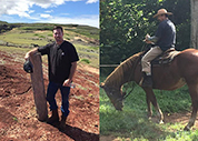
John Nelson, from the Island of Kaua'i, recently joined the navigation response team operating out of Fernandina Beach, Florida. He studied biological, geological, and physical oceanography at the University of Hawaii-Manoa and Humboldt State University. He previously worked as a conservation specialist, writing conservation plans for farmers and ranchers through partnerships with the U.S. Department of Agriculture, Natural Resources Conservation Service. Prior to his time with the Kaua'i conservation districts, he studied the Klamath River and worked closely with the Yurok and Tolowa Tribes in Northern California. Conservation and sustainability are extremely important to him and he enjoys ranching and raising beef cattle at home on West Kaua'i.
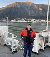
Alexis "Lexi" Ferguson is now assigned to the Coast Survey Development Lab's Hydrographic Systems and Technology Branch (HSTB) as the field liaison for the Atlantic Coast. Her role in the branch will be to focus on research-to-operation collaboration, operational support, and regular updates and maintenance of survey systems. Prior to joining the NOAA Corps, she graduated from the University of South Florida-St. Petersburg and was a marine mammal observer and water quality contractor. Her junior officer tour on NOAA Ship Fairweather, from December 2020 to November 2022, helped build a foundation of survey knowledge and operational capabilities for her role at HSTB.

Brennan Perkins is the newest member of the navigation response team based in Stennis, Mississippi. Brennan joined on November 21 and is one of the newest employees to NOAA! Before coming to Coast Survey, Brennan completed his undergraduate degree at the Metropolitan State University of Denver, studying statistical and applied mathematics, mechanical engineering, and data science. Previously, he worked at McMurdo Station, Antarctica. Prior to the station assignment, Brennan was a data scientist and water operator, working on many things including Colorado Department of Public Health/Environmental Protection Agency data and building GIS maps of district infrastructure.
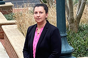
Rosemarie McKeeby joins Coast Survey as a management and program analyst working on strategic planning, performance measures, risk management, and other projects. She has more than 20 years of experience with NOAA, primarily with National Marine Sanctuaries and coastal management, and most recently with NOAA's Office of the Chief Financial Officer. Rosemarie is excited to be back in NOS and is looking forward to supporting Coast Survey.
did you know?
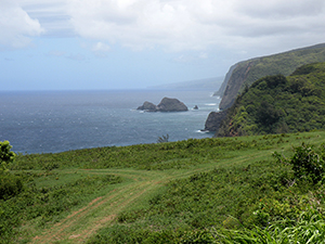
Why is one side of an island sometimes greener than the other? Winds! One side is leeward, the other windward. Which one do you think made this side of the island so lush and verdant?
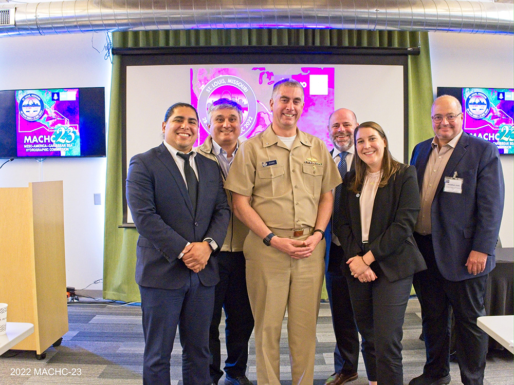 From left to right: Julio Castillo, Nicolas Alvarado, RDML Ben Evans, John Nyberg, Alexis Maxwell, and Jonathan Justi at the MACHC 2022.
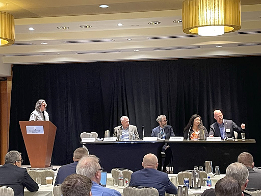 Miya Pavlock and Darren Wright (right) discuss data collection and dissemination at NAVTECH 2022.
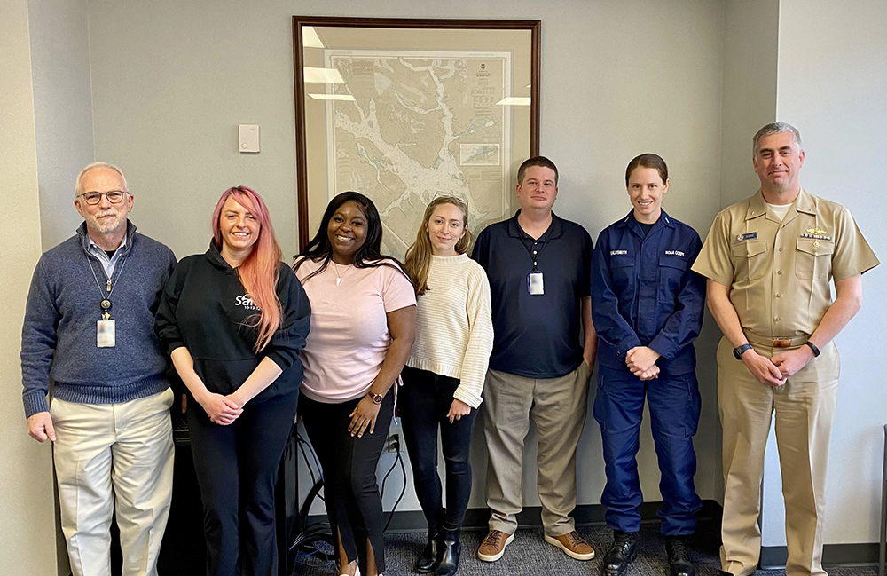 The Marine Cartography Graduate Program Class of 2022. Shown from left to right: program coordinators Colby Harmon and Megan Bartlett, graduates Ren Okojie, Kathryn Smith, Bill Stanus, LTJG Julia Waldsmith, and Office of Coast Survey Director RDML Ben Evans.
 The Kongsberg multibeam echosounder mounted on the survey vessel and a close-up of the EM204P transducer.