Office of Coast Survey
National Oceanic and Atmospheric Administration
U.S. Department of Commerce

Office of Coast Survey
National Oceanic and Atmospheric Administration
U.S. Department of Commerce
September 14, 2022
Regional navigation manager speaks at U.S. Coast Guard Auxiliary National Conference
The U.S. Coast Guard Auxiliary National Conference was held the week of August 15-20 in Orlando, Florida. Texas Navigation Manager Quentin Stubbs and Florida Navigation Manager Nicolas Alvarado, were in attendance along with several hundred attendees. Quentin Stubbs had the opportunity to speak at the National Board Meeting where he highlighted hydrographic surveying, the nautical chart transition, and the importance of USCG Auxiliary activities like verifying aids to navigation and recreational boater training. He also had the opportunity to speak with Commodore David Porter, the diversity officer of the USCG Auxiliary Diversity Directorate on recruitment strategies to increase the diversity of the USCG Auxiliary leadership and general body. Also in attendance at this conference was Admiral Linda Fagan, the first female Commandant of the USCG! Quentin and Nicolas along with Darren Wright, the National Weather Service National Marine Program Manager, got to meet Admiral Fagan and grab a photo. For more information, contact Nicolas.Alvarado@noaa.gov.
Alaska navigation manager meets with NOAA leadership in Anchorage and Nome
Alaska Navigation Manager LCDR Hadely Owen met with NOAA Administrator Dr. Richard Spinrad and other NOAA leaders on August 16 and 17 as part of their ten day comprehensive trip to Alaska. LCDR Owen gave an overview of navigation and foundational needs which took place as part of a walking conversation in Anchorage. She was also able to meet with the group in Nome, Alaska where they spent two days meeting with city and port representatives, tribal organizations in the area, and with general area familiarization. LCDR Owen was able to add on to meet with Nome harbormaster Lucas Stotts, listen in on a meeting with the city about the port, join for a tour of the port's plans and an overview flight of the region, from Nome and over Port Clarence to Shishmaref and back. She also followed up on next year's Coast Survey plans for approaches to Nome with the Nome harbormaster – planned as Alaska's only deep draft port north of Anchorage. For more information, contact Hadley.A.Owen@noaa.gov.
Inland Waterway User Board meeting held in Walla Walla, Washington
Heather Gilbert, NOAAs senior advisor to the U.S. Committee on the Marine Transportation System attended the 97th meeting of the Inland Waterways Users Board, August 16 and 17 in Walla Walla, Washington. The board meeting focused on the inland waterways system, monitoring the Inland Waterways Trust Fund and making recommendations to the Army and Congress on investment priorities using resources from the fund. The meeting included a trip to Ice Harbor Lock and Dam which consists of a powerhouse, navigation lock, two fish ladders, a removable spillway weir and a juvenile fish bypass facility. As the NOAA federal observer to the board, Heather highlighted the work NOAA does in the Pacific Northwest to support the inland system, specifically on the Columbia and Snake Rivers. This includes work done by the National Weather Service River Forecast Office and the navigation response teams. She also briefed the board on the nautical chart transition process, updates to PORTS and RDML Evan’s trip to the Mississippi River as part of his role on the Mississippi River Commission. For more information, contact Heather.Gilbert@noaa.gov.
Navigation response team activities on the Columbia River
On August 24, representatives from the Columbia River Inter-Tribal Fish Commission (CRITFC) and Yakama Nation Fisheries visited NRT-Seattle while on project in Hood River, Oregon. NRT-Seattle is conducting a hydrographic survey of the Columbia River between Bonneville Dam and the Dalles, Oregon updating nautical chart data, but also in collaboration with CRITFC and the Yakama Nation in support of fish habitat assessment and restoration activities. Members of the CRITFC and the Yakama tribe worked with the Navigation Services Division in advance of survey work to identify high priority survey areas along the stretch of river. NRT-Seattle Team members Annie Raymond and Tim Wilkinson gave Charles Seaton, Mike Swirsky, Sanjeev Joshi, and David Graves of CRITFC and Bill Sharp from Yakama Nation Fisheries a tour or the survey vessel S3006 and discussed survey methods and progress. Daryl Stafford, Waterfront Manager for the port of Hood River, also stopped by the vessel to discuss a request from the port for survey depths at the port entrance and concerns of shoaling. For more information, contact Annemieke.Raymond@noaa.gov.
Navigation response team supports meeting in Gulfport, Mississippi
On August 24, Coast Survey joined with numerous NOAA office participants in a large coastal forum with the University of Southern Mississippi (USM), Port of Gulfport, and members of several Congressional offices and committees. The event was focused on NOAA operations and capabilities along the Gulf Coast, and on emerging and operational use of uncrewed systems for coastal mapping, environmental studies, and incident response. The navigation response team (NRT-Stennis) participated and gave a comprehensive demonstration. The team rolled their mobile command and operations trailer into the warehouse area of the USM Marine Center and gave an extensive tour of their equipment, processing and data displays. They discussed the various projects they are currently working on that will see deployment and collection of data from two uncrewed systems. The Office of Marine and Aviation Operations (OMAO) Deputy Director Admiral Chad Cary was present with other senior OMAO members. They joined in with the response team members for a discussion of the joint collaboration of deployment and use of uncrewed systems today, and in the future. After the event, a tour of the new USM/Port Gulfport building was made with all the meeting participants. Thank you to LTJG Collin McMillan, Alex Ligon and Joshua Bergeron for their excellent work and participation in this event. For more information, contact Tim.Osborn@noaa.gov.
Uncrewed surface vehicle integrated into survey operations on NOAA Ship Thomas Jefferson
Following delivery and acceptance testing during early August in New Hampshire, NOAA's newly acquired DriX uncrewed surface vehicle (USV) is aboard the NOAA Ship Thomas Jefferson. The DriX project team, comprised of personnel from the Office of Coast Survey, Office of Marine and Aviation Operations, National Marine Fisheries Service, UxS Operations Center, University of New Hampshire, and iXblue (DriX's manufacturer), are working with the crew of Thomas Jefferson to define the staffing, support and procedures necessary to integrate the DriX USV into routine shipboard hydrographic survey operations. The DriX will be operated for two underway periods over the full month of September. The first period is focused on developing safe launch and recovery procedures and crew member training. During the second period the DriX will be operated by NOAA personnel with iXblue support to conduct hydrographic surveys on the approaches to Cleveland. For more information, contact Corey.Allen@noaa.gov.
CCOM/JHC and NOAA developers publish article on automating hydrographic data review
Dr. Giuseppe Masetti (CCOM/JHC), Tyanne Faulkes, Matt Wilson, and Julia Wallace (HSD), recently published an article in Geomatics describing ongoing efforts to better automate hydrographic data review. This team, together since 2015, developed the QC Tools and CA Tools software applications via the HydrOffice framework. The custom made Python software applications described in this article translate Coast Survey Hydrographic Survey Specifications into automated processes that eliminate many of the tedious and manual processes in the workflow. The approach is proven to increase both the quality and timeliness of the review process, while also increasing confidence in the final survey products. Because many hydrographic offices share the same challenges in the review of hydrographic data, the tools and the approach in building them generated interest and inquiry from the international ocean mapping community, as well as many new users of the open source and freely available applications. For more information, contact Matthew.Wilson@noaa.gov.
Texas navigation manager assists with battleship relocation
On August 31, Texas Navigation Manager Quentin Stubbs shadowed a team from USCG Station Houston as they assisted in the transportation of Battleship Texas via dead tow from San Jacinto State Historic Site in La Porte, Texas to Gulf Copper and Manufacturing Corporations' Galveston Shipyard in Galveston, Texas. According to the Battleship Texas Foundation, the ship is up and out of the water on a dry dock for the first time in 32 years and only the second time since she became a museum in 1948. Future chart corrections will be needed to reflect proposed alterations (i.e. potential filling) to the small harbor in San Jacinto Battleground State Historic Site. Chart corrections and updates will also be needed for Battleship Texas' new home, which is still being identified. The dead tow journey down the Houston Ship Channel to Galveston Harbor lasted approximately ten hours. As a consortium of tugboats maneuvered the ship, channel closure and a moving safety zone was established and maintained by federal, state, and local law enforcement agencies in order to ensure the safety of the tow and maritime public. Numerous recreational boaters from local marinas ventured out to marvel and capture images of Battleship Texas as she was being transported to her new, temporary home for repairs and renovations. Special thanks is extended to LCDR Jeff Schwind, chief of Enforcement Division of USCG Sector Houston-Galveston. For more information, contact Quentin.Stubbs@noaa.gov.
NOAA Ships and Contractor Operations
Weekly Hydro Ship Activity Report – July 31 through August 6, 2022
Weekly Hydro Ship Activity Report – August 7 through August 13, 2022
Weekly Hydro Ship Activity Report – August 14 through August 19, 2022
Weekly Hydro Ship Activity Report – August 21 through August 27, 2022, 2022
Weekly Hydro Ship Activity Report – August 28 through September 3, 2022
Weekly Hydro Ship Activity Report – September 4 through September 10, 2022
As folks continue to return to the office this year, everyone should be aware of emergency procedures for their specific office and outside environment. NOAA's Office of the Chief Administrative Officer has a wealth of emergency preparedness information for the Silver Spring Metro Campus. Of particular note are the SSMC Occupant Emergency Plan and the SSMC Campus Emergency Procedures Quick Reference Guide.
HSD Chiefs and Team Leads met in Norfolk, Virginia August 30 to September 1 for a three day offsite. The offsite is an annual meeting to review and prioritize objectives and set plans for the year ahead.
On September 8 and 9, CDR Briana Hillstrom, Matt Wilson, Grant Froelich, Julia Powell, CDR Olivia Hauser, Glen Rice and Paul Turner met with members from the Deputy Hydrographer of the Navy and members of the Navy's Fleet Survey Team. Discussion revolved around common hydrographic interests such as data sharing and licensing, the National Bathymetric Source, and potential collaborations with personnel training and data acquisition.
Staff Updates
Two new hires for MCD, Morgan Zaleski who started August 29, and William Stanus who will start on August 12.
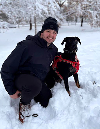
Morgan Zaleski joined Coast Survey as a cartographer for Products Branch C on August 29. He holds a bachelor's degree in Geographical Sciences from the University of Maryland, College Park. Prior to NOAA, Morgan worked at NGA as a contractor doing nautical cartography for two years. He also spent seven years in the US Navy as an enlisted intelligence analyst. In his spare time he enjoys spending time with his dog Rhino and cycling.
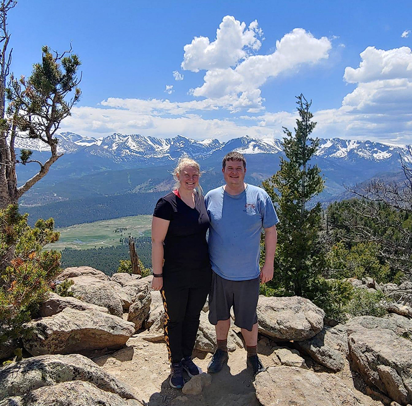
William (Bill) Stanus joins Coast Survey as a cartographer working within production branch D. Originally from Virginia Beach, he has spent countless hours on the water: fishing, surfing, sailing, and using NOAA charts to set traps for blue crab. He received his bachelor's degree in geospatial science from Radford University and is currently enrolled in the University of Maryland's Geospatial Information Science master's program. Many weekends he can be found exploring new hiking trails with his fiancee.
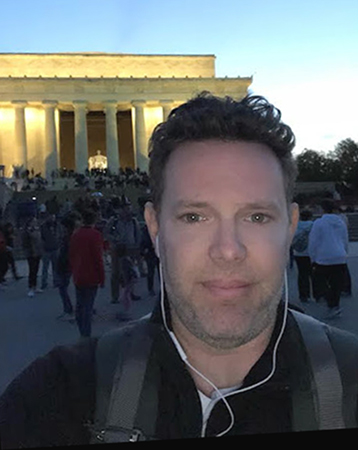
The Hydrographic Surveys Division welcomes Grant Froelich as its new deputy chief, starting October 9. Grant started his NOAA career 20 years ago as an assistant survey technician aboard NOAA Ship Whiting and eventually moved to the West Coast, where he became the chief survey technician of NOAA Ship Fairweather. In 2008 he moved to the Pacific Hydrographic Branch, and in 2014 he was selected as the hydrographic team lead. Grant recently served as the acting deputy chief of the Expeditions and Exploration Division in Ocean Exploration and Research and as the acting chief of the Operations Branch in HSD. He is very excited about this new opportunity to broaden his skills, contribute to HSD in a new way, and move to the east coast along with his new puppy, Indigo. Many thanks to Peter Holmberg and Lucy Hick who were detailed as HSD Deputy Chief during the search for a new permanent deputy!
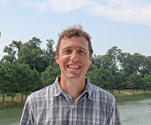
Matt Wilson was recently selected as streamlining team lead at the Atlantic Hydrographic Branch in Norfolk. Matt has over 11 years of experience as a Coast Survey physical scientist, during which time he obtained master's degrees in Ocean Mapping from UNH/CCOM and from Penn State. He served as a U.S. Navy officer before joining NOAA in 2008, and more recently he worked as sales and marketing manager for QPS, Inc., prior to returning to NOAA in 2020. In his new role, he will be focused on the faster and more efficient throughput of hydrographic data towards products and services. Congratulations Matt!
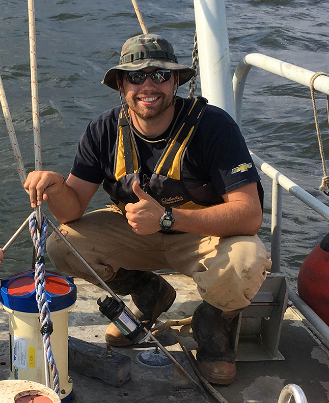
Michael Stephens has been selected to be the new contracts team lead within the Operations Branch of Hydrographic Surveys Division. Michael has been with the Operations Branch for the past two years as a physical scientist, and has been acting contracts team lead since the end of May. Prior to joining the Operations Branch, he worked at an environmental engineering firm for six years. In addition to bathymetric and remote sensing survey experience, he has a diverse suite of technical skills including dredged material evaluations, pre-design investigations of contaminated sediments and unexploded ordnance detection. He lives in Baltimore and enjoys fishing, crabbing and getting out on the bay in his free time. Prior to moving to Baltimore, Michael spent a year living and working in Key Largo, Florida, where he earned his Divemaster certification and U.S. Coast Guard captain's license.
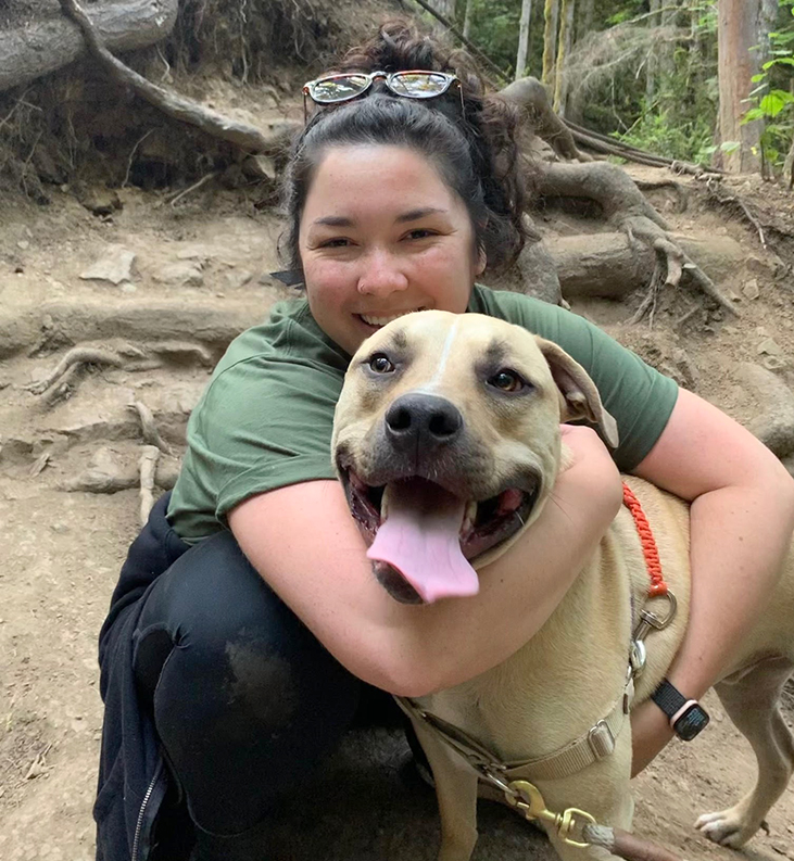
Miya Pavlock joins the Hydrographic Surveys Division, Operations Branch as the team lead of the External Source Data team. Previously, she worked as a contractor on the National Bathymetric Source project. She holds a bachelor’s degree in Oceanography from the University of Washington and a master's degree in Marine Science from Moss Landing Marine Labs through California State University, Monterey Bay – NOAA Center for Marine Ecosystems Cooperative Science Center scholar. Her other interests include cooking, quality time with her dog and two cats, and adventuring in the Pacific Northwest.
did you know?
Coast Survey's Director, RDML Ben Evans, serves as a member of the Mississippi River Commission with colleagues from the Army Corps of Engineers, academia, and the private sector. While the Commission is primarily focused on flood control, navigation, and commerce in the Mississippi River Basin, it also has an important international role through the Sister Rivers Partnership with the Mekong River Commission in Southeast Asia. Both the Mekong and Mississippi River Commissions are similar, with the Mekong Commission's added challenge of coordination across four nations (Cambodia, Laos, Thailand, and Vietnam).
coming up
9/12-9/16 – Marine Debris Week
9/15-10/15 – Hispanic Heritage Month
9/17 – International Coastal Cleanup
9/20-9/22 – HSRP Public Meeting
9/17-9/24 – National Estuaries Week
9/24 – National Public Lands Day
9/25 – World Rivers Day
gis corner
NOAA Esri Central Support - contact for GIS software issues.
OCS GIS Portal & NOAA Geoplatform – data access
NOAA GIS Community – information on GIS projects, software, and geospatial initiatives
ArcGIS StoryMaps – Discover our stories
Submit issues with ArcGIS-based applications to the help desk with the subject line "URGENT – GIS Server Issue."
Please reference this document for free and e_Learning ArcGIS Pro training to familiarize yourself with the newer software from Esri which will replace ArcMap in the future. This will allow you to play with the tools and the workspace within Pro. You will need to begin to dedicate time to looking at this material and Pro. The training for Maritime is still being developed in-house for our use. More information will be available in the future.
diversity and inclusion
National Hispanic Heritage Month is annually celebrated beginning September 15 through October 15. During this time, we recognize and commemorate the contributions and influence of Hispanic Americans to the history, culture and achievements of the United States. This year's theme is Unidos: Inclusivity for a Stronger Nation. It begins in the middle of the month because the national Independence day of several Latin American countries, specifically Costa Rica, El Salvador, Guatemala, Honduras, and Nicaragua, coincide on September 15. In addition, Mexico and Chile celebrate their independence days on September 16 and September 18.
The National Council of Hispanic Employment Program Managers is celebrating on September 15 at 1:00 p.m. (EDT) with a half-day virtual forum. Be sure to check out the Latinos@NOAA site for access details.
NOAA's 2022 National Hispanic Heritage Month program will take place on September 20 from 2:30 to 3:30 p.m. (EDT). The event will include panelists John Cortinas, director of NOAA's Atlantic Oceanographic and Meteorological Laboratory; Ada Monzón, chief meteorologist at WAPA-TV; and Dr. Rocío Caballero-Gill, founder of GeoLatinas.
The American Indian Alaska Native ERG presents: Smoke Signals Meet & Greet Autumn Equinox, via Google Meet on September 22 from 1:00 to 2:00 p.m. (EDT). This event is open to all NOAA employees, so please join in and get to know some native employees within the NOAA family as we discuss the book Killers of the Flower Moon: The Osage Murders and the birth of the FBI, by David Grann.
NOAA is launching a Mid-Career Leadership Development Program as a nine-month opportunity for Band 3 employees to explore and develop their leadership skills. The program will also include coaching from certified NOAA coaches, ERG/Affinity Group Diversity Presentations and an internationally renowned author as a guest speaker. If you are interested in participating, please contact your Line or Staff Office Chief Learning Officer by September 26.
updates
NOS News
Coast Survey News
 Navigate with Confidence
About Us | IOCM | HSRP | Contact
Privacy Policy | Disclaimer | Information Quality | Freedom of Information Act | USA.gov | Ready.gov | EEO
Website owned by: Office of Coast Survey
National Ocean Service | NOAA | Department of Commerce