

NOAA maintains a suite of nearly 2000 electronic navigational charts (NOAA ENC®), as well as the ten volume United States Coast Pilot®. The seafloor and coastline are dynamic environments, which means that our products are constantly scrutinized for possible changes. Each year we make thousands of updates to ENCs, ensuring we are providing the most accurate products possible. The source data for most of these updates comes from NOAA or contractor surveys or from our federal partners, such as the U.S. Army Corps of Engineers and the U.S. Coast Guard. However, we also rely on many other data sources to help keep our ENCs up-to-date.
Improving the accuracy of NOAA Charts and Publications
The Nautical Chart Update Pilot Project is an opportunity for individuals and local groups, such as boating clubs, to help evaluate and improve information on NOAA ENCs. Citizen scientists are encouraged to submit annual reports addressing a specific ENC or area. These reports will be evaluated by NOAA cartographers for potential chart updates. The report may be assembled and submitted anytime during the boating season. At the end of the year, citizen scientists, who have submitted ENC updates may choose to be recognized on our website.
Do I need a boat or special equipment to participate?
Some updates can only be identified from a boat. However, many features such as shoreline and landmarks, can be investigated by using NOAA’s ENC Viewer to examine the charted information overlaid on satellite imagery. Instances where the ENC does not match the imagery can be easily seen and reported. Citizen scientists can also make observations though other means or can report information found via the internet or other sources.
What types of information can be submitted?
Hydrography and Critical Corrections
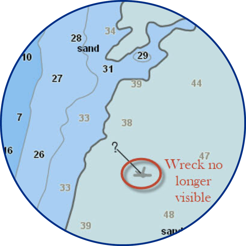
These are “on the water” issues that have the potential to cause groundings or are otherwise hazardous to marine navigation. Examples include: water depths that are shallower than charted; uncharted features such as wrecks, rocks, and obstructions; any feature, such as wrecks and piles, that are charted as “visible” but were not seen upon inspection; charted islands that are no longer visible
Aids to Navigation
Updates to private aids to navigation (ATON) can be included in reports to NOAA. However, the report should not include U.S. Coast Guard ATONs – these should be reported immediately to your local Coast Guard office.
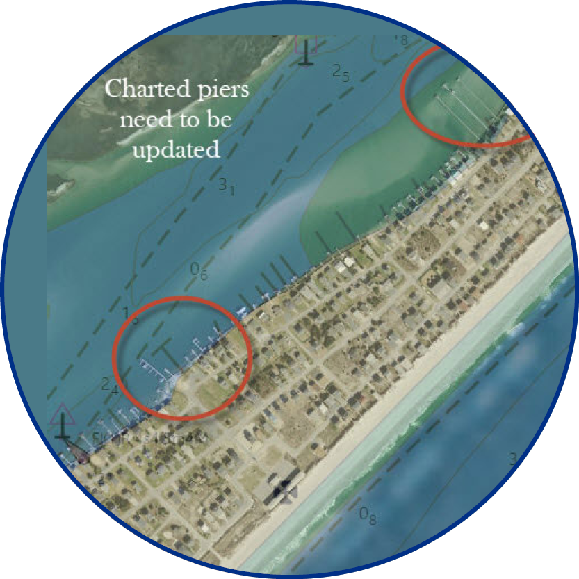
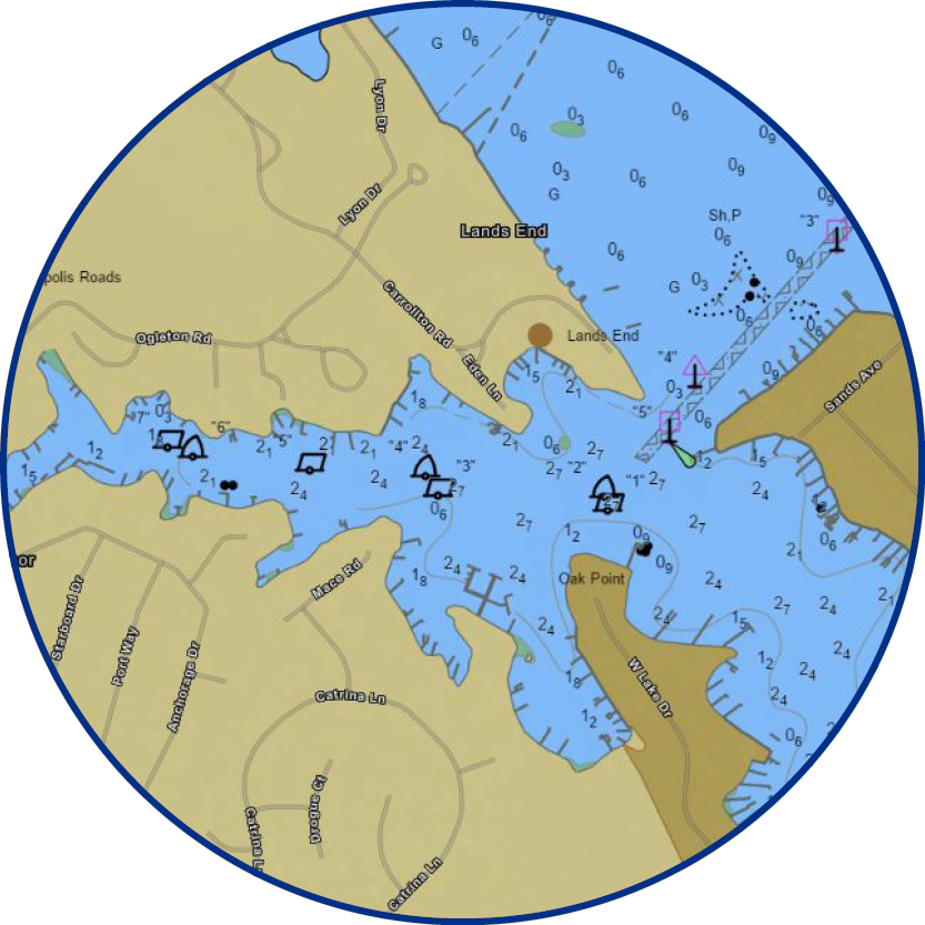
Shoreline
Note any major changes in the natural and manmade shoreline, such as piers, docks, platforms, and jetties.
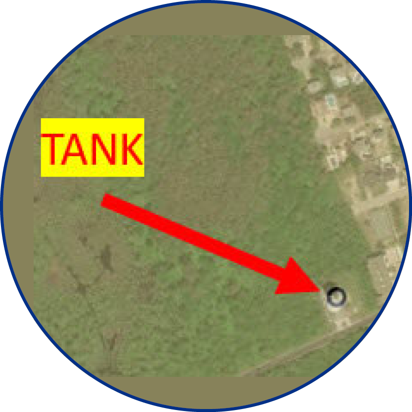
Landmarks
A landmark is any fixed natural or artificial object, generally on land, which is prominent from seaward and can be used in determining a vessel’s direction or position. Landmarks include tanks, towers, stacks, buildings, and other prominent objects.
Updates to the Coast Pilot
Discrepancies in the Coast Pilot may also be reported. These include channel descriptions, anchorages, bridge and cable clearances, currents, tide and water levels, prominent features, weather, ice conditions, wharf descriptions, dangers, routes, traffic separation schemes, and small-craft facilities.
How do I submit an update?
- Individuals or groups must first notify NOAA that they would like to participate in the ENC Update Pilot Project by sending an email to ocs.citizen.science@noaa.gov.
- Submit reports via email in a Microsoft Word format (.doc/.docx) using the template found at this link.
Can be a great process as the “daily local users” see all the changes over time. Others might only see them every __ yrs.