Office of Coast Survey
National Oceanic and Atmospheric Administration
U.S. Department of Commerce
Office of Coast Survey
National Oceanic and Atmospheric Administration
U.S. Department of Commerce
June 16, 2022
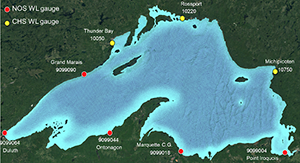 An image showing Lake Superior and the stations that make up the forecast system.
A new version of the NOS Lake Superior Operational Forecast System has been developed using the finite volume community ocean model (FVCOM). The upgraded forecast system is a collaborative project among NOAA's Great Lakes Environmental Research Laboratory, the National Ocean Service's Coast Survey Development Laboratory, the Center for Operational Oceanographic Products and Services, and the FVCOM development team at the University of Massachusetts-Dartmouth. The forecast systems for Lakes Erie, Huron, and Michigan have already been upgraded to FVCOM. The lake numerical forecast modeling system uses near real-time atmospheric analyses, river observations, and numerical weather prediction model forecast guidance to generate hourly nowcasts and short-range forecast guidance of three-dimensional water temperatures and currents, and two-dimensional water levels for Lake Superior out to 60 hours. For more information, contact John.Kelley@noaa.gov.
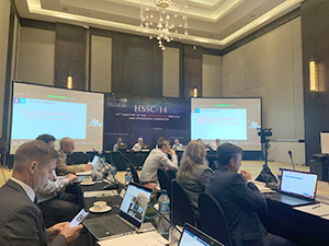 An image showing the meeting room during HSSC-14 in Denpasar, Indonesia.
In mid-May, Julia Powell traveled to Denpasar, Indonesia to attend the International Hydrographic Organization's Hydrographic Services and Standards Committee. The committee focuses on implementing a strategic direction which will be used to develop, improve, and promote global hydrographic standards. These standards enhance safety of navigation at sea, protection of the marine environment, maritime security, and economic development. As the chair of the S100 working group, she presented the 2021-2022 work for endorsement and approval. The committee approved the following standards for publication this year:
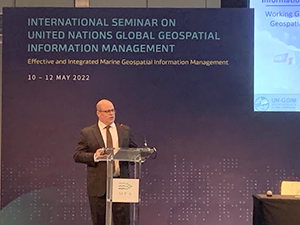 An image showing John Nyberg giving his presentation at the meeting.
In early May, John Nyberg chaired the United Nations Working Group on Marine Geospatial Information. He delivered the welcoming remarks to the International Seminar on United Nations Global Geospatial Information Management and was featured in an interview with Channel News Asia. Both the working group meeting and seminar served to progress work on the Operational Framework for Integrated Marine Geospatial Information which will serve as a guide for developing marine geospatial programs around the world, help to integrate the marine domain into the larger geospatial information ecosystem, and assist with the increasing the availability and accessibility of marine geospatial information. This is considered a critical contribution toward monitoring progress on the UN Sustainable Development Goals. John also delivered two presentations at the seminar, an update on the IGIF-H and an introduction on the work that HSD is doing with regard to data licensing. For more information, contact John.Nyberg@noaa.gov.
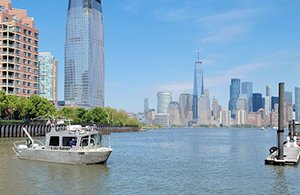 An image showing the response team survey vessel working along the pier.
The Navy and U.S. Coast Guard requested survey support from Northeast Navigation Manager Colleen Roche ahead of Fleet Week 2022. Fleet Week serves as an opportunity for the citizens to meet military mariners and see the latest capabilities of today's maritime services. This long standing and politically sensitive request was delayed by issues with the Navigation Response Team's trailer and poor weather. Down to the wire, Physical Science Technician Howie Meyers and LTJG Nick Azzopardi of NRT-New London made the 110-mile transit from New London, Connecticut to Staten Island, New York and were joined by Physical Science Technician Michael Bloom to complete a survey of Stapleton pier and quickly produced a chartlet to ensure safe transit and berthing for the Coast Guard and Navy vessels. While in New York, NRT-New London also investigated the location of rocks exposed during a low tide event at the critical turn from the Kill Van Kull into Newark Bay. The Coast Guard had moved the buoy to protect vessels from the potential danger to navigation at the turn into Port Elizabeth, New Jersey. This turn is transited by approximately 85% of the commerce into one of the largest ports in the U.S. The NRT was able to confirm for USCG that the position of the rocks matched the charted positions. For more information contact Nicholas.Azzopardi@noaa.gov.
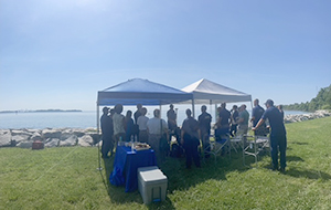 An image showing attendees of the unrewed systems open house under a tent at Possum Point near Annapolis, Maryland.
Coast Survey hosted an uncrewed systems (UxS) open house for Congressional, NOS, and NOAA staff on June 1, 2022 in Annapolis, Maryland. RDML Benjamin Evans and CAPT William Mowitt, Deputy Director, NOAA UxS Operations Center, discussed the integration of uncrewed platforms into Coast Survey and OMAO missions, while showcasing Coast Survey's Navigational Response Team Stennis's uncrewed system, the 8-foot-long Echoboat 240. The response team was on project along with its 30-foot aluminum crewed vessel, acquiring data inside of the 3.5 meter contour. This data will be used to update the nautical charts of the area and be applied to storm surge models for more accurate predictions. Attendees were able to view data in real-time during collection, use the controllers to drive the Echoboat, and take a tour of the survey vessel, while discussing the benefits and value of incorporating uncrewed systems into Coast Survey's data acquisition capabilities. The upgrade of the Echoboat was made possible through the Office of Response and Restoration's Disaster Preparedness Program Lagniappe Award. For more information contact chief.nrb.ocs@noaa.gov.
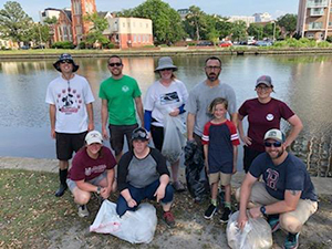 A group image of the Hydropickers from the Atlantic Hydrographic Branch.
The Atlantic Hydrographic Branch Hydropickers enjoyed a very hot but productive afternoon volunteering with the 2022 Chesapeake Bay Foundation's Clean the Bay Day on Wednesday June 1. The volunteers picked up approximately 20 pounds of trash along The Hague behind the Chrysler Museum of Art, with unexpected but very appreciated assistance from a crowd of YMCA volunteers! Trash rescued from The Hague included mystery fabrics, plastic sheeting, a variety of plastic pieces, and a mountain of cigarette butts. For more information contact Rita.S.Bowker@noaa.gov.
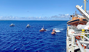 An image showing two hydrographic survey launches and two dive boats, waiting to be picked up at the end of the day by NOAA Ship Rainier.
NOAA Ship Rainier just finished her second leg on the RICHARD project, taking place in and around Guam and the Commonwealth of the Northern Mariana Islands in the western Pacific. The project's acronym stands for "Rainier Integrates Charting, Hydrography and Reef Demographics" and is a major collaborative effort between the Office of Coast Survey, the National Centers for Coastal and Ocean Science, the National Geodetic Survey, the NOAA Coral Reef Conservation Program, the National Marine Fisheries Service, and the Office of Marine and Aviation Operations. It is dedicated to and in honor of the late Rear Adm. Richard Brennan, a champion of this one-NOAA mission, crossing NOAA line and program offices. So far, the project has logged over 6,700 linear nautical miles and over 900 scientific dives. At the end of this year, NOAA Ship Rainier will contribute to a seamless map linking the tallest peaks of the Mariana Islands to 1,500 meters under the ocean. The work will support coral reef health analysis, navigational chart updates, and benthic habitat mapping. Pictured here is NOAA Ship Rainier anchored in the middle of the volcanic caldera of the Maug Islands. Additional information on the project can be found on the NOAA Coast Survey storymap as well as on the NOAA Fisheries story map. For more information contact Douglas.Wood@noaa.gov.
A long-time contractor (currently with Lynker), Jill Stoddard, has let us know that she will be moving on to a new position, effective COB, Friday, June 17, 2022. Jill served as the Executive Assistant to the Coast Survey Director for ~10 years, helping manage impossible schedules, tracking Coast Survey strategic planning actions, and being a GoToWebinar guru, amidst handling a myriad of other administrative tasks critical to keeping the front office running smoothly. Best of luck in your new job and we will miss you Jill!
Denise Gibson, also a Lynker contractor, recently joined the front office staff as Administrative Assistant. Denise will be managing travel for the front office and serving as the point of contact for scheduling my (Lorraine's) calendar, among other things. Also, until Jill's position is backfilled, Denise will be helping with scheduling for RDML Evans and coordinating for Controlled Correspondence. Next time you're in the office, please stop by and introduce yourself. Welcome Denise!
Tammie Herrin, was selected for Coast Survey's business manager detail; therefore, will continue her acting role for the next 120 days. Congrats Tammie and thank you for your steady, expert leadership on all things Coast Survey business!
MCD welcomed LCDR Michael Doig aboard as the new chief of Production Branch G, Western Gulf of Mexico. Michael will be overlapping with CDR William Winner for a few weeks for handover. LCDR Doig is reporting to MCD after being aboard NOAA Ship Ferdinand Hassler as Executive Officer. Some of LCDR Doig’s Career highlights include deploying to the U.S. Virgin Islands for the Hurricane Irma and Maria ESF-10 response, sailing through the Panama Canal aboard NOAA Ship Ronald H. Brown, conducting marine mammal surveys aboard NOAA Ship Gordon Gunter, diving to protect endangered Acropora corals prior to dredging in the Port of Miami, and conducting trawling operations aboard NOAA Ship Pisces for the Natural Resource Damage Assessment following the Deepwater Horizon oil spill.
did you know?
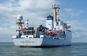
Keeping our marine transportation system functioning in a way that is safe, efficient, and environmentally sound requires information about water depth, the shape of the seafloor, lakebed, and coastline, the location of possible obstructions, and other physical features of water bodies. Hydrography is the science behind this information, and surveying is a primary method of obtaining hydrographic data. In this episode, we learn about surveying and NOAA Ship Thomas Jefferson’s survey missions in the Great Lakes. Listen to the podcast.