Office of Coast Survey
National Oceanic and Atmospheric Administration
U.S. Department of Commerce
Office of Coast Survey
National Oceanic and Atmospheric Administration
U.S. Department of Commerce
March 8, 2023
Between February 6-10, 2023, Coast Survey personnel met with several Mississippi River stakeholders in New Orleans, Louisiana. Julia Powell, Darren Wright, and Tim Osborn from the Navigation Services Division and LCDR Mike Doig and Brian Akers from the Marine Chart Division, shared information on Coast Survey programs, products, and services, such as Precision Marine Navigation, reschemed ENCs and the new version of the NOAA Custom Chart. They also identified several datum issues on the River and outlined a plan to work through them with the U.S. Army Corp of Engineers and other stakeholders. There were ten meetings in all and two ship rides, demonstrating how the pilots are using our NOAA data and charts. For more information, contact Darren.Wright@noaa.gov.
Between February 15-19, 2023, Nicolás Alvarado, Kyle Ward, Michael Gaeta, and Lucy Hick represented Coast Survey at the annual Discover Boating Miami International Boat Show. The boat show is the largest boat and yacht event in the world, with over 100,000 visitors attending. The show provides an excellent opportunity to talk to recreational boaters about the products and services that NOAA offers to the community. This year, attendees were especially interested to learn more about the NOAA Custom Chart, and in particular the enhancements that were available in the NCC Version 2.0. For more information, contact Lucy.Hick@noaa.gov.
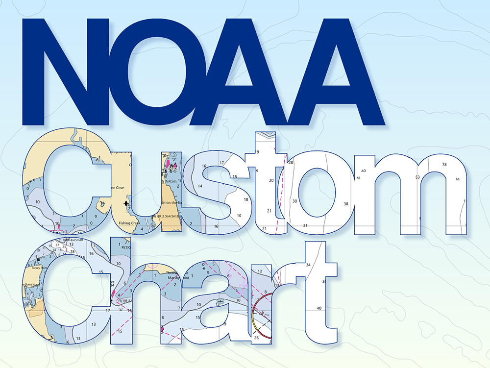
NOAA Custom Chart version 2.0 has been released to the public! The dynamic application allows users to create their own paper and PDF nautical charts derived from the official NOAA electronic navigational chart (NOAA ENC®), NOAA’s premier nautical chart product. The online application uses the latest official NOAA ENC data to create nautical charts with customized scale and extent, which can then be downloaded as PDF files. The data on the chart is presented in a manner similar to traditional paper nautical charts, showing soundings, buoys, beacons and other aids to navigation, compass roses and the like. Enhancements to this version of the application include personal chart catalog functionality, streamlined user interface, and modified symbology to emulate paper charts. For more information, contact Edward.J.Vandenameele@noaa.gov.
On February 13, the Pacific Hydrographic Branch (PHB) hosted three members of the Royal Canadian Navy (RCN) as they visited several offices at NOAA’s Western Regional Center. While their ship was anchored in Lake Washington, the RCN members toured PHB, as well as the Office of Response and Restoration, Pacific Marine Environmental Lab, and the Center for Operational Oceanographic Products and Services. While at PHB, Branch Chief James Miller and Jessica Murphy discussed hydrographic surveying capabilities and navigational products. Annie Raymond, from Navigation Response Team Seattle, was on hand to highlight the unique role of the response teams following hurricanes or maritime incidents when mapping capabilities are required to identify debris or dangers to navigation. The External Source Team’s Miya Pavlock discussed her team’s mission to identify and ingest data from non-NOAA sources supplementing the National Bathymetric Source database and navigational products. Four NOAA personnel (including PHB’s James Miller and Jessica Murphy) were then given a tour of the RCN’s Orca-class patrol vessel. These are purpose-built training vessels for introducing naval officers to ship driving, navigation, and life at sea. The majority of the ship is composed of a large enhanced bridge with modern communication and navigation technology. For more information, contact Jessica.Murphy@noaa.gov.
A draft of the new Hydrographic Surveys Specifications and Deliverables (HSSD) is now available for an internal review period within the Office of Coast Survey. Anyone in Coast Survey is invited to review and provide feedback on the new version. This project commenced in 2022 with a particular vision – to rewrite specifications with a forward-looking focus, with respect to new and developing technology, to best facilitate automation, and to better integrate with the National Bathymetric Source and S-100 based products. The new HSSD will better accommodate the increasing amounts of external source data, with metadata tags to denote data quality and universal data licenses to define terms of use. Lastly, the new version (available in both PDF and HTML) is a lighter, leaner, and easier to use document that leverages the latest accumulated knowledge from the hydrographic community. The draft is a result of many subject matter experts who graciously volunteered their time and effort. Thanks to all who contributed! If you are interested in reviewing the draft HSSD “revamp”, it is available under the “Quick Reference” section of the Hydropedia front page. The internal review period will be followed later in the year by field beta testing, an external review period, and availability of the draft HSSD for public comment. The new HSSD is expected to replace the current version in 2024. If you don’t have access to Hydropedia, or if you have any questions otherwise, please contact Matthew.Wilson@noaa.gov.
A joint project kickoff meeting was held February 15-16 at the National Hurricane Center in Miami, Florida. This highly anticipated project involves the Office of Coast Survey supporting the National Hurricane Center’s (NHC) Storm Surge Unit in its mission to develop next generation, on-demand storm surge modeling capabilities. The meeting was a great success, as NHC Director (acting) Jamie Rhome, NHC Deputy Director (acting) Michael Brennan, NHC Storm Surge Unit Lead Cody Fritz, and Laura Alaka hosted the Coast Survey modeling team including John Kelley, Soroosh Mani, Liujuan Tang, Saeed Moghimi, Ed Myers (virtual) and Corey Allen (virtual). For more information, please contact Edward.Myers@noaa.gov.
Weekly Hydro Ship Activity Report – January 29 through February 4, 2023
Weekly Hydro Ship Activity Report – February 5 through February 11, 2023
Weekly Hydro Ship Activity Report – February 12 through February 18, 2023
Weekly Hydro Ship Activity Report – February 19 through February 25, 2023
 Instructors and students of the 40-hour NOVA/NACP class in Seattle, Washington, January 2023. Back row: Harrison Bruce (NOAA). Middle row: Felix Munoz (NOAA’s WVPR), Deborah Rose (NOAA), Alejandro Palacios (NOVA Instructor), Samantha Hinchey (NOVA Instructor), Jessica Murphy (NOAA), Sophia Adams (NOAA), Melissa Trede (NOAA), Carrington Conerly (NOAA). Front row: Laura Rock (NOAA), Miya Pavlock (NOAA)
Miya Pavlock (Operations Branch) and Jessica Murphy (Pacific Hydrographic Branch) recently completed Volunteer Assistance Liaison (VAL) training with the NOAA Workplace Violence Prevention and Response Program (WVPR). Volunteer Assistance Liaison’s assist those who have experienced workplace-related sexual assault and sexual harassment (SASH) by providing transparency, support, and information, as well as resources to navigate the reporting process at NOAA. Trainees complete a 40-hour training provided by the National Organization for Victim Assistance (NOVA)/National Advocate Credentialing Program and then attend 2-hour monthly training classes. WVPR services are available to all of the NOAA workforce including contractors and federal employees. You can find additional information about the Volunteer Assistance Liaison role here. If you need victim assistance, you can contact any of the following:

Scott Sherman was selected for a 4-month detail as the acting deputy chief of the Coast Survey Development Lab, starting in February 2023.
did you know?
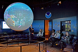
Did you know that Science On a Sphere® (SOS) is traveling to the International Hydrographic Organization’s (IHO) 3rd Assembly meeting in Monaco this spring? The U.S. delegation, including Coast Survey representatives, solicited data, content, and photos from all 98 IHO Member States to be displayed on SOS!
 Coast Survey personnel pause for a picture on the Mississippi River. From left to right are LCDR Mike Doig, Tim Osborn, Brian Akers, and Darren Wright.
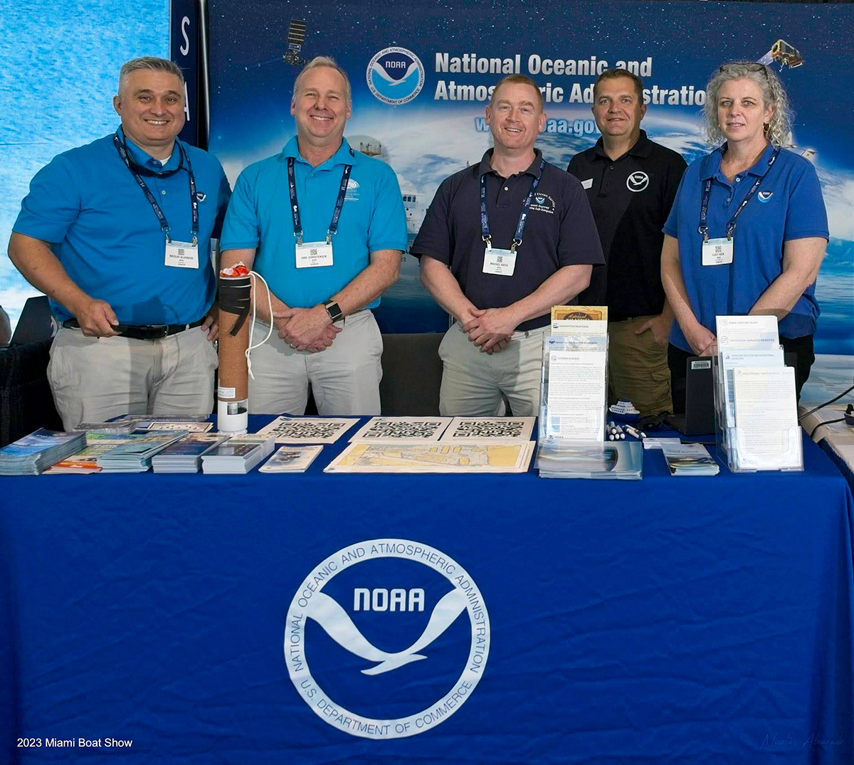 Coast Survey emplyees behind the booth at the 2023 Miami Boast Show. From left to right are: Nicolás Alvarado, Eric Christensen (NWS), Michael Gaeta, Kyle Ward, and Lucy Hick.
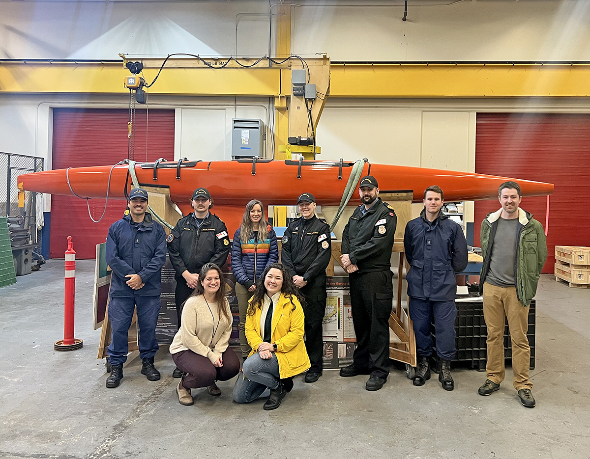 Members of the Royal Canadian Navy and NOAA stand in front of a Saildrone hull at NOAA’s Western Regional Center. Back row: LTJG William Abbott (NOAA), Lieutenant Zachary Perron (RCN), Jessica Murphy (NOAA), Lieutenant Anna Childerhose (RCN), Lieutenant Michael Van Vlaenderen (RCN), LTJG Kyle Vincent (NOAA), James Miller (NOAA). Front row: Adi Hanein (NOAA), Miya Pavlock (NOAA)
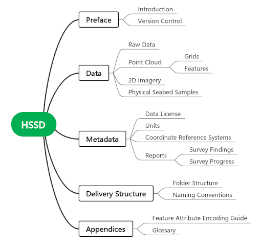 The structure of the new HSSD is simplified yet more flexible to better support new and developing technologies, automated tools, and data-driven workflows.
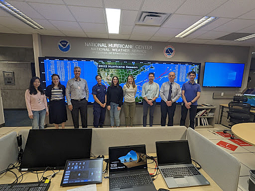 A group image of participants in the OCS-NWS joint kickoff meeting held at the National Hurricane Center in Miami Florida.