
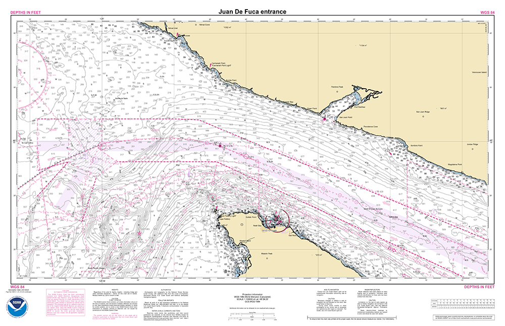
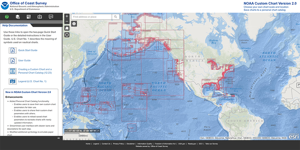
On February 14, 2023, NOAA’s Office of Coast Survey released NOAA Custom Chart version 2.0, a dynamic map application, which enables users to create their own paper and PDF nautical charts derived from the official NOAA electronic navigational chart (NOAA ENC®), NOAA’s premier nautical chart product.
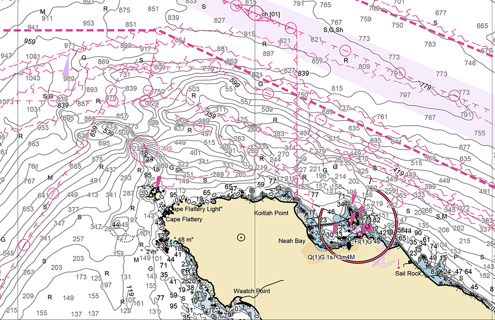
The online application uses the latest official NOAA ENC data to create nautical charts with customized scale and extent, which can then be downloaded as PDF files. The data on the chart is presented in a manner similar to traditional paper nautical charts, showing soundings, buoys, beacons and other aids to navigation, compass roses and the like.
Additional enhancements from the previous version include:
- A streamlined user interface that describes each setting.
- Further improvement of chart symbols.
- Additional page size options.
- The addition of more chart notes, particularly in areas where traditional paper charts have been canceled.
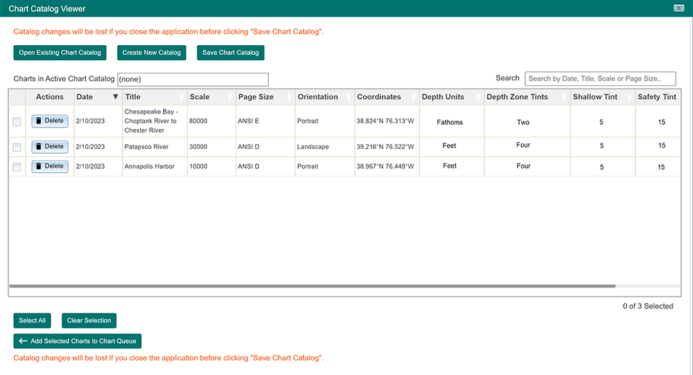
The most noteworthy change is the addition of the Personal Chart Catalog functionality, which allows users to save their charts to an exported Chart Catalog file. Users can then recreate a chart or multiple charts repeatedly as NOAA releases ENC updates by uploading the file in a new session of the NOAA Custom Chart in their web browser. The Chart Catalog file is small in size and can be emailed easily as an attachment, allowing users to share with print vendors or collaborate with others. NOAA is working on enhancing its Chart Updates website to allow users to upload the same Chart Catalog file and check for updates to their custom charts.
NOAA looks forward to future enhancements, which include improved compass rose placement, enhanced text labels, and options for use of additional types of chart symbols.
Traditional paper and raster charts are still updated on a weekly basis with critical navigation changes that are released in the U.S. Coast Guard Local Notice to Mariners. However, other changes, such as data from new shoreline and bathymetric surveys, and other non-critical changes – which are routinely applied to the ENC – are no longer compiled onto traditional paper and raster charts. NOAA will end production of its traditional paper nautical charts by January, 2025, but will continue to provide users access to paper charts created directly from ENC data via the NOAA Custom Chart application.
Custom chart PDFs created for letter or legal-size paper can be printed on a home printer. PDFs for large format charts may be sent to one of these companies for plotting or printed through other commercial print shops.
A User Guide is available to help users navigate the NOAA Custom Chart application. NOAA is actively making improvements to NOAA Custom Chart, and is interested in hearing about users’ experiences and getting suggestions for additional enhancements. You can provide your input through the online ASSIST customer feedback interface.
Related to this release, check out the NOAA Ocean Podcast on NOAA Custom Chart featuring Capt. E.J. Van Den Ameele, chief of NOAA’s Marine Chart Division, discussing how the transition from paper charts will affect mariners, why electronic charts offer many advantages over paper, and the NOAA Custom Chart application.
Good Day
Appreciate that NOAA distributes S-57 ENCs free for download on web. Same ENC through AVCS Distribution is at $6/year or $1.5/qtr, which is reasonable. The most expensive ENCs in the world are costing about $40 and thereabout.
Obviously, costs are involved in surveying, converting Data & creating ENCs.
However, if US NOAA can distribute it free online, why can’t other HOs?
Also, how does US Administration recover the cost of Surveying & Charting?
If the individual States are contributing, in what proportion?
If recovered as part of Port Dues, how?
Appreciate your response
Best regards
Capt. Kamalaksha V. Kamath
Capt. Kamath,
NOAA is unable to speak to the business models of other HOs around the world; you would need to inquire directly with them to ask this question. As to NOAA’s costs, we receive our operating funding, including costs of hydrographic surveying and charting production and distribution, through annual appropriations developed and approved by the US Congress and the President. We do not generally receive funds from individual states or ports for those purposes.