Office of Coast Survey
National Oceanic and Atmospheric Administration
U.S. Department of Commerce
Office of Coast Survey
National Oceanic and Atmospheric Administration
U.S. Department of Commerce
November 9, 2022
Charleston, South Carolina hosted the biennial convention of the American Pilots Association the third week of October and Coast Survey was there, showing off new data sets and tools for navigation. Harbor pilots are key navigation services customers and this event is the largest gathering of pilots in the United States. Navigation Services Division Chief Julia Powell, presented on the precision navigation initiative and introduced Darren Wright as the new precision navigation program manager. Darren is already a familiar face due to his work for many years as the Physical Oceanographic Real-Time System (PORTS®) program manager for the Center for Operational Oceanographic Products and Services (CO-OPS). Along with Southeast Navigation Manager Kyle Ward, they fielded many questions related to specific charting issues and what to expect as we transition our navigation services to the S-100 standard. Brent Ache and Chris DiVegilo from CO-OPS representing PORTS were also in attendance. For more information, contact Kyle.Ward@noaa.gov.
The NOAA-funded Center for Ocean Mapping and Innovative Technologies (COMIT) at the University of South Florida's College for Marine Science (CMS) held its second annual review October 24 to 26, 2022 in St. Petersburg, Florida. Representatives from NOAA, the University of South Florida, and the private sector came together to share the latest updates in ocean mapping, satellite remote sensing, coastal/ocean modeling and autonomous systems. Integrated Ocean and Coastal Mapping and data stewardship were also major topics of discussion. The meeting kicked off with a welcome from COMIT Director Steve Murawski and remarks by Coast Survey's RDML Ben Evans before leading into an overview of COMIT progress and the center's development from USF-CMS leadership. The three-day event consisted of a variety of presentations by COMIT, USF-CMS student contributions covering a range of project areas, and three panel discussions on educating and training the new/next hydrographic workforce, meeting NOMEC and Seabed 2030 goals, and operational response and readiness to sea level rise and coastal storms. For more information, contact Ashley.Chappell@noaa.gov.
Following the University of South Florida's Center for Ocean Mapping and Innovative Technologies review, RDML Ben Evans visited the Tampa Bay Pilots Association and met with Tampa Bay Pilot CAPT Carolyn Kurtz and Executive Director Terry Fluke. Admiral Evans and Regional Navigation Manager Nicolas Alvarado, discussed with the pilots the NOAA products that they use daily. They also toured the upper harbor of Tampa Bay where they came across NOAA Ship Nancy Foster in dry dock. After the tour of the Tampa Bay waterfront, RDML Evans and Nicolas Alvarado headed east to Lakeland, Florida to visit the Office of Marine and Aviation Operations, Aviation Operation Center (AOC) and met with Commanding Officer CAPT Kerns and Executive Officer Captain Newman, NOAA (Ret.). RDML Evans received a tour of the center, including the NOAA Lockheed WP-3D Orion, and presented at the center's All-hands highlighting how the AOC supports the Office of Coast Survey mission. For more information, contact Nicolas.Alvarado@noaa.gov.
In October, Coast Survey released updated ENCs which reflected the now complete Boston Harbor Deepening Project. The project widened the channels in some areas and deepened the main ship channels from 35 and 40 feet to 47 and 51 feet deep. Coast Survey hosted a kickoff meeting in January 2022 with the U.S. Army Corps of Engineers New England District (USACE), First U.S. Coast Guard District (USCG), and the Boston Harbor Pilots to discuss the upcoming chart changes. All parties agreed to switch the channels from open hydrography to dredged areas with controlling depths. Charting dredged areas will allow the Marine Chart Division to more efficiently update charted controlling depths resulting in quicker chart updates to mariners. USACE and the Boston Pilots also came to an agreement on channel reach names where the names differed in the past and caused confusion. USACE released the deeper survey data and channel frameworks in September and Coast Survey released the updated ENCs a month later. Boston Harbor is now ready to accommodate deeper draft vessels. Special thanks to Northeast Navigation Manager Colleen Roche for coordination and communication with our partners, Casey O'Heran and Pramod Singh for charting updates, and Chris Libeau for working with USACE New England to register the data. For more information, contact Allison.Wittrock@noaa.gov.
Weekly Hydro Ship Activity Report – October 16 through October 22, 2022
Weekly Hydro Ship Activity Report – October 23 through October 29, 2022
Weekly Hydro Ship Activity Report – October 30 through November 5, 2022
Navigation Response Team Activities
NRT Stennis and the NRT Stennis uncrewed systems team (UxS), and CDR Olivia Hauser met with the Navy's Fleet Survey Team on Wednesday, October 26. The Fleet Survey team supported an on the water demonstration of their survey vessels and their portable survey systems. They also showcased their autonomous systems, answering questions on a variety of topics including concept of operations and operational challenges.
Bay Hydro II personnel, LTJG Jane Saunders, LTJG Carly Robbins, and Robb Mowrey, participated in Naval Air Station Patuxent River's Trunk or Treat event on Friday, October 28 in Southern Maryland. In addition to handing out NOAA stickers, vessel information, and teacher at sea books, they answered questions about Coast Survey's mission and had a great time guessing kids costumes!
Mike Annis attended the 2022 Oceans conference in Norfolk, Virginia from October 18 to 20, along with personnel from other NOAA offices. In addition to attending technical presentations on new developments in vessel autonomy, Mike was able to meet with several technology vendors to discuss new products and improvements to existing systems. He also volunteered time at the NOAA booth to answer questions about hydrography and employment opportunities within NOAA. One highlight of the conference was the plenary speech from Senator Tim Kaine (D-VA). Senator Kaine spoke about the importance of coastal resiliency and the need for bipartisanship in tackling issues such as climate change, as well as meeting big challenges with a sense of optimism and positivity.
The Funakoshi Group in Coast Survey received the Team Member of the Year award for exceptional achievements in working across NOAA and the scientific community to pioneer NOS' storm surge modeling with world-class advancements, both for extratropical surge operations and on-demand surge capabilities. Congratulations to the 2022 NOS Awardees from Coast Survey: Yuji Funakoshi, Soroosh Mani, Panagiotis Velissariou, William Pringle, Zachary Burnett, Joannes Westerink (Notre Dame University), Joseph Zhang (Virginia Institute of Marine Science), Charles Seaton (Columbia River Inter-Tribal Fish Commission)
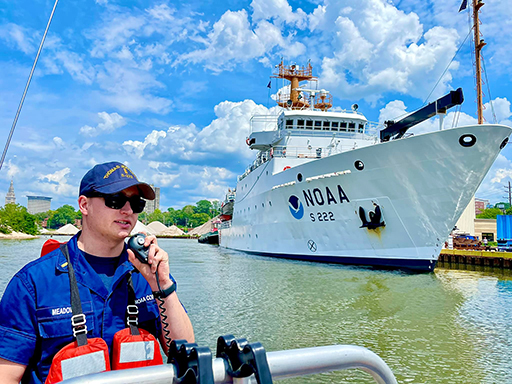
LTJG Mark Meadows is the new Team Lead for NRT New London. Mark joined the NOAA Corps after graduating with a bachelor's degree in Physics from Radford University and was assigned to NOAA Ship Thomas Jefferson from May 2020 to August 2022. Mark conducted operations in the Gulf of Mexico for Hurricane Delta response during his first season aboard. He surveyed the upper Chesapeake Bay in the approaches to Annapolis his second season aboard. Mark accompanied the ship to the Great Lakes and surveyed the approaches to Cleveland, western Lake Erie, and offshore Erie, Pennsylvania. He finished his time aboard the ship with a shore party surveying the Detroit River.
Riley O'Connor joined NOAA as a hydrographic survey technician with NRT-Stennis on October 24. Riley completed his undergraduate and graduate studies at the University of Rhode Island studying history, political science, and underwater archaeology. Additionally, Riley completed post-graduate studies in remote sensing and GIS programs. Previously, he worked at Woods Hole Oceanographic Institute and the Providence Public Library conducting historical weather research on whaling logs composed of the New England whaling fleet during the 1800's.
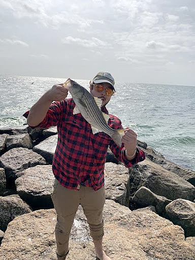
Jeffery Marshall commenced a 4-month detail as the PHB Streamlining Team Lead on October 24, 2022. Jeff, a physical scientist with the Atlantic Hydrographic Branch since 2013, holds a masters degree in Geology from the University of North Carolina-Wilmington and a bachelor's degree in Earth and Atmospheric Sciences from Rutgers University. Prior to his time with NOAA, he worked as a research specialist and marine operations manager with the Center for Marine and Wetland Studies at Coastal Carolina University. Outside of work, he enjoys fishing, surfing, and spending time with his family. Congratulations Jeff!
Peter Holmberg was selected for a 6-month LANTERN detail starting January 17, 2023. As the acting Chief of the CO-OPS Pacific Operations Branch, he will oversee nine employees and manage field maintenance of the National Water Level Observation Network and Physical Oceanographic Real Time System. Pete has been working for HSD for over 20 years. He started his career with NOAA as an intern in 2001 working at HSD Operations. A year later he was hired as a physical scientist working aboard Bay Hydrographer. In 2004 he joined the Pacific Hydrographic Branch in Seattle, Washington. In 2011 he was selected as a lead physical scientist at PHB and recently served as the acting deputy chief of HSD. He enjoys outdoor recreation, especially bicycling, camping, and sea kayaking. Congratulations Pete!
did you know?
NOAA GeoPlatform Publishing Guidance is now available. This document provides guidance for users who wish to produce StoryMaps, web apps, and other NOAA Geoplatform content intended for the general public. This guidance is published by the NOAA Geographic Information System (GIS) Community.
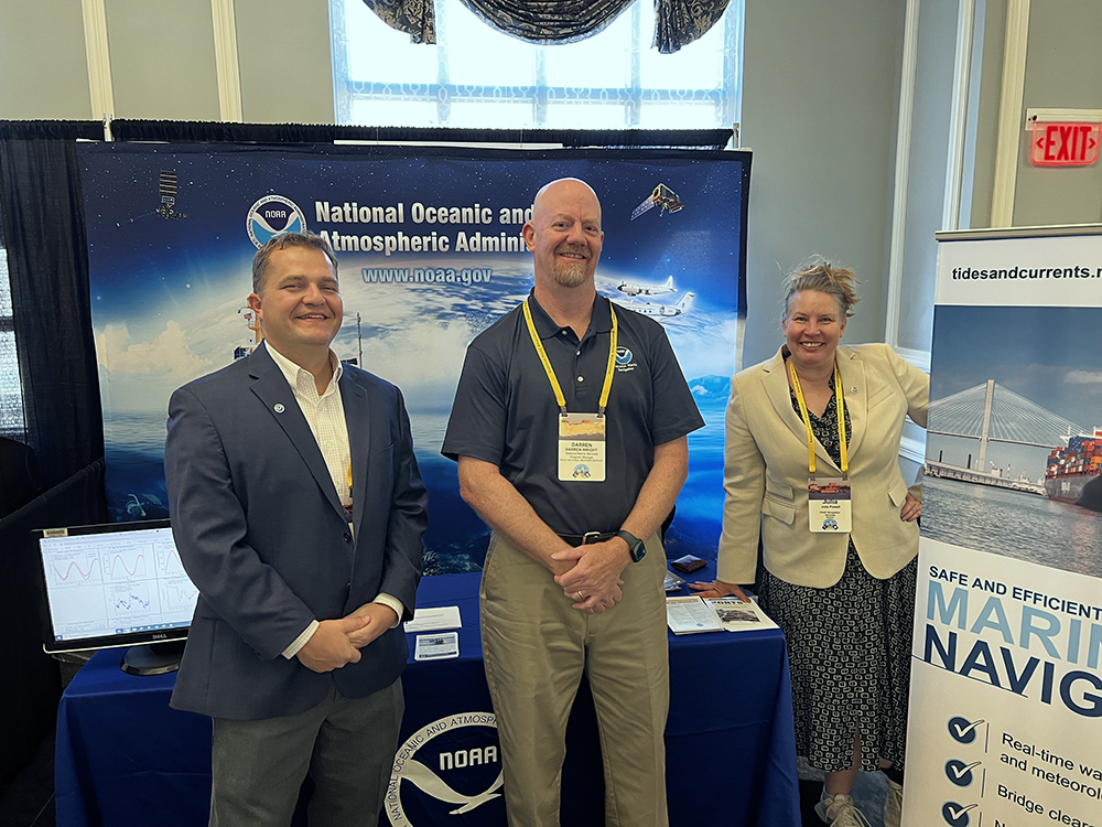 From left to right; Kyle Ward, Darren Wright, and Julia Powell at the American Pilots Association biennial convention in Charleston, South Carolina 2022.
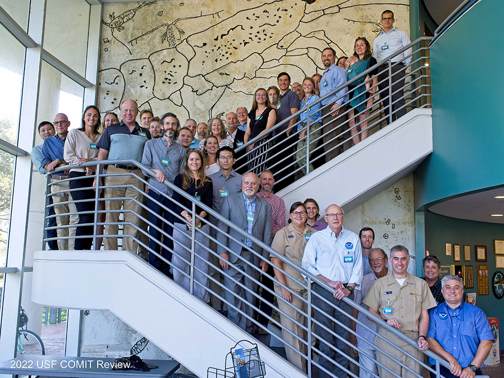 A group image showing participants, along with several Coast Survey personnel, at the Center for Ocean Mapping and Innovative Technologies annual review, held at the University of South Florida's College of Marine Science. Image credit: Nicolas Alvarado.
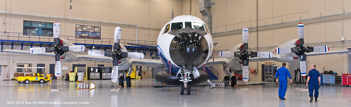 LCDR Alan Hough gives Admiral Evans a tour of the Aviation Operations Center and the NOAA Lockheed WP-3D Orion (aka Kermit) in Lakeland, Florida. Image credit: Nicolas Alvarado.
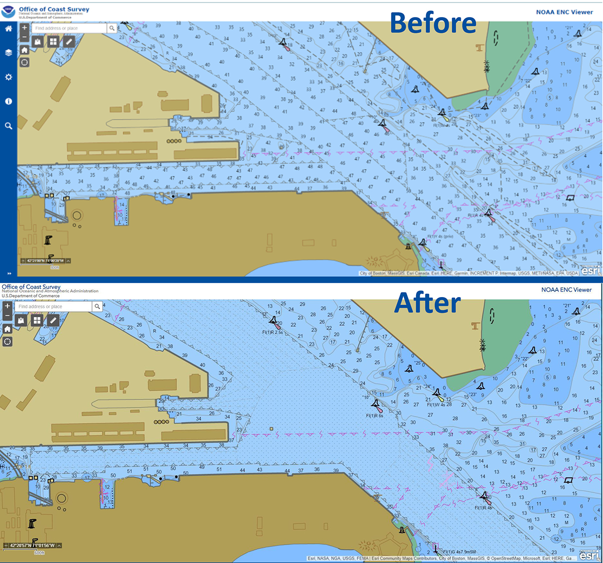 An image of two ENC's, both showing areas around Boston's Reserved Channel. The top image shows the channel with open hydrography and the bottom image shows dredged areas divided into reaches and quarters with associated controlling depths.
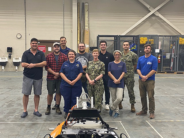 Navigation Response Branch personnel and the Navy Fleet Survey Team. Standing from left to right, Dan Jacobs (NRT Stennis), Riley O'Connor (NRT Stennis), LTJG Collin McMillan (NRT Stennis UxS), CDR Olivia Hauser (NRB Chief), Josh Bergeron (NRT Stennis UxS), CDR Jennifer Landry and personnel from Navy Fleet Survey Team, and Alex Ligon (NRT Stennis UxS).
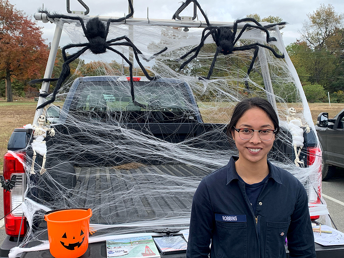 LTJG Carly Robbins in front of Bay Hydro II's "trunk or treat" display at Naval Air Station Patuxent River.