by Meredith Westington, Coast Survey geographer
Good, informed decisions are often based on analyses of historic and present conditions. Researchers, decision-makers, and amateur history buffs find detailed documentation of past conditions in the thousands of Coast Survey charts, dating back to the mid-1800s, in our Historical Map and Chart Collection.
Just like present day nautical charts, historic charts contain a wealth of information about geographic features — including their names, shape, and condition. Geographic names are important locational references for today’s emergency responders, but current and historic names also convey important aspects of local people and culture, which may persist through time.
Continue reading “Geographic names disappear from charts, but not from history — #Data4Coasts”
Catch the digital wave in NOAA navigation products #Data4Coasts

This week, NOAA’s National Ocean Service is inviting you to explore #Data4Coasts that NOS provides to the public, to researchers and decision makers, and to the many industries involved in coastal resilience and maritime commerce. Much of Coast Survey’s data for the coasts is easily accessible by downloading or by using a web map. Other products, like our beautiful printed nautical charts, are available for purchase – as they have been since the mid-1800s – from chart agents.
We’ve been making charts for a long time – and we’ve never been more excited about it! A quickly evolving (r)evolution is transforming the way we plan voyages and navigate, and Coast Survey is reconstructing our nautical product line for the millions of boaters and commercial pilots who are catching the new digital wave.
Continue reading “Catch the digital wave in NOAA navigation products #Data4Coasts”
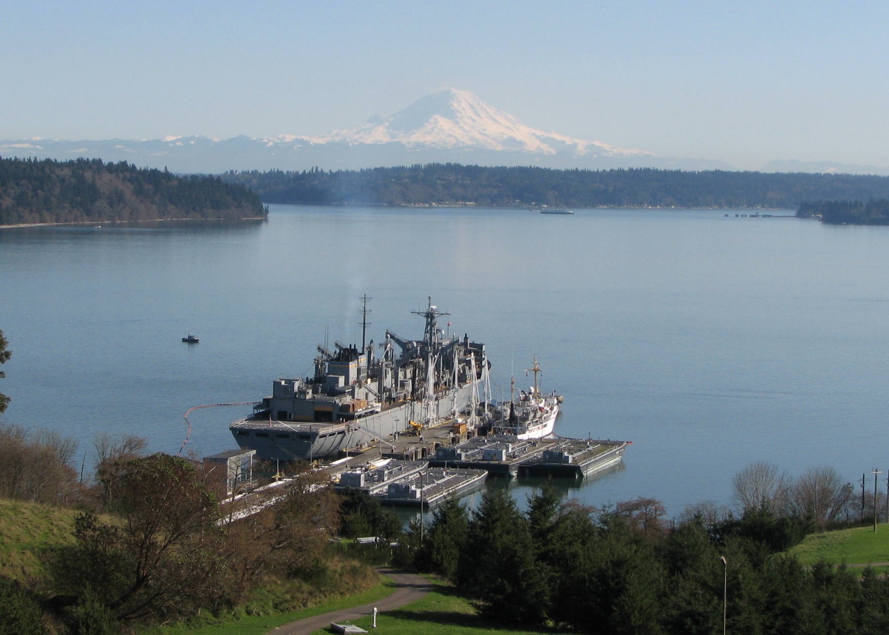
Rainier beauty X 3
NOAA Ship Rainier had the wonderful fortune of cool, clear weather on March 13 as they fueled at the Navy Fuel Depot in Manchester, WA. This provided a clear view of Mount Rainier. However, it is even more rare that you would have three “Rainiers” all in view at once! At the pier you can see USNS RAINIER (on the left side of the pier), NOAA Ship Rainier (on the right side of the pier), and the iconic Mount Rainier in the background. Absolutely beautiful.