
by Melissa Volkert, Coast Survey communications associate
NOAA’s Office of Coast Survey has added a wide range of publications to our Historical Map and Chart Collection. The collection of publications consists of annual reports, catalogs, United States Coast Pilot, Notes on the Coast, and special reports.
Continue reading “Coast Survey adds historical publications to online collection”
Coast Survey assists pilots in efforts to “see” dredging operations on laptop displays
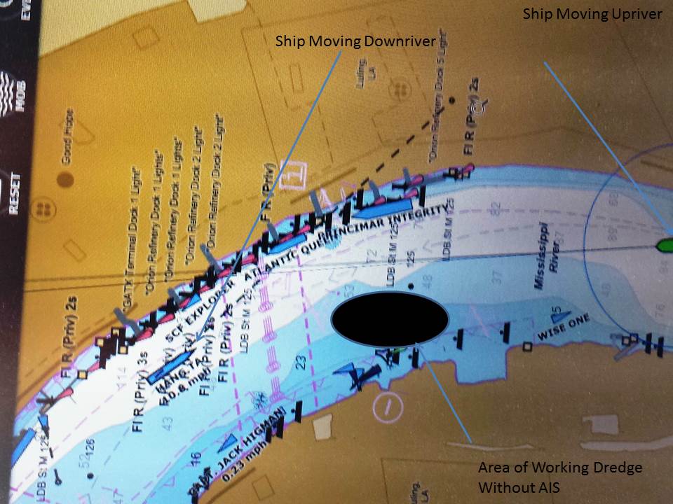
What do pilots see on the navigation laptop displays of their portable pilot units (PPUs) when they guide deep-draft ships to dock? Often, they aren’t seeing all that is actually out there in the navigation channel.
NOAA Coast Survey’s navigation manager Tim Osborn recently observed the problem when he accompanied one of the pilots from the New Orleans Baton Rouge Pilots Association in a ship transit on the Mississippi River.
Continue reading “Coast Survey assists pilots in efforts to “see” dredging operations on laptop displays”
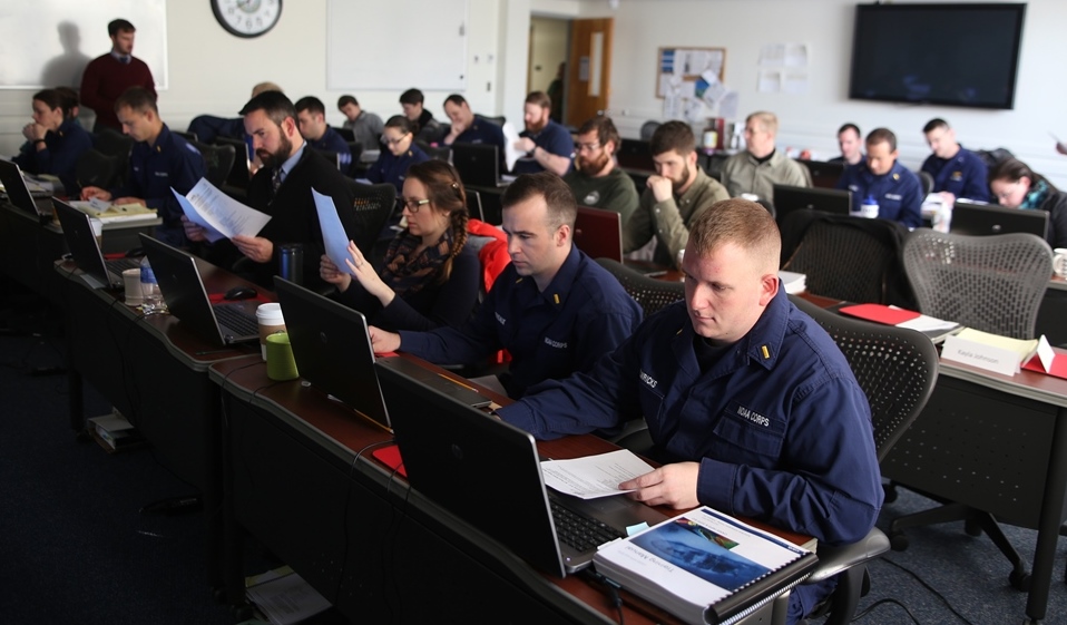
Coast Survey helps scientists sharpen hydrographic skills
By Lt.j.g. Eric Younkin
For four weeks in February, NOAA’s Office of Coast Survey offers formal hydrographic training to newly hired survey technicians and physical scientists, using the beautiful campus at the United States Coast Guard Training Center in Yorktown, Virginia. This year, dozens of NOAA employees and others took the extensive training, covering everything from acoustics and statistics to the processing of hydrographic survey data within the CARIS software package.
Two dozen people attended in person. They came from a wide range of duty assignments: NOAA ships Rainier, Fairweather, Thomas Jefferson, Pisces, and Oscar Dyson; Coast Survey’s R/V Bay Hydro II, Navigation Response Team 1, and the Atlantic Hydrographic Branch; NOAA’s National Geospatial Data Center; and the Washington State Energy Office. In addition, we had “virtual” attendance from the NOAA ships as well as from the Olympic Coast National Marine Sanctuary, the Integrated Ocean and Coastal Mapping Center, Washington State Energy Office, and United States Coast Guard District 17.
Continue reading “Coast Survey helps scientists sharpen hydrographic skills”