To a marine pilot looking forward to a long-awaited nautical chart update, a white NOAA survey ship “mowing the lawn” of the approaches to a port is a gorgeous site. The ship slowly moving back and forth, collecting hydrographic data from the ocean floor, is easily recognizable.
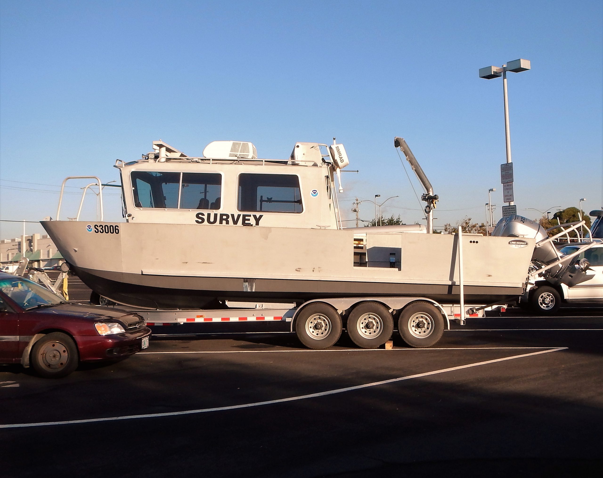
Less well known are Coast Survey’s smaller survey vessels, operated by navigation response teams (NRTs) situated strategically along the U.S. coasts. These vessels are hard worked by two- or three-member teams of physical scientists and technicians who must know everything about the vessel, the specialized survey equipment, and the science of collecting and processing data. On top of all that, they must be expert sailors.
Continue reading “New small survey boats for hard working navigation response teams”
New small survey boats for hard working navigation response teams