
NOAA sets charting priorities by considering a range of factors. Some of the most important factors include requests by the maritime industry. So when the Hudson River Pilots asked a Coast Survey navigation manager to accompany them on a transit down the Hudson River for a first-hand look at the problems caused by out-of-date soundings, our Northeast navigation manager jumped at the opportunity. Coast Survey understood the pilots’ concerns, especially since the charts in areas outside the federal channel have not been surveyed since 1939, and in some areas the soundings are pre-1900.

Continue reading “NOAA begins multiyear project to update Hudson River charts”
Change of command for NOAA Ship Ferdinand Hassler
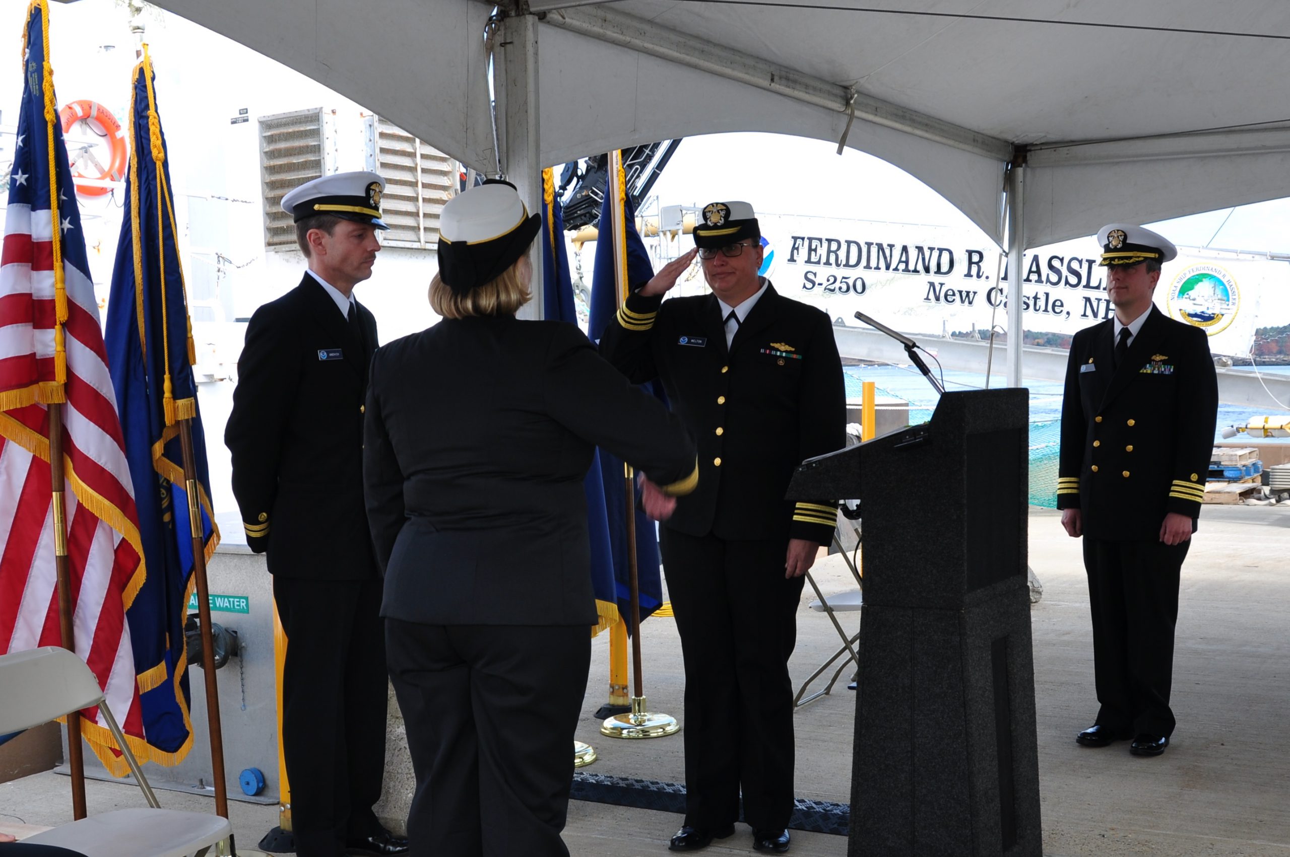
The crew of the NOAA Ship Ferdinand R. Hassler (S-250) hosted a change of command on November 5, while moored at its homeport in New Castle, New Hampshire.
In front of the crew and guests – including Rear Adm. Gerd Glang, director of the Office of Coast Survey, and Capt. Anne Lynch, commanding officer of the Atlantic Marine Operations Center – Lt. Cmdr. Briana Welton accepted command of Hassler, replacing Cmdr. Marc Moser.
Welton is the new survey ship’s third commanding officer.
Continue reading “Change of command for NOAA Ship Ferdinand Hassler”
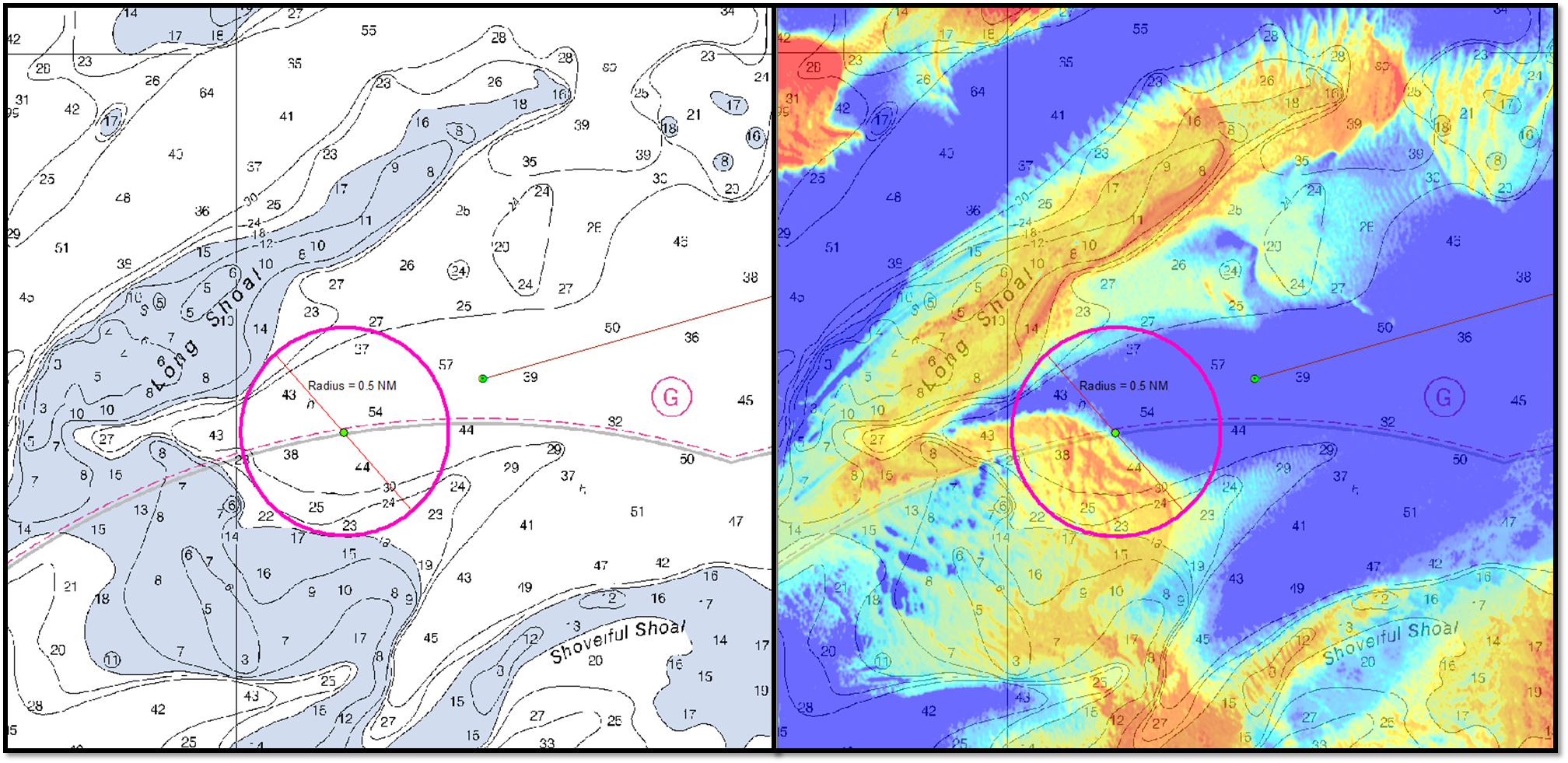
Studying the use of satellite-derived bathymetry as a new survey tool
by Ensign Kaitlyn Seberger, onboard NOAA Ship Thomas Jefferson
Nautical charts are an important tool in navigating safely in coastal waters, and Coast Survey’s mission is to keep these charts up to date. However, maintaining accurate charts can be a challenge in locations where sandy shoals may shift seasonally and present a danger to navigation. These areas differ from the current nautical charts, and bottom contours change so rapidly that it may seem an impossible task to keep up using the traditional survey methods. Office of Coast Survey and NOAA Ship Thomas Jefferson are seeking a solution to this ongoing problem and may have an answer with satellite-derived bathymetry.
Satellite-derived bathymetry (SDB) begins with using multi-spectral satellite imagery, obtained by satellites such as Landsat and WorldView2, which compares green and blue color bands.
Continue reading “Studying the use of satellite-derived bathymetry as a new survey tool”