Coast Survey’s research vessel, Bay Hydro II, was diverted from its regular hydrographic mission this week to help the U.S. Coast Guard determine if there was a new danger to navigation in the Chesapeake Bay.
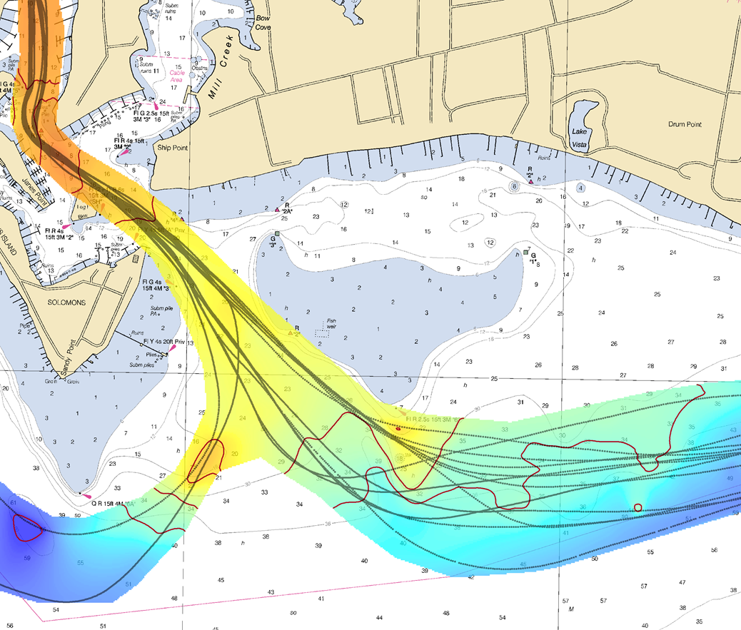
On June 13, 2016, U.S. Coast Guard Sector Hampton Roads was notified that the barge WEEKS 179 lost a large portion of its cargo near the Virginia-Maryland line, in a charted traffic scheme area that takes ships around Smith Point in the Chesapeake Bay. The WEEKS 179, carrying construction materials to New Jersey, lost approximately 25 concrete beams and bridge deck pieces, ranging from 10 ft. to 15 ft. long. While the Coast Guard diverted ship traffic around the area, Bay Hydro II deployed to the site, to establish the cargo’s exact position and determine if it posed a hazard to navigation.
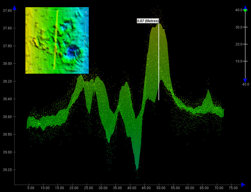
By early the next morning, Bay Hydro II was conducting the search. The survey technicians used side scan sonar to locate the sunken cargo, and then followed it up with their multibeam echo sounder to collect bathymetric data over the field of debris. (While the side scan sonar is typically a better search tool for locating objects in large areas, the multibeam is best for obtaining precise position and depths over the items so the hydrographers can determine if dangers to navigation exist.)
Continue reading “Coast Survey research vessel helps Coast Guard re-establish normal ship traffic in the Chesapeake”
Coast Survey research vessel helps Coast Guard re-establish normal ship traffic in the Chesapeake