Coast Survey’s navigation response teams, which are 3-person hydrographic survey teams on small boats, have made a fast start on this year’s survey season.
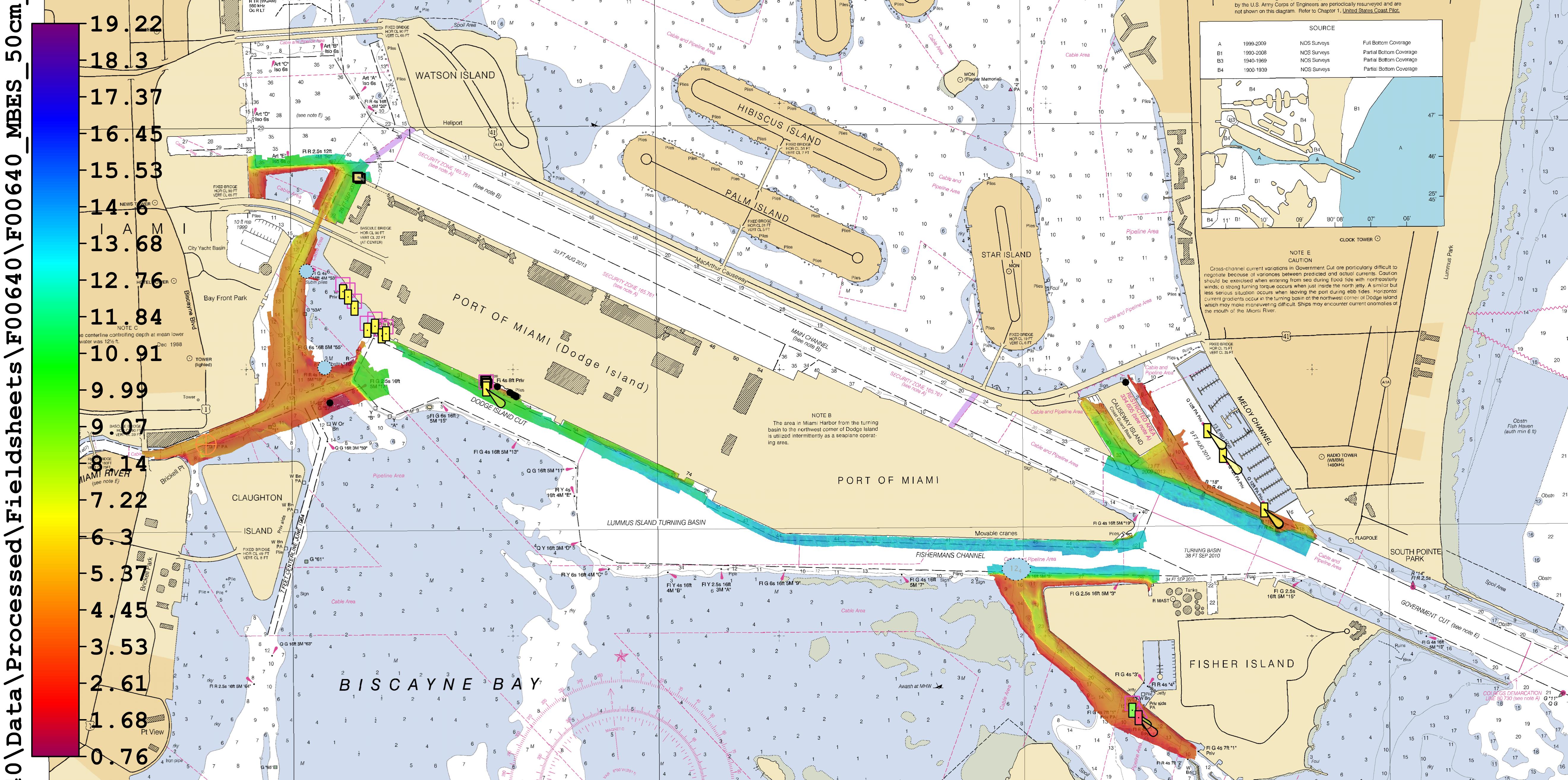
In Florida, where Coast Survey is preparing to issue a “new and improved” Miami Harbor Chart 11468 to alleviate vessel congestion at the Port of Miami, a navigation response team finished final hydrographic surveys to ensure the new chart has the latest and most accurate depth measurements around several areas identified as critical within the port. In just ten days, team members Erik Anderson, James Kirkpatrick, and Kurt Brown acquired, processed, and submitted the multibeam survey data covering 64 nautical miles.
Continue reading “NOAA navigation response teams improve charts for ships transiting Miami and San Francisco”

News and Updates