By Darcy Herman
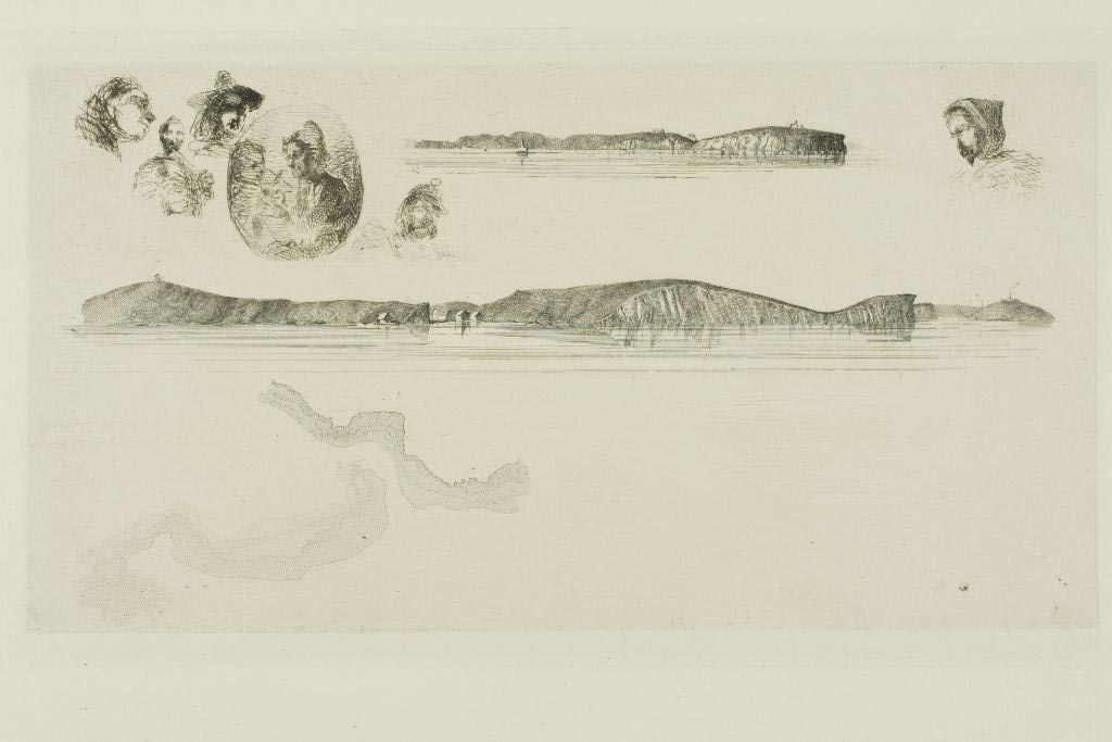
Over its 200-year history, NOAA’s Office of Coast Survey has employed men who are preeminent in their fields. Most of the time, their career successes follow traditional professional trajectories ‒ but at least one Coast Survey alum’s ultimate renown was born of his failure at Coast Survey.
James McNeill Whistler (1834 – 1903), the American artist best known for his painting colloquially known as “Whistler’s Mother,” was briefly and unhappily employed in the drawing division of the U.S. Coast Survey in 1854 and 1855.
Continue reading “Whistler hints at artistic flair during Coast Survey stint”
Correcting chart discrepancies at Alaska’s Whale Passage
by Ensign Sarah Chappel, NOAA Ship Rainier
NOAA Ship Rainier recently surveyed Whale Passage, which separates Whale Island from Kodiak Island, Alaska. The area has never been surveyed with modern full bottom coverage methods, and some project areas were last surveyed by lead lines around a hundred years ago. The area frequently experiences 7 knot currents, making rocky or shoal areas particularly treacherous. Whale Passage is a high traffic area for fishing vessels, U.S. Coast Guard cutters, barges, ferries, and small boats, which is why updating the area’s nautical charts is so important.
Continue reading “Correcting chart discrepancies at Alaska’s Whale Passage”
Coast Survey improves access to data on thousands of wrecks and obstructions
Knowing the locations of shipwrecks and other obstructions has always been important for safe navigation ‒ but mariners are not the only people who want to know about wrecks. They are also important for marine archeology, recreational diving, salvage operations, and fishing, among other interests. Now, Coast Survey has improved our Wrecks and Obstructions Database, giving everyone easy access to new records to explore.
Historically, Coast Survey has maintained two separate sources of information on wrecks. We recently combined the sources, bringing together information on nearly 20,000 wrecks and obstructions.
Continue reading “Coast Survey improves access to data on thousands of wrecks and obstructions”
NOAA issues new nautical chart for the Arctic
NOAA has issued a new nautical chart for the Delong Mountain Terminal, a shallow draft port servicing the Red Dog Mine, on the western coast of Alaska in the Arctic. New chart 16145 fills in historically sparse depth measurements, using new survey data recently acquired specifically for this chart.
Continue reading “NOAA issues new nautical chart for the Arctic”