

NOAA and Cuban chartmakers working together to improve maritime safety
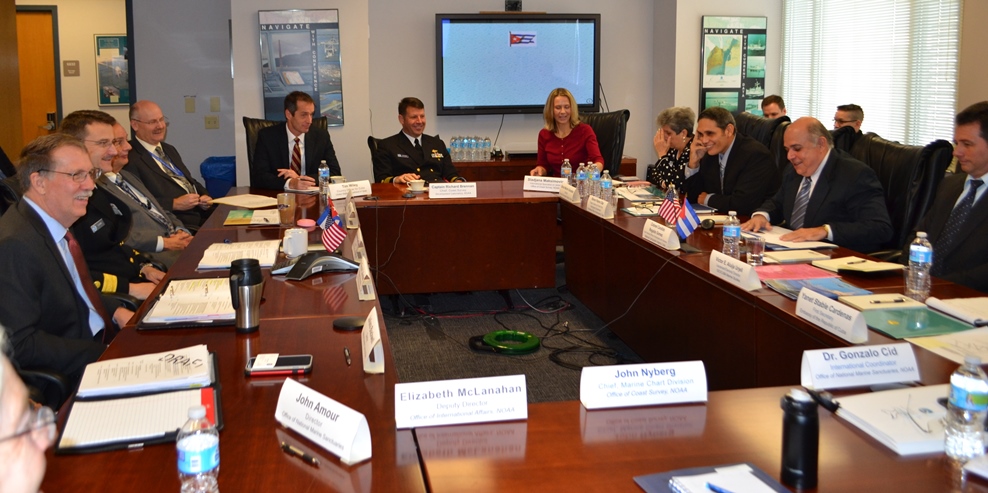
Following up on Coast Survey’s visit to Havana last spring, Cuban hydrographic officials traveled to Maryland on December 15-17, to meet with NOAA National Ocean Service leaders for discussions about potential future collaboration. High on the agenda for Coast Survey is improving nautical charts for maritime traffic transiting the increasingly busy Straits of Florida.
The historic meeting began with Dr. Russell Callender, NOS acting assistant administrator, welcoming the Cuban delegation, led by Colonel Candido Regalado Gomez, chief of Cuba’s National Office of Hydrography and Geodesy.
Continue reading “NOAA and Cuban chartmakers working together to improve maritime safety”
Nigerian naval officer augments on NOAA survey ship
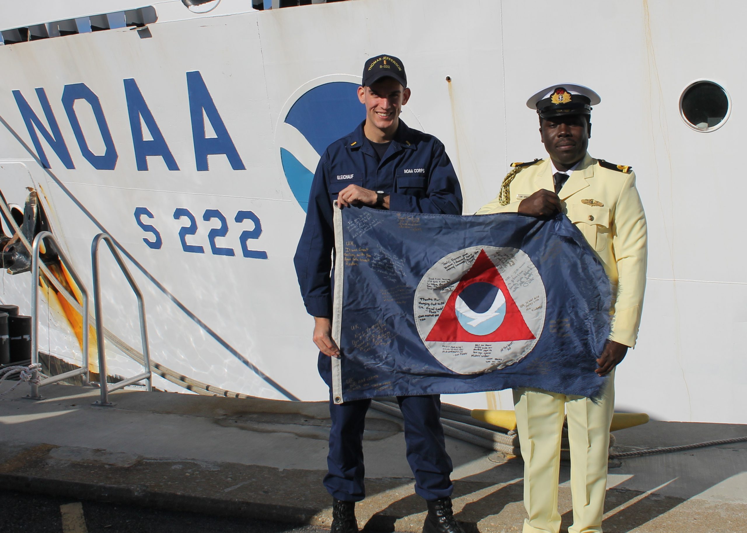
by Ensign Kaitlyn Seberger, Junior Officer, NOAA Ship Thomas Jefferson
This fall, NOAA Ship Thomas Jefferson has had the pleasure of hosting Sub-Lieutenant Uchechukwu Erege. Sub-Lieutenant Erege, known to the ship’s crew as “UK,” is a hydrographer in the Nigerian Navy Hydrographic Office. The Nigerian Navy Hydrographic Office is the national hydrographic authority for the country and is responsible for conducting hydrographic surveys in territorial waters, ensuring nautical charts are up-to-date, processing bathymetric data, and providing Notice to Mariners for hazards to navigation.
UK joined the Nigerian Navy in 2012 after graduating with distinction from the University of Lagos with a bachelor’s and master’s degree in geoinformatics. He then completed a 10-month training program at the Nigerian Defense Academy before transitioning to his current position in the hydrography branch.
Continue reading “Nigerian naval officer augments on NOAA survey ship”
Upgrading Great Lakes operational forecast systems
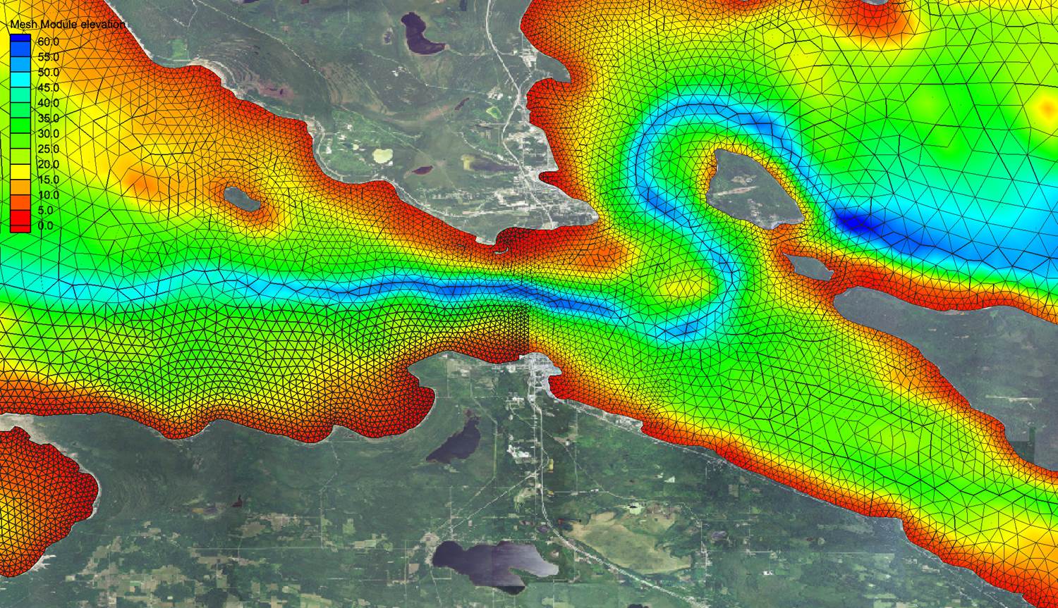
by Thomas Loeper, Coast Survey navigation manager for the Great Lakes
Have you ever wondered how scientists make short-term forecast water levels, currents, and water temperature for the Great Lakes? They use the National Ocean Service’s operational forecast systems. There are now five different computer forecast modeling systems running for the Great Lakes — one for each lake. The forecast guidance from these forecast systems supports a variety of activities, including environmental management, emergency response for incidents like hazardous materials spills, homeland security, and search and rescue, as well as safe and efficient navigation of recreational and commercial vessels along the entire Great Lakes system.
The current operational forecast systems have been operational since 2005/2006, and Coast Survey is planning upgrades in the coming years. The original forecast systems were developed in the early 1990s as a collaborative effort between NOAA’s National Ocean Service, the Great Lakes Environmental Research Laboratory, the National Weather Service, and the Ohio State University. They were the first civilian coastal ocean systems to produce regularly scheduled predictions for the U.S.
Continue reading “Upgrading Great Lakes operational forecast systems”
NOAA National Ocean Service honors Coast Survey employees
NOAA’s National Ocean Service had a ceremony for its honorees for 2015, and we are so pleased that several Coast Survey employees were recognized for their contributions.
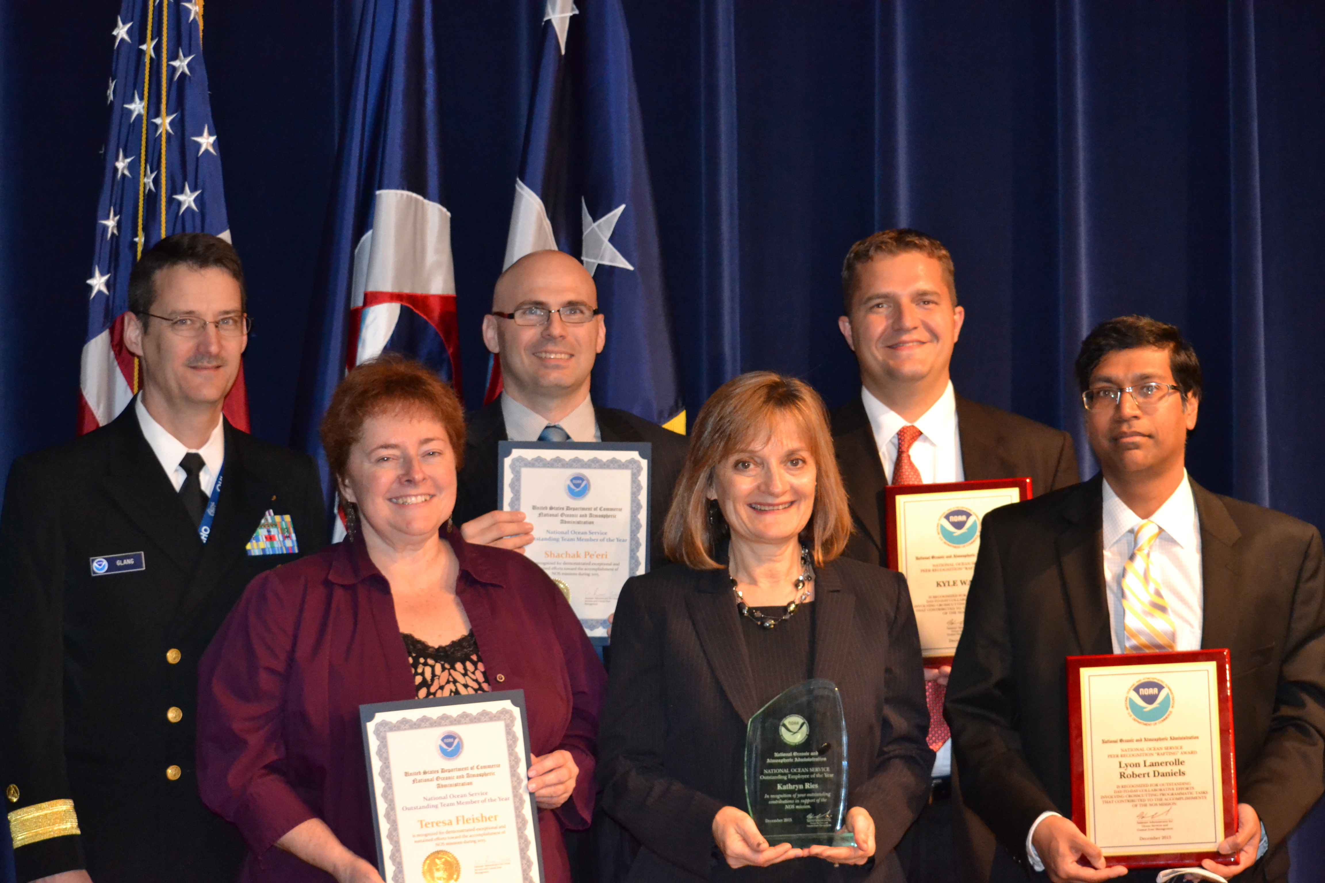
Congratulations to deputy director Katie Ries, who was selected as a 2015 Employee of the Year! This award recognizes significant contributions to NOS programs and the demonstration of exceptional and sustained effort toward the accomplishment of NOS missions. Katie is being honored for many things, chief among them “for being the indefatigable force driving Coast Survey’s crucial improvements in quality management, strategic planning, and employee support.”
Continue reading “NOAA National Ocean Service honors Coast Survey employees”