Coast Survey uses unmanned technology to find submerged danger to navigation

AUV preparation

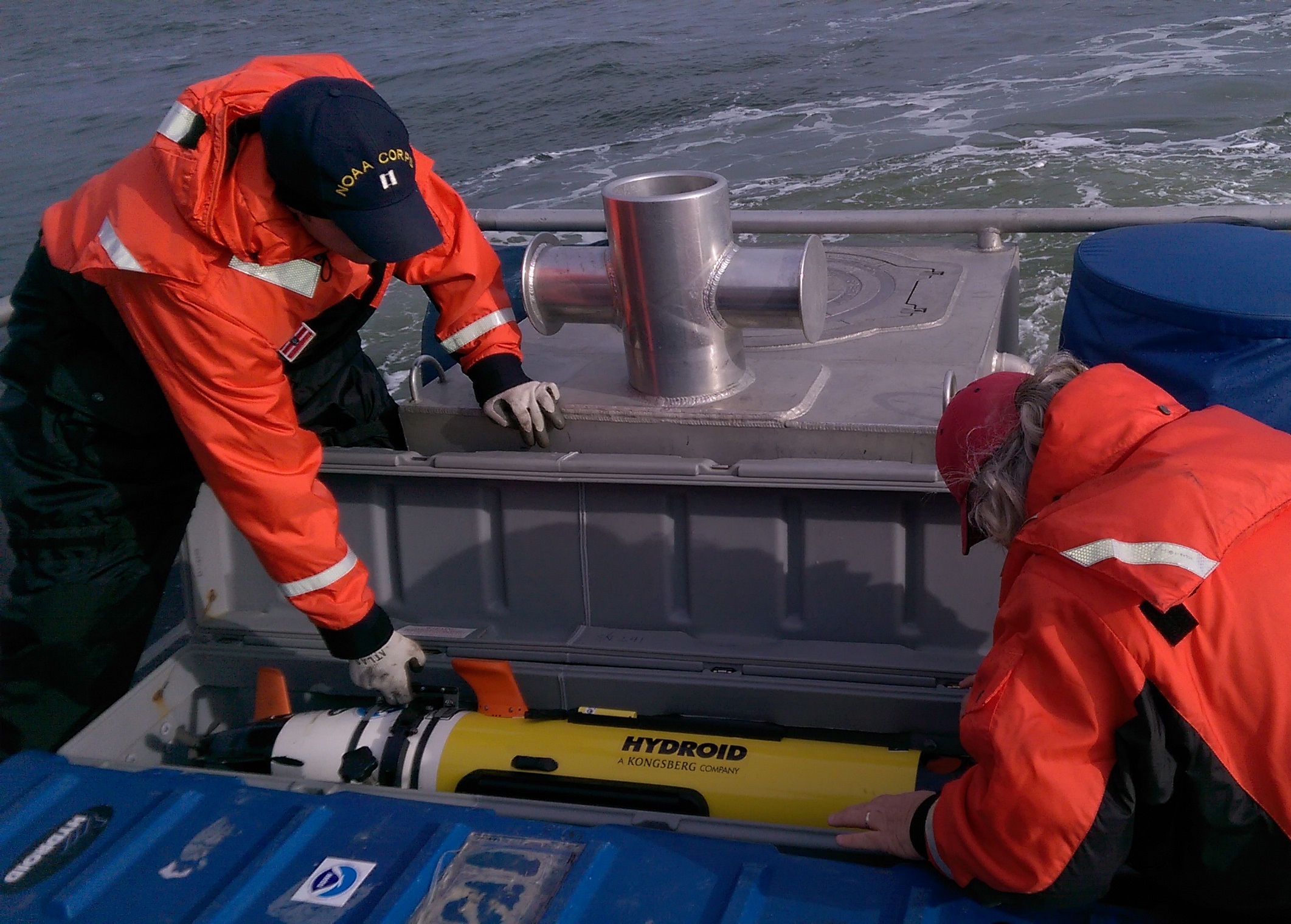
Coast Survey has been discovering and marking the locations of underwater dangers since our surveyors took the nation’s first official ocean soundings in 1834. We’ve used or developed all the technological advancements – lead lines, drag lines, single beam echo sounders, towed side scan sonars, and post-1990 multibeam echo sounders – and now we can point to a new major advancement for fast deployment and quick recovery. In February, Coast Survey’s Mobile Integrated Survey Team (MIST) used an autonomous underwater vehicle (AUV) to locate a submerged buoy that was interfering with anchorages in the Chesapeake Bay.
“You and the crew of the HASSLER put us right where we needed to be!” said a confirmation email from the U.S. Coast Guard to NOAA Lt. Ryan Wartick, one of Coast Survey’s navigation managers. “Thanks for the great work!”
Continue reading “Coast Survey uses unmanned technology to find submerged danger to navigation”

Happy 209th anniversary to the Office of Coast Survey, the oldest federal scientific organization

The Office of Coast Survey dates from 1807, when much of the commerce between the states was by coastal shipping. And all foreign trade, especially critical to our prosperity, had to come by ship. With so many ships coming into our ports and harbors, shipwrecks were common, and it was clear the young maritime nation needed accurate nautical charts.

NINTH CONGRESS OF THE UNITED STATES
At the Second Session,
Begun and held at the city of Washington, in the territory of Columbia,
on Monday the first of December, one thousand eight
hundred and six.

AN ACT to provide for surveying the coasts of the United States.

Be it enacted by the Senate and House of Representatives of the United States of America, in Congress assembled, that the president of the United States shall be, and he is hereby authorized and requested, to cause a survey to be taken of the coasts of the United States, in which shall be designated the islands and shoals, with the roads or places of anchorage, within twenty leagues of any part of the shores of the United States; and also the respective courses and distances between the principal capes, or head lands, together with such other matters as he may deem proper for completing an accurate chart of every part of the coasts within the extent aforesaid.
Continue reading “Happy 209th anniversary to the Office of Coast Survey, the oldest federal scientific organization”

Coast Survey announces surveys by navigation response teams

NRT data will be used to update nautical charts

Coast Survey’s navigation response teams have proven their value, time and again, especially after hurricanes when ports suspend operations, and shipping (or naval movements) cease until Coast Survey’s small boats can locate underwater dangers to navigation. But what do the six navigation response teams (NRTs) do during those long periods between deployments for maritime emergencies? They are busy, mostly year-round, collecting hydrographic data for updating nautical charts.
Continue reading “Coast Survey announces surveys by navigation response teams”