Coast Survey spotlight: Meet John Doroba

John aboard the NOAA Ship Bell M. Shimada as they perform autonomous underwater vehicle operations near Channel Islands National Marine Sanctuary.

Ever wonder what it’s like to be a member of the NOAA Coast Survey team? We use the Coast Survey spotlight blog series as a way to periodically share the experiences of Coast Survey employees as they discuss their work, background, and advice.


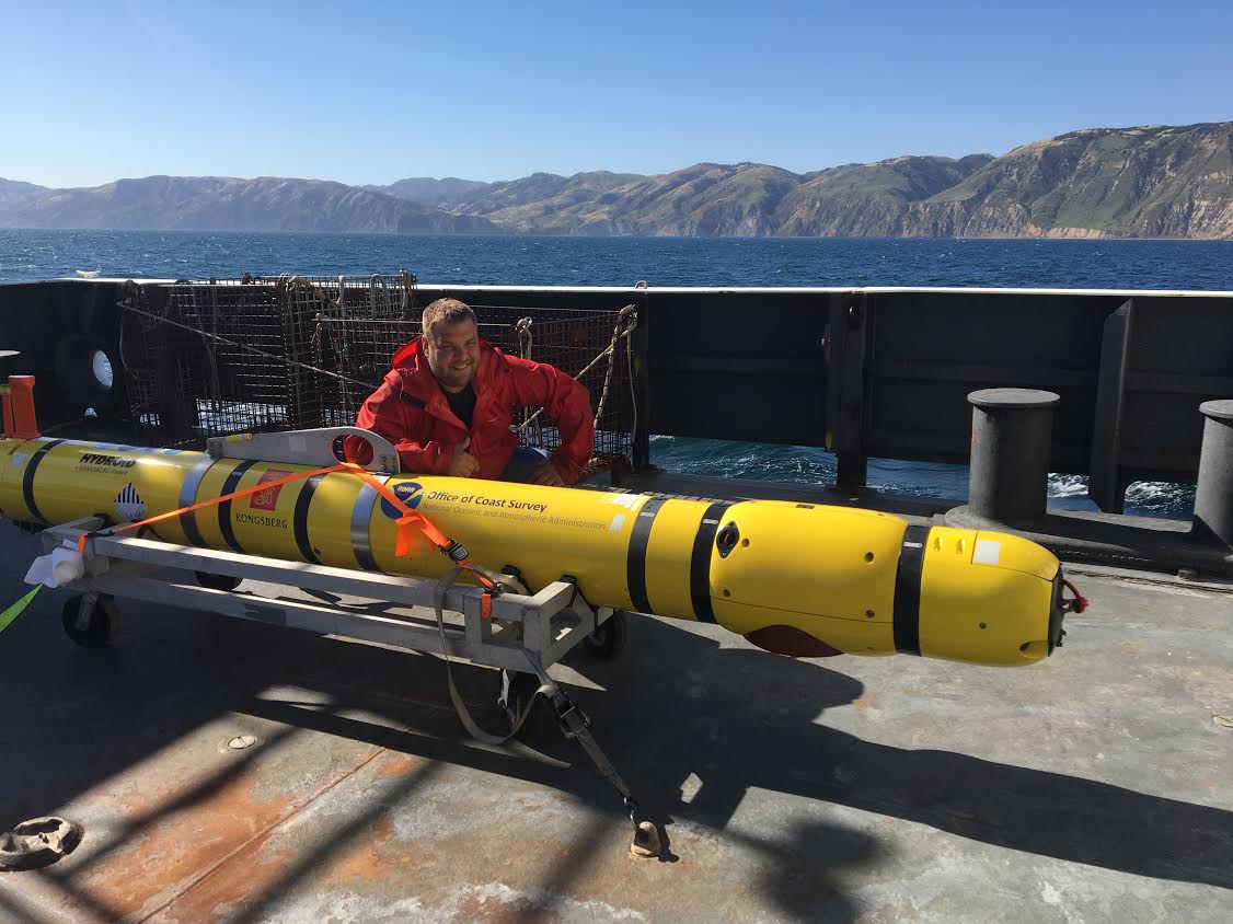
John Doroba, physical scientist

“Once I saw the mission I was hooked. It was the best job a recent graduate who loved being in the field could ask for, especially when you get to travel all around the country. Where else could I practice my love for science, utilize my education, solve real world problems that serve a purpose, and directly impact people in a positive way?”

Continue reading “Coast Survey spotlight: Meet John Doroba”

nowCOAST® offers new Gulf of Maine, Chesapeake Bay forecast services

Depiction of NOS Vv probability of occurrence forecast guidance for Chesapeake Bay on nowCOAST map viewer.

NOAA’s nowCOAST®, a GIS-based online web mapping service that provides frequently updated weather and ocean observations, analyses, imagery, and ocean model forecast guidance, along with weather watches and warnings and forecasts, now provides maps of oceanographic forecast guidance from the National Ocean Service (NOS) 3-D operational forecast modeling system for the Gulf of Maine (GoMOFS) and NOS forecast guidance of the marine pathogen, Vibrio Vulnificus (Vv), for the Chesapeake Bay via two new map services and map viewer. Continue reading “nowCOAST® offers new Gulf of Maine, Chesapeake Bay forecast services”

NOAA Ship Thomas Jefferson tests drone use for shoreline mapping

By, Lt. j.g. Matt Sharr, NOAA, and Lt. Charles Wisotzkey, NOAA

NOAA’s Office of Coast Survey and the National Geodetic Survey (NGS) recently conducted operational tests of small unmanned aerial systems — or drones — on board NOAA Ship Thomas Jefferson in support of survey operations conducted along the south coast of Puerto Rico. The tests show the potential of imagery from low-cost off-the-shelf drones to meet NOAA survey specifications for near-shore and shoreline feature mapping. This could replace traditional shoreline verification and mapping techniques used by NOAA hydrographic survey field units. Potential benefits of using drones for shoreline mapping include: improved data collection efficiency compared to data collection from small skiffs; more accurate feature investigation than traditional techniques; and, most importantly, removal of personnel from potentially dangerous situations (i.e. survey in close proximity to features being mapped). Continue reading “NOAA Ship Thomas Jefferson tests drone use for shoreline mapping”