A dynamic river calls for dynamic collaborations

Lt. j.g. Shelley Devereaux monitors survey collection near Price Island on the Columbia River.

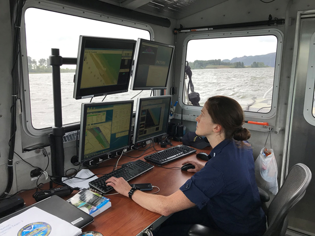
By Lt. j.g. Michelle Levano, Officer in Charge, Navigation Response Team-Seattle

Navigation response team (NRT)-Seattle continued hydrographic survey work on one of the West’s most relentless rivers, the Columbia. The Columbia River is the lifeblood of the regional economy, expanding far beyond the natural divide it provides between the states of Oregon and Washington.

Continue reading “A dynamic river calls for dynamic collaborations”

Coast Survey spotlight: Meet Kurt Mueller

Kurt Mueller and survey technicians

Ever wonder what it’s like to be a member of the NOAA Coast Survey team? We use the Coast Survey spotlight blog series as a way to periodically share the experiences of Coast Survey employees as they discuss their work, background, and advice.


Kurt Mueller, physical scientist

“The hydrographic data we acquire and review adds to the scientific knowledge of the seafloor and is valuable to other agencies to simulate sea level effects on coasts, identify sensitive marine habitats, and select alternative energy sites, among many other uses.”

Continue reading “Coast Survey spotlight: Meet Kurt Mueller”

Register for NOAA Nav-cast webinar – S-100 for System Implementers

NOAA Nav-cast announcement for S-100 System Implementers presentation

Join us for our first NOAA Nav-cast, a quarterly webinar series that highlights the tools and trends of NOAA navigation services.

S-100 for System Implementers
Learn about the S-100 Universal Hydrographic Data Model and what navigation system developers need to know in order to implement various S-100 based product specifications. Also, gain insight into NOAA’s work in the S-100 product development space for S-111 surface currents. 

Date and time: Tuesday, June 18, 2019 at 11 a.m. (EDT)
How to register: https://attendee.gotowebinar.com/register/7354579801420345345

Continue reading “Register for NOAA Nav-cast webinar – S-100 for System Implementers”

Centennial anniversary of aerial surveying and mapping

By Kevin Mackenzie

A year after Coast and Geodetic Survey (C&GS) Director Ernest Lester Jones returned from World War I, he took the Survey’s mission to the sky. From his time in war, Jones understood the advantages that airplane photography had for locating military features of the enemy. In his 1919 annual report to Commerce Secretary William C. Redfield, he noted, “The same principle employed in the military work can be used in surveying and mapping.” The following months would produce a series of tests and research in cooperation with the Air Services of the Army and Navy.

Continue reading “Centennial anniversary of aerial surveying and mapping”