
As 2019 comes to a close, we reflect not only on our accomplishments throughout the year, but also the exciting challenges that lie ahead, particularly in the field of hydrography. In late October 2019, Rear Adm. Shep Smith, director of NOAA’s Office of Coast Survey and chair of the International Hydrographic Organization Council, delivered the keynote address at the Seabed 2030 Summit at the Royal Society in London, encouraging participation in the grand global challenge to map the world’s seafloor by the year 2030. The following is a video and transcript of this presentation.
Continue reading “The Future of Seabed 2030: From Vision to Action”Register for NOAA Nav-cast webinar: How to obtain NOAA ENC-based paper nautical charts
Join us for our next NOAA Nav-cast, a quarterly webinar series that highlights the tools and trends of NOAA navigation services.
How to obtain NOAA ENC-based paper nautical charts after NOAA ends production of traditional paper charts
Recently, NOAA announced the start of a five-year process to end traditional paper nautical chart production. While NOAA is sunsetting its traditional nautical chart products, it is undertaking a major effort to improve the data consistency and provide larger scale coverage within its electronic navigational chart (NOAA ENC®) product suite. Over the next five years, NOAA will work to ease the transition to ENC-based products, such as providing access to paper chart products based on ENC data. The online NOAA Custom Chart prototype application enables users to create their own charts from the latest NOAA ENC data. Users may define the scale and paper size of custom-made nautical charts centered on a position of their choosing. Users may then download, view, and print the output. The application is an easy way to create a paper or digital backup for electronic chart systems.
This webcast will provide an overview of the sunsetting process and a live demonstration of the NOAA Custom Chart prototype, including a discussion of the improvements that are planned for the prototype.
Date and time: Thursday, January 9, 2020, at 2 p.m. (EST)
How to register: https://attendee.gotowebinar.com/register/7410207397804043779
Coast Survey Spotlight: Meet Rick Powell
Ever wonder what it’s like to be a member of the NOAA Coast Survey team? We use the Coast Survey spotlight blog series as a way to periodically share the experiences of Coast Survey employees as they discuss their work, background, and advice.
Rick Powell, cartographer
Continue reading “Coast Survey Spotlight: Meet Rick Powell”“The Coast Pilot is a supplement to the chart, and eventually the electronic navigational chart… This helps ensure that our knowledge of the subject is transferred to the navigator/mariners with little effort.”
Do you believe in miracles? New exhibit highlights National Weather Service support of 1980 Winter Olympic Games
This week, as part of the 40th anniversary of the XIII Olympic Winter Games in 1980, the Lake Placid Olympic Museum launched the exhibit, Foretelling the Future – The National Weather Service at the 1980 Olympic Winter Games. These Olympic Games stand out in our collective memory as the venue for the “miracle on ice,” when the U.S. hockey team beat the 4-time Olympic champions, the Soviet Union. Little do most people know, however, another kind of team was pulling off a small miracle of their own at these games.
Change of command for NOAA Ship Rainier
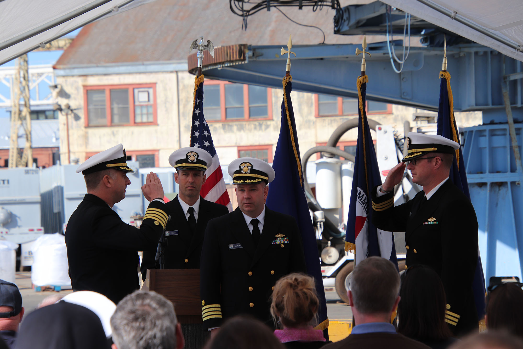
On November 15, 2019, the crew of NOAA Ship Rainier hosted a change of command in Valejo, California. Cmdr. Sam Greenaway accepted command of Rainier, relieving Capt. Ben Evans in a ceremony led by Capt. Michael Hopkins, commanding officer of NOAA’s Office of Marine and Aviation Operations (OMAO) Marine Operations Center-Pacific.
Continue reading “Change of command for NOAA Ship Rainier”One year later – Coast Survey’s response to the Anchorage earthquake
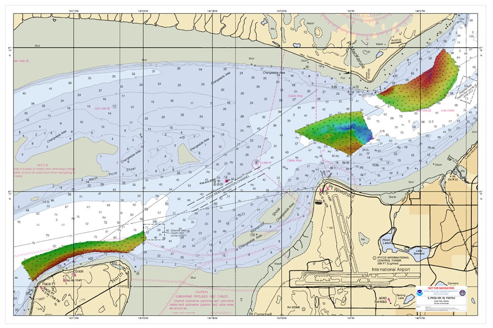
By Lt. Cmdr. Bart Buesseler
At 8:29, on the morning of Friday, November 30, 2018, a magnitude 7.1 earthquake shook Anchorage, Alaska, for thirty stressful seconds. It was the largest earthquake in Anchorage since the Good Friday Quake of 1964, and brought Alaska’s most populated city to a standstill as residents evacuated buildings and came to terms with what they had just experienced.
Continue reading “One year later – Coast Survey’s response to the Anchorage earthquake”