Collecting aerial images on the Chesapeake’s Western Shore

U.S. Naval Academy bridge crossing the Severn River

By Tom Loeper

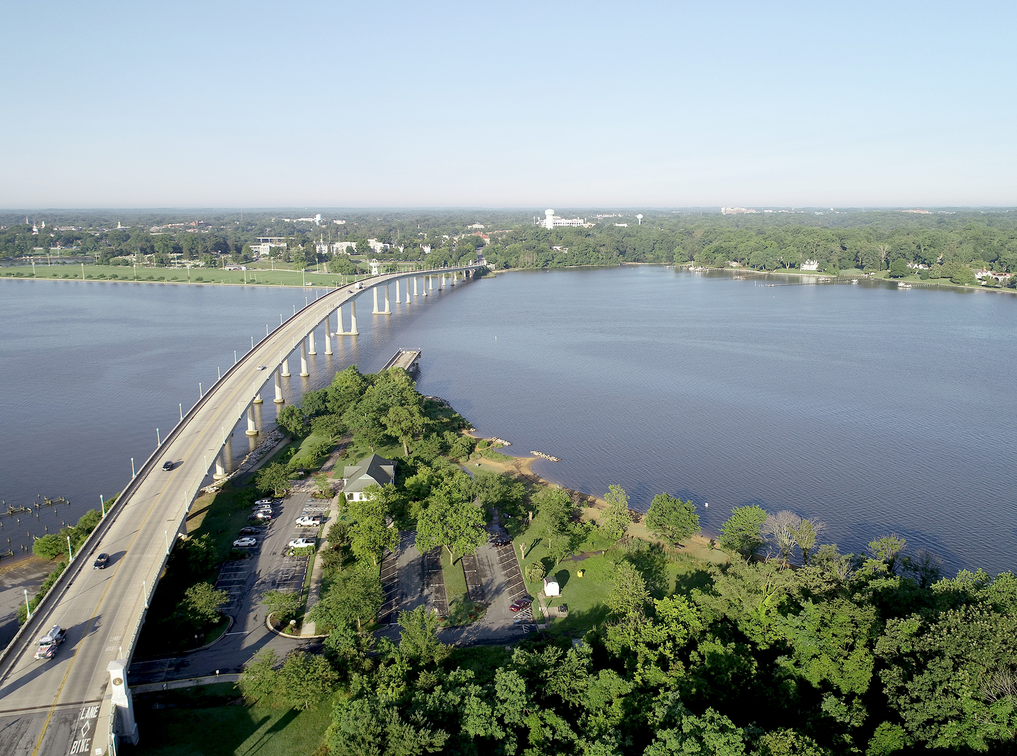
Early in the morning of June 15, John Doroba and Tom Loeper met with Anne Arundel Park Ranger Adam Smith to collect aerial oblique images of several rivers on the Western Shore of the Chesapeake Bay. These images will be used to update existing content in the United States Coast Pilot 3, Atlantic Coast: Sandy Hook, New Jersey to Cape Henry, Virginia. In addition to acquiring images, experience gained during the field exercise will be used to update aerial photography specifications in the Coast Pilot manual.

Continue reading “Collecting aerial images on the Chesapeake’s Western Shore”

Capturing scenes from hydrographic surveying

NOAA Ship Rainier kayak in Holkham Bay, Alaska

There are many benefits to working on a hydrographic survey project for NOAA’s Office of Coast Survey. Some would say having the opportunity to visit amazing landscapes, work with talented people, and collect important environmental data are just a few of them. Recently, Coast Survey’s Hydrographic Surveys Division hosted an internal photo contest inviting employees and contractors to submit images in the categories of Ships and Boats, Landscapes, People, and Data. On this Earth Day 2020, we thought we would share our contest winners with you.

Continue reading “Capturing scenes from hydrographic surveying”

From NOAA Ship Fairweather to Mt. Fairweather: Commanding officer summits ship’s namesake

The high camp, at an elevation of 10,400 feet on the Grand Plateau Glacier.

By Cmdr. Mark Van Waes, former commanding officer of NOAA Ship Fairweather

Mount Fairweather stands tall above Glacier Bay National Park and Preserve, dominating the skyline for miles around (when weather permits visibility). Only about 12 miles inshore from the Gulf of Alaska and soaring to 15,325 feet, it is one of the highest coastal peaks in the world.
Continue reading “From NOAA Ship Fairweather to Mt. Fairweather: Commanding officer summits ship’s namesake”

Take a 360 tour of NOAA Ship RAINIER

In celebration of 50 years of survey and service to the nation, NOAA ships Rainier and Fairweather—two of NOAA’s hydrographic survey vessels—will be opening their doors and hosting public ship tours. Since we understand that many of you are unable to be in Newport, Oregon, the afternoon of March 22 to take a tour in person, we are bringing the tour to you! The following 20 images offer a 360 degree view of the interior and exterior of NOAA Ship Rainier. The images were taken last field season on the survey operations mission to Channel Islands, California. From the crew mess and engine room to a view from the bow, we have captured it all.
Continue reading “Take a 360 tour of NOAA Ship RAINIER”

Lt. Smith shows us the beauty of Gambell Alaska

Gambell panorama
Photo by Lt. Timothy Smith

This summer, the Bering Sea Alliance hosted a private-public summit in Gambell, Alaska, to discuss Arctic resource development and infrastructure. (See page 10 in this edition of the Nome Nugget for a good summary of the meeting.) Lt. Tim Smith, NOAA Coast Survey’s regional manager for Alaska, updated the participants on the status of Arctic nautical charts and described NOAA’s Arctic Nautical Charting Plan. He also outlined the preliminary 2015 survey plans to acquire hydrographic data around Point Hope, Point Barrow, Port Clarence, and Kotzebue Sound, as NOAA strives to ensure the navigational safety of the increasing ship traffic through Arctic waters.
Continue reading “Lt. Smith shows us the beauty of Gambell Alaska”