NOAA contributes to Empowering Women in Hydrography through at-sea experience, part 5

A series of images showing Victoria Obura acquiring data on a survey launch, standing on the bridge of NOAA Ship Thomas Jefferson, and preparing to board the survey launch.

The Empowering Women in Hydrography project is a global effort led by the International Hydrographic Organization and Canada that seeks to initiate, organize and track a series of activities and initiatives which will enable more women to participate equitably in the field of hydrography and to assume leadership roles within the hydrographic community. NOAA is contributing to the project via an ‘at-sea experience’ on NOAA hydrographic ships for three women each year over the lifespan of the project. After a global call for nominations, three women were selected to join NOAA ships for the 2023 survey season. Victoria Obura, a Hydrographer from Survey of Kenya Hydrographic Office, joined NOAA Ship Thomas Jefferson from 12 June to 23 June 2023, while surveying offshore Galveston, Texas.

Continue reading “NOAA contributes to Empowering Women in Hydrography through at-sea experience, part 5”

Geospatial information in the Southwestern Pacific

An image of the Island of Tarawa, part of the Republic of Kiribati in the Central Pacific.

By Dr. John Nyberg

An image of Dr. John Nyberg
Dr. John Nyberg

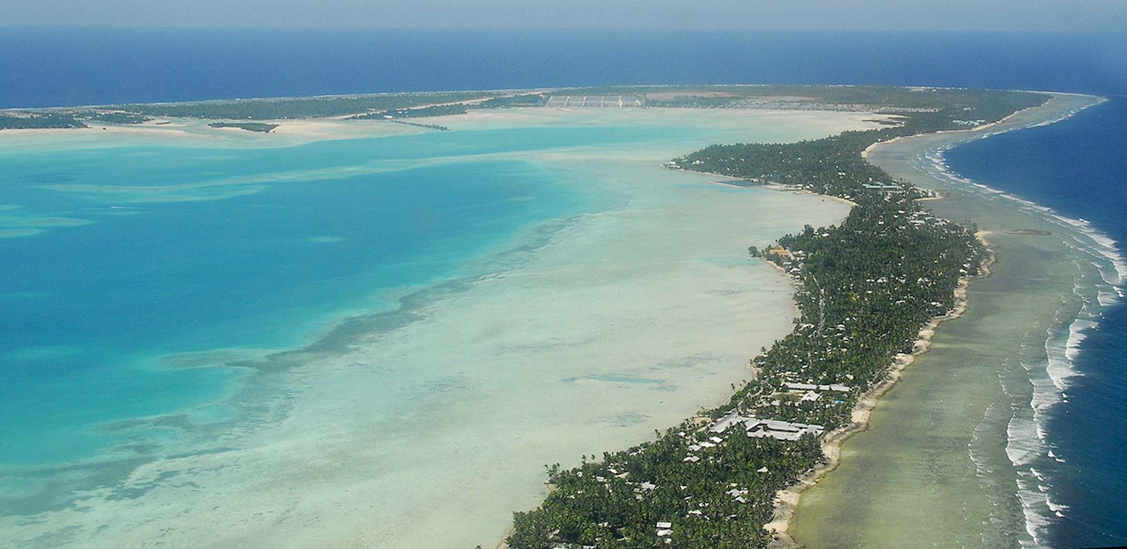
NOAA’s Office of Coast Survey Deputy Hydrographer Dr. John Nyberg participated in a State Department Science Fellowship through the U.S. Embassy in Suva, Fiji this past summer. The fellowship’s main goal for the region is to assist in accelerating the use of coastal and marine spatial planning for marine conservation and to deliver a curriculum to support it. Dr. Nyberg was asked to pay particular attention to engaging Kiribati (pronounced Kiribas), home to the Phoenix Islands Protected Area, one of the world’s largest and most important protected areas. The government of Kiribati is in the process of re-evaluating their approach toward managing the area, and one of the primary goals is to encourage the use of marine spatial planning in that process.

Continue reading “Geospatial information in the Southwestern Pacific”