By Linda Joy, NOAA Communications and External Affairs
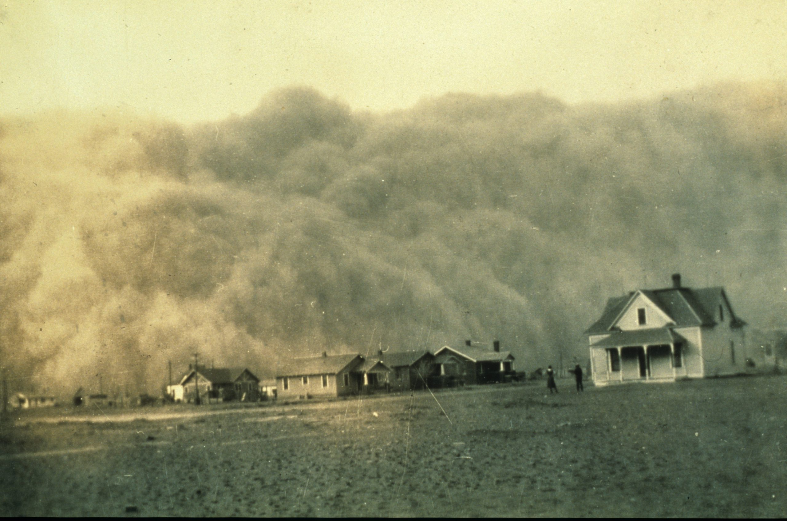
In April 1935, George Marsh, an unassuming engineer employed by the U.S. Coast and Geodetic Survey, took a photo in the course of his work during a Texas surveying mission. Not having Facebook or other social media tools at hand, he put the photo in an album and stored it away. He could not have known that many decades later, thanks to the NOAA Library and the Internet, his photo would eventually reach millions of people around the globe.
The now famous photo captured boiling dust clouds about to swallow a homestead during the Dust Bowl’s infamous Black Sunday storm.
Continue reading “NOAA library blows the dust off a photo of dust clouds”
NOAA library blows the dust off a photo of dust clouds