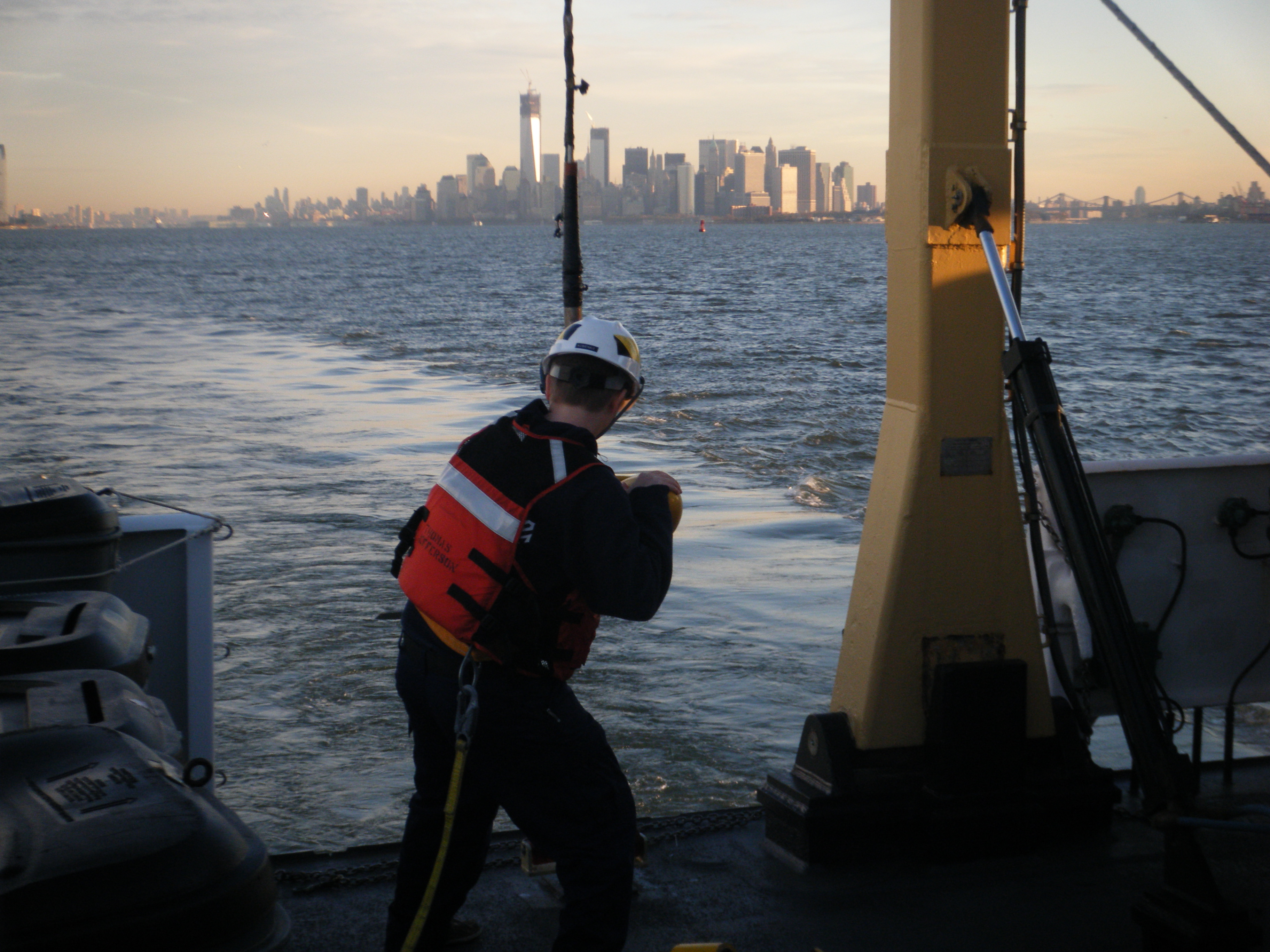
NOAA continues to work in partnership with other federal, state, and local partners in response to the devastation of Hurricane Sandy. NOAA’s efforts are focused on navigation surveys to restore maritime commerce; aerial surveys to assist in those efforts and to aid on-the-ground responders from FEMA and local authorities; and in oil spill cleanup and damage assessment. NOAA’s National Weather Service is also keeping authorities aware of changing weather conditions that could impact recovery and response efforts.
NOAA’s hydrographic survey vessels, including two three-person navigation response teams (NRTs) and the NOAA Ship Thomas Jefferson with her two survey launches, have completed surveys of the Port of New York and New Jersey. Working over the past five days, the high-tech vessels searched approximately 20 square nautical miles of shipping lanes, channels, and terminals to search for dangers to navigation.

Continue reading “NOAA’s navigation assets complete primary post-Sandy assignments, remain available to assist”
Surveys continue in Port of New York / New Jersey, completed in Virginia
Coast Survey’s major survey operations in response to Sandy are completed in Port of Virginia, allowing port operations to resume. That timely resumption is proving to be vital for East Coast shipping, as the port is now receiving cargo diverted from the Port of New York and New Jersey. Associated Press is reporting that more than a thousand containers were offloaded in Virginia yesterday, with more on the way.
Meanwhile, critical survey work continues in the Port of New York and New Jersey, with two of Coast Survey’s navigation response teams (NRT) and two of the Thomas Jefferson launches continuing their search for dangers to navigation in shipping channels and terminals. Today, the high tech survey boats attached to the Thomas Jefferson surveyed the East River, as the ship processes data for delivery to the Coast Guard. One of the boats then went to survey Church Hill Channel this afternoon, while the other went to Gravesend Bay. NRT 2 is surveying Port Elizabeth and Port Newark in Newark Bay. NRT 5 surveyed Kill Van Kull and then proceeded to Author Kill.
Continue reading “Surveys continue in Port of New York / New Jersey, completed in Virginia”
Thomas Jefferson night work gives go-ahead for fuel barge delivery into New York – New Jersey

Even before Sandy hit the New Jersey shore, NOAA’s Office of Coast Survey was mobilizing to respond to the emergency, preparing vessels, personnel, and equipment to conduct hydrographic surveys of hard-hit areas, searching for the underwater debris and shoaling that can paralyze shipping at the nation’s ports.
Continue reading “Thomas Jefferson night work gives go-ahead for fuel barge delivery into New York – New Jersey”
Post-SANDY navigation response in full swing
Continue reading “Post-SANDY navigation response in full swing”
NOAA Ship Rainier completes year’s surveys along Alaskan archipelago, heads home to Newport
NOAA Ship Rainier is due to arrive at its homeport in Newport, Ore., on November 1, completing the ship’s 2012 hydrographic survey season. (Watch Rainier’s progress on NOAA’s Ship Tracker.) This survey season, Rainier departed Newport on May 17 and spent her summer mapping 604 square nautical miles of the ocean floor in Alaska, stretching from Kodiak to the Shumagin Islands, along the Alaskan archipelago.

Continue reading “NOAA Ship Rainier completes year’s surveys along Alaskan archipelago, heads home to Newport”
NOAA Ship Hassler starts post-SANDY survey of deep draft routes to Hampton Roads and Baltimore

NOAA’s newest survey ship, the Ferdinand R. Hassler, began survey operations today in support of the U.S. Coast Guard efforts to re-open the Port of Virginia. Hassler was in port at NOAA’s Marine Operations Center – Atlantic in Norfolk, Virginia, for maintenance when Hurricane Sandy affected the area. The ship’s crew spent Monday completing the work and system tests necessary to get underway once the storm passed, and has now been returned to limited operational status.
Continue reading “NOAA Ship Hassler starts post-SANDY survey of deep draft routes to Hampton Roads and Baltimore”
NOAA deploys personnel and survey assets to speed resumption of shipping after Sandy – Update 29 Oct

As conditions go downhill, NOAA is deploying personnel and hydrographic survey assets to help speed the resumption of shipping after SANDY clears out.
Coast Survey has deployed navigation managers from outside Hurricane Sandy’s areas of impact, supplemented with headquarters personnel, moving them to areas expected to be hit hard. Navigation managers are now at U.S. Coast Guard Incident Command Centers for New York – New Jersey and for Delaware Bay. We are also working with Coast Guard Captains of the Port for Virginia, Baltimore, and New England. NOAA’s navigation managers are working with the Coast Guard and the Army Corps of Engineers to coordinate deployment of NOAA’s navigation response teams (NRT) for rapid maritime response. They are also identifying vessels of opportunity, for potential use with Coast Survey’s mobile survey team (MIST).
Continue reading “NOAA deploys personnel and survey assets to speed resumption of shipping after Sandy – Update 29 Oct”
NOAA pre-positions survey assets for SANDY maritime response

As Hurricane SANDY heads north along the Atlantic coast, NOAA’s Office of Coast Survey is deep into preparations for maritime rapid response. Two objectives stand out: move navigation response personnel and assets into position to move quickly once SANDY moves out; and batten down survey vessels, to protect them from storm damage.
Coast Survey regularly responds to requests for quick navigation surveys after storms and other damaging events, pulling vessels from their normal survey schedules and deploying them to ports that need hydrographic surveys before they can resume full-fledged shipping.
Continue reading “NOAA pre-positions survey assets for SANDY maritime response”
NOAA and American Pilots’ Association sign Memorandum of Agreement to advance safe navigation

Dr. Kathryn Sullivan, NOAA Assistant Secretary of Commerce for Environmental Observation & Prediction, signed an agreement today that recognizes the longstanding working relationship between marine pilots and NOAA’s navigational services. Coast Survey has a long-term working relationship with the American Pilots’ Association, whose members include virtually all of the 1,200 state-licensed marine pilots working in the 24 coastal states and the Great Lakes. This agreement updates an earlier collaborative agreement between APA and NOAA. Continue reading “NOAA and American Pilots’ Association sign Memorandum of Agreement to advance safe navigation”
NOAA Ship Thomas Jefferson mapping Long Island Sound seafloor: contributing to multi-level collaboration
How many geospatial products can be developed by one seafloor mapping project? As a phased-in project for Long Island Sound shows, a strong collaboration among diverse groups of researchers and technology developers can integrate temporal and geospatial data sources to produce dozens of products. In addition to updating NOAA’s nautical charts, ongoing collaborations in Long Island Sound will create products that depict physical, geological, ecological, geomorphological, and biological conditions and processes – all to balance the development of new ocean uses while protecting and restoring essential habitats.
Continue reading “NOAA Ship Thomas Jefferson mapping Long Island Sound seafloor: contributing to multi-level collaboration”
