by Ensign Diane Perry, onboard NOAA Ship Thomas Jefferson
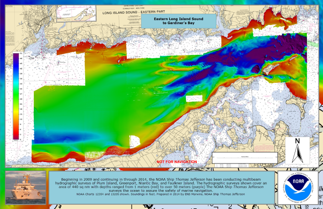
From 2005 through today, NOAA Ship Thomas Jefferson has been surveying Long Island Sound, one project area at a time. Some of the area was last surveyed between the late 1800s and 1939. For the 2014 field season, Thomas Jefferson was assigned her final Long Island Sound project, 89 square nautical miles of Eastern Long Island Sound, Fisher Island Sound, and Western Block Island Sound. When this project is complete, we will have resurveyed over 95% of Long Island Sound and all of Block Island Sound with modern survey technology that allows for a complete picture of the seafloor and highly accurate soundings.

Continue reading “NOAA Ship Thomas Jefferson celebrates survey success with maritime community”
NOAA Ship Thomas Jefferson finds two divers in Block Island Sound
NOAA hydrographic survey vessels are valuable assets for search and rescue operations, as experienced crews use their knowledge of tides and ocean currents to develop science-based search patterns. Last month, two divers found out just how valuable NOAA’s expertise can be. — DF
Report submitted by Ensign Brittany Anderson, NOAA Ship Thomas Jefferson
On the morning of August 26, 2012, NOAA Ship Thomas Jefferson was conducting routine hydrographic survey operations south of Block Island. At 0904 hours, a distress call was made on the very high frequency (VHF) radio to the Coast Guard Station. The caller reported two divers lost in the water at Southwest Ledge, a popular recreational point off Block Island. The coordinates were a mere seconds north of the Thomas Jefferson.
Continue reading “NOAA Ship Thomas Jefferson finds two divers in Block Island Sound”

