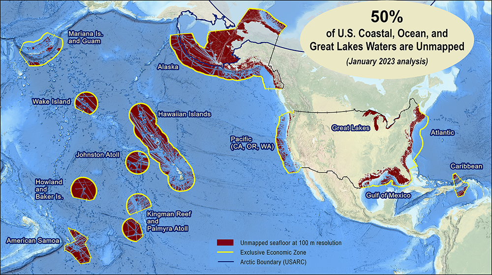
The federal Interagency Working Group on Ocean and Coastal Mapping (IWG-OCM) has released the fourth annual report on progress made in mapping U.S. ocean, coastal, and Great Lakes waters. Knowledge of the depth, shape, and composition of the seafloor has far-reaching benefits, including safer navigation, hazard mitigation for coastal resilience, preservation of marine habitats and heritage, and a deeper understanding of natural resources for sustainable ocean economies. The 2020 National Strategy for Mapping, Exploring, and Characterizing the United States Exclusive Economic Zone (NOMEC) and the Nippon Foundation-GEBCO Seabed 2030 Project make comprehensive ocean mapping a priority for the coming decade. The Unmapped U.S. Waters report tracks progress toward these important goals.
Continue reading “The Interagency Working Group on Ocean and Coastal Mapping announces progress report on mapping U.S. ocean, coastal, and Great Lakes waters”Naming Brennan Reef, a previously uncharted pinnacle in Channel Islands National Marine Sanctuary
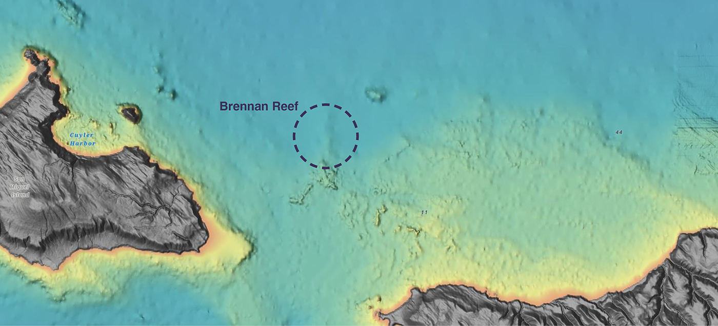
NOAA Corps Rear Adm. Richard T. “Rick” Brennan, recent director of NOAA’s Office of Coast Survey, was deeply dedicated to NOAA’s mission and was an integral part of building connections across NOAA programs to benefit coastal communities around the United States. One example of Rick’s leadership was the Southern California Seafloor Mapping Initiative, a partnership between Coast Survey, Office of National Marine Sanctuaries (ONMS), National Centers for Coastal Ocean Science (NCCOS) and National Marine Fisheries Service (NMFS). Among many important accomplishments of this coordinated mapping effort was the survey of a previously uncharted reef in Channel Islands National Marine Sanctuary. Through legislative action led by U.S. Congressman Salud Carbajal of California’s 24th District, this reef has been officially designated as “Brennan Reef.”
Continue reading “Naming Brennan Reef, a previously uncharted pinnacle in Channel Islands National Marine Sanctuary”

