NOAA Ship Rainier surveys the waters around Kodiak Island

by ENS Michelle Levano

Kodiak Island is the 2nd largest island in the United States; it is part of the Kodiak Island Archipelago, a group of islands roughly the size of Connecticut. Due to the island’s location in the Gulf of Alaska and North Pacific Ocean, Kodiak is ranked as third in commercial fishing ports in the U.S. in terms of value of seafood landed. In 2015, the Port of Kodiak was responsible for 514 million pounds of fish and $138 million of product. More than one-third of the jobs in Kodiak are related to the fishing industry.
The Port of Kodiak is home to more than 700 commercial fishing vessels, and has more than 650 boat slips and three commercial piers that can dock vessels up to 1,000 feet. In addition to fishing, Kodiak is the hub of the Gulf of Alaska container logistics system, serving the southwest Alaskan communities with consumer goods and outbound access to the world’s fish markets. Continue reading “NOAA Ship Rainier surveys the waters around Kodiak Island”

Teaming up with small business to expand hydrographic technology

Sandy shoals in certain near shore areas shift continuously and present a danger to navigation. It is logistically impossible to keep nautical charts current using the traditional survey methods when the bottom contours change so rapidly. NOAA’s Office of Coast Survey leverages remote sensing data in new ways to derive bathymetry for the purposes of updating nautical charts in dynamic coastal areas. An exciting new method Coast Survey is exploring is X-band radar wave imaging. Marine radar is not a new technology, however, there are advantages to exploring old technology for new purposes. Many NOAA vessels and other coastal installations are already equipped with the hardware to facilitate this type of data acquisition. Continue reading “Teaming up with small business to expand hydrographic technology”

NOAA releases 2017 hydrographic survey season plans

NOAA’s Office of Coast Survey maintains the nautical charts and publications for U.S. coasts and the Great Lakes. This is over a thousand charts covering 95,000 miles of shoreline and 3.4 million square nautical miles of waters. Measuring depths and determining new dangers to navigation in this large area is a monumental job given the seafloor is constantly changing.
One of NOAA Coast Survey’s biggest tasks during the winter months is to plan hydrographic survey projects for the coming field season. Survey planners consider requests from stakeholders such as marine pilots, local port authorities, the Coast Guard, and the boating community, and also consider other hydrographic priorities in determining where to survey and when. Continue reading “NOAA releases 2017 hydrographic survey season plans”

Beta test of crowdsourced bathymetry holds promise for improving U.S. nautical charts

BHII bathymetric data collection

We are on the verge of acquiring a significant new source of data to improve NOAA nautical charts, thanks to an enthusiastic industry and mariners equipped with new technology.

By Lt. Adam Reed, Integrated Oceans and Coastal Mapping (IOCM) Assistant Coordinator
The United States has about 3,400,000 square nautical miles of water within our coastal and Great Lakes jurisdiction. Coast Survey, who is responsible for charting that vast area, averages about 3,000 square nautical miles of hydrographic surveying each year. The data collected by those surveys update over a thousand NOAA charts. However, hydrographic surveys are expensive and laborious, and so Coast Survey directs them toward the highest priority sites, which leaves many coastal areas without updates for many years.
Coast Survey may soon get new sources of information, provided voluntarily by mariners, which will alert cartographers to areas where shoaling and other changes to the seafloor have made the chart inaccurate.
Continue reading “Beta test of crowdsourced bathymetry holds promise for improving U.S. nautical charts”

Studying the use of satellite-derived bathymetry as a new survey tool

by Ensign Kaitlyn Seberger, onboard NOAA Ship Thomas Jefferson

Nautical charts are an important tool in navigating safely in coastal waters, and Coast Survey’s mission is to keep these charts up to date. However, maintaining accurate charts can be a challenge in locations where sandy shoals may shift seasonally and present a danger to navigation. These areas differ from the current nautical charts, and bottom contours change so rapidly that it may seem an impossible task to keep up using the traditional survey methods. Office of Coast Survey and NOAA Ship Thomas Jefferson are seeking a solution to this ongoing problem and may have an answer with satellite-derived bathymetry.
Satellite-derived bathymetry (SDB) begins with using multi-spectral satellite imagery, obtained by satellites such as Landsat and WorldView2, which compares green and blue color bands.
Continue reading “Studying the use of satellite-derived bathymetry as a new survey tool”

Explore once, use many times

OE Survey W00286

This post is adapted from a poster at the U.S. Hydro 2015 conference, in National Harbor, Maryland.

Pilot project shows nautical charting applications using NOAA Ship Okeanos Explorer data

By
James J. Miller and Tyanne Faulkes, physical scientists, NOAA Office of Coast Survey, Atlantic Hydrographic Branch
Lindsay McKenna, physical scientist, ERT Inc. contractor with the NOAA Office of Ocean Exploration and Research
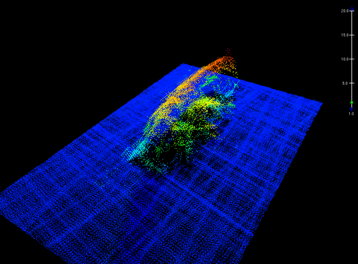
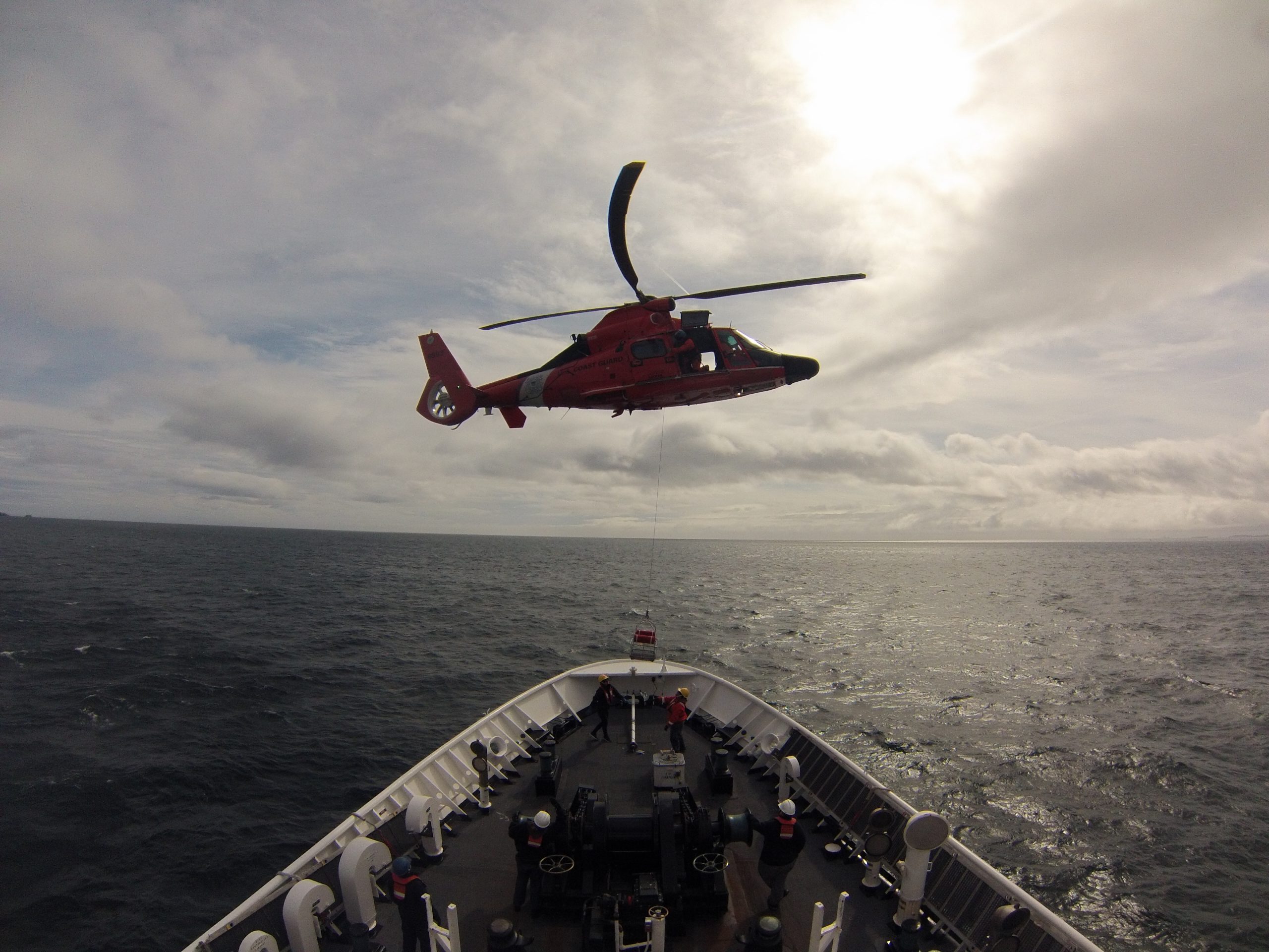
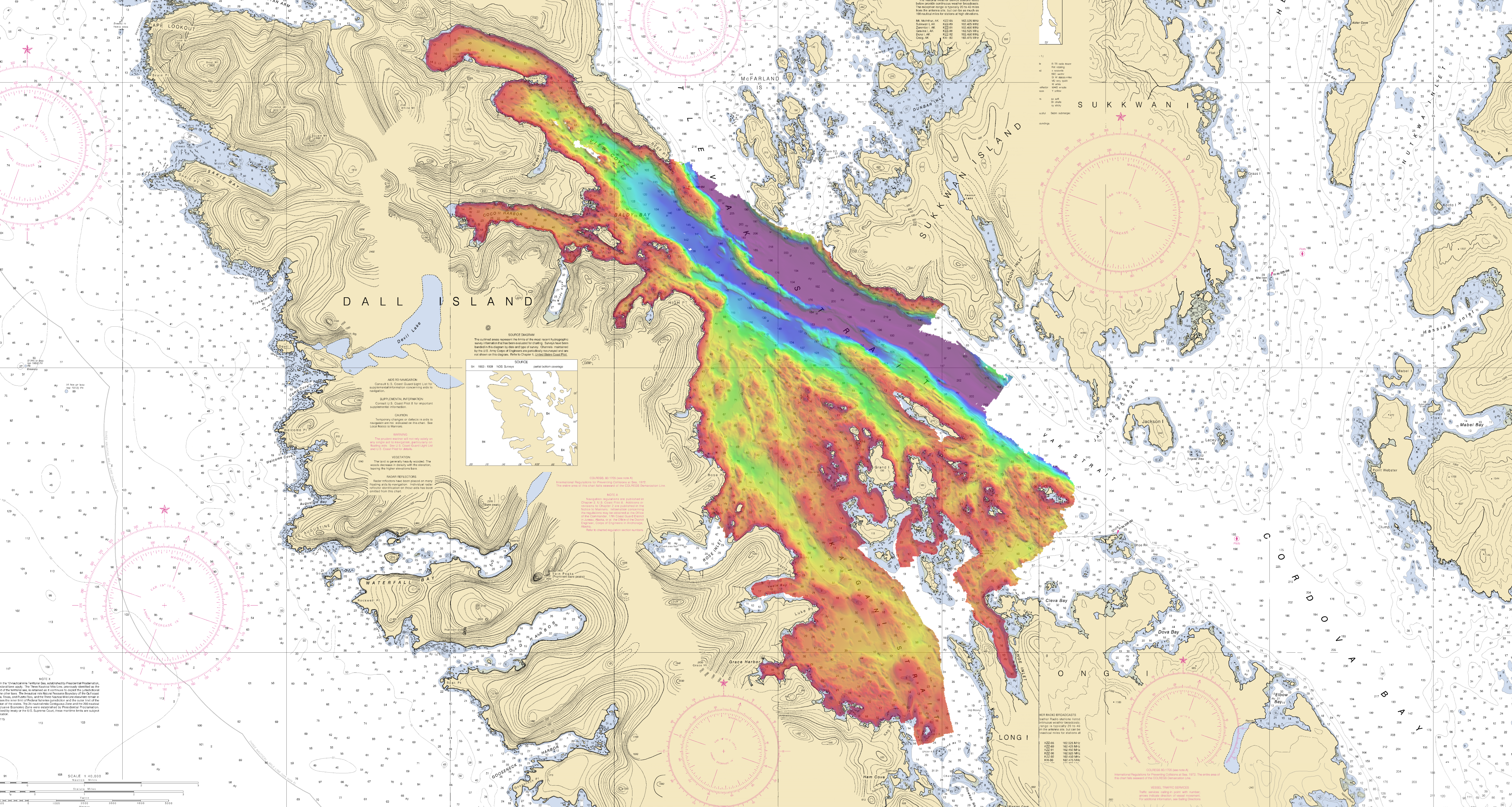
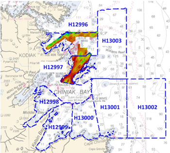
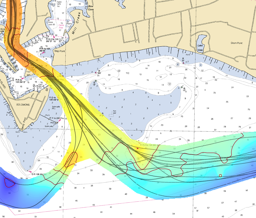
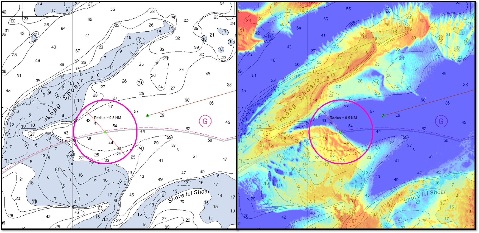
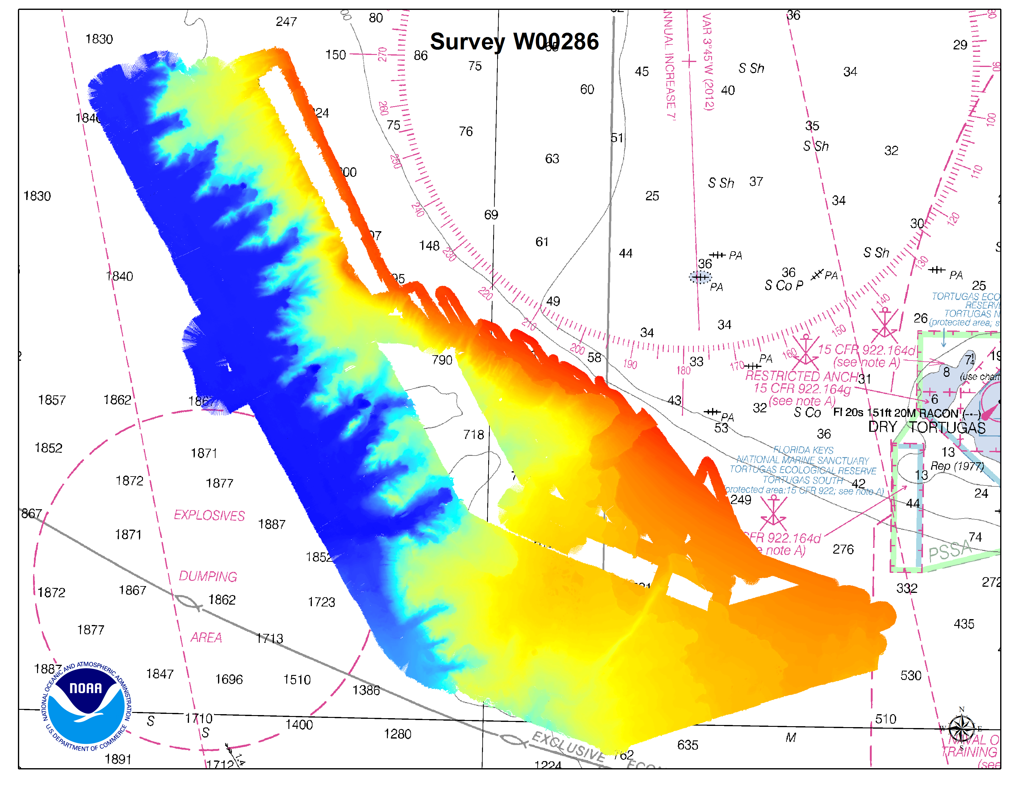
Mapping is the foundation of ocean exploration and marine spatial planning. In its mission to explore and broaden our knowledge of the oceans, the NOAA Ship Okeanos Explorer has collected high-resolution multibeam data as an integral part of its operations around the globe. Since 2013, the Office of Coast Survey has collaborated with the Okeanos Explorer during their expeditions, to improve hydrographic acquisition and processing methods and expand multibeam coverage in the Gulf of Mexico and Atlantic Ocean. The resulting bathymetry has supported a diverse array of oceanic research and contributed to the protection of ecologically critical habitats in U.S. waters.
Continue reading “Explore once, use many times”