
In November 2013, we introduced NOAA ENC Online – a continuous viewer for our electronic navigational charts. You can click on the web map and zoom to selected features or locations, to see the information contained in over a thousand electronic charts of NOAA-charted waters. Each zoom moves you through an ENC depiction that takes into account the ENC scale and other attributes that are encoded in the ENC, allowing features to become visible or invisible as you seamlessly zoom in and out of the data.
NOAA ENC Online is based on Esri’s Maritime Chart Server.
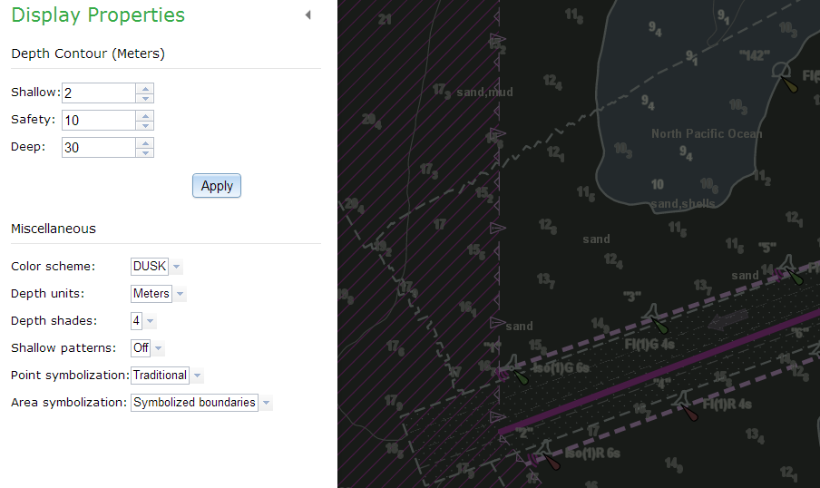
Now this latest release of NOAA ENC Online lets you:
- Set a shallow and deep depth contour, which changes the shading to those parameters
- Set a safety contour (In electronic charting systems, the safety contour is set based on the ship’s draft changes the depiction of rocks, wrecks and obstructions to isolated dangers depending on if the water is “safe” or “unsafe” for vessel navigation.)

- Change between S-52 simplified and S-52 traditional symbols

- Change the background colors of the display based on the S-52 color palette for different light conditions on the bridge of a ship
- Turn off certain features based on different categories such as buoys and traffic routes

NOAA ENC Online is not certified for navigation. It does NOT fulfill chart carriage requirements for regulated commercial vessels under Titles 33 and 46 of the Code of Federal Regulations.
You guys are great! Thank you for all you do.