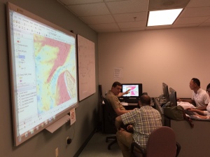
This week, hydrographers from 11 different countries traveled to Silver Spring, Maryland, to attend a workshop on nautical chart adequacy. Workshop participants included scholar students from the General Bathymetric Chart of the Oceans Organization, and participants from Israel, Malaysia, South Korea and United Kingdom. The workshop, developed and hosted by Coast Survey and the Joint Hydrographic Center, University of New Hampshire, trained the hydrographers on procedures to assess the adequacy of their respective nautical charts using publicly-available information.
This workshop was developed in part to address the International Hydrographic Office C-55 publication recognizing the need to improve the collection, quality, and availability of hydrographic data world-wide. Evaluating the adequacy of charts can be challenging to many national hydrographic offices given the lack of reliable vessel traffic data and minimal resources to survey and assess the changing nature of the seafloor and shoreline.
During the workshop trainers incorporated the latest techniques, using data from the maritime automatic identification system (AIS) that displays actual vessel traffic, as well as depth measurements deduced from satellite images. The Silver Spring workshop is the first of several U.S.-planned training activities that will facilitate a global standardized procedure for assessing the adequacy of nautical charts used by mariners around the world.


News and Updates
How can i study and work at the same time as a hydrographic surveyor