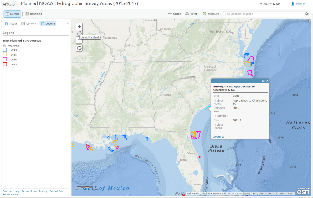
With over 3.4 million square nautical miles of U.S. waters to chart, NOAA’s Office of Coast Survey is constantly evaluating long-term hydrographic survey priorities. Now, for the first time, Coast Survey is posting its three-year survey plans and making them publicly available at the Planned NOAA Hydrographic Survey Areas (2015-2017) in ArcGIS Online. In addition to seeing the outlines of planned survey areas for the next three years, users can obtain additional metadata (project name, calendar year, and area in square nautical miles) for each survey by simply clicking on the outlines. Other features display the survey area information in a tabular format, and can filter the information using metadata fields.

The Hydrographic Survey Division is Coast Survey’s primary data acquisition arm. They plan and manage the large survey ships’ hydrographic operations. (The Navigation Services Division manages the smaller survey boats used by the navigation response teams. Their survey plans will soon be added to this webmap.)
Because of the enormousness of our area of responsibility and limited resources, Coast Survey develops long-term survey priorities using a number of parameters, including navigational significance, survey vintage (when the area was last surveyed), vessel usage, and potential for unknown dangers to navigation. Coast Survey then culls the long-term priorities for annual survey plans using other factors such as urgent needs (recent grounding, accidents, etc.), compelling requests from the maritime industry and U.S. Coast Guard, traffic volume, and identified chart discrepancies.
While Coast Survey tries to consider operational constraints, ice coverage, and weather patterns while making plans, sometimes the unexpected does occur. We have to emphasize that these are plans, subject to reevaluations, operational constraints, weather, and resource allocation. Because plans often change, people should bookmark the site and check back often. This is an operational site, and we will update plans as they change.
For more information about specific survey areas or to request a survey, please submit an inquiry through NOAA’s Nautical Inquiry & Comment System or contact the regional navigation manager for your area.
The Planned NOAA Hydrographic Survey Areas webmap is powered by Esri’s ArcGIS Online technology.

News and Updates
Nice web map. Would be good to add additional information on the “planned” cruise like, type of cruise, projected start-end data, type of data being collected, and a “planned” metadata record for the project,
etc.
The development of the webmap doesn’t end here! We will be adding attributes and metadata, and we appreciate hearing what the maritime and recreational boating communities want to know. Thanks for joining the conversation.
Is there a way to know which ship will be surveying in which region? I’m curious to know which ship I might see out on the water!
Dr. G, the Rainier and Fairweather survey the West Coast, and Thomas Jefferson and Ferdinand S. Hassler cover the East Coast. Beyond that, we announce specific project assignments around late February or early March. You might want to subscribe to this blog so you won’t miss the announcement. OR, if you ever see any NOAA ship (not just the survey vessels), check the Ship Tracker (link on the left side of this blog) to see which ship it is and where it’s been.
I avidly follow the progress of the annual Alaskan surveys, which tend to be long overdue. Some of the soundings on modern charts were old in the Russian era. It drive me nuts that I can’t find out when a final product will be delivered! I see survey ships working each year, and then I see final survey BAGS randomly pop up at odd times and apparently random order. Certain portions of the surveyed areas seem to be forgotten. Who is in charge of the modern equivalent of the old dusty store room with the forgotten data?
Thanks for your question, Arthur. There are many factors that determine when survey data is ready for charting. We’d be happy to look at the specific area you are concerned with. Please go to our nautical inquiry system and give us the location or chart number, and we’ll get back to you. Or, if you prefer to see the survey data itself (after it is processed), check out these data sets.