New unmanned surface vehicles to deliver shoaler depth measurements for NOAA nautical charts

Lt. Carrier deploys Z-Boat

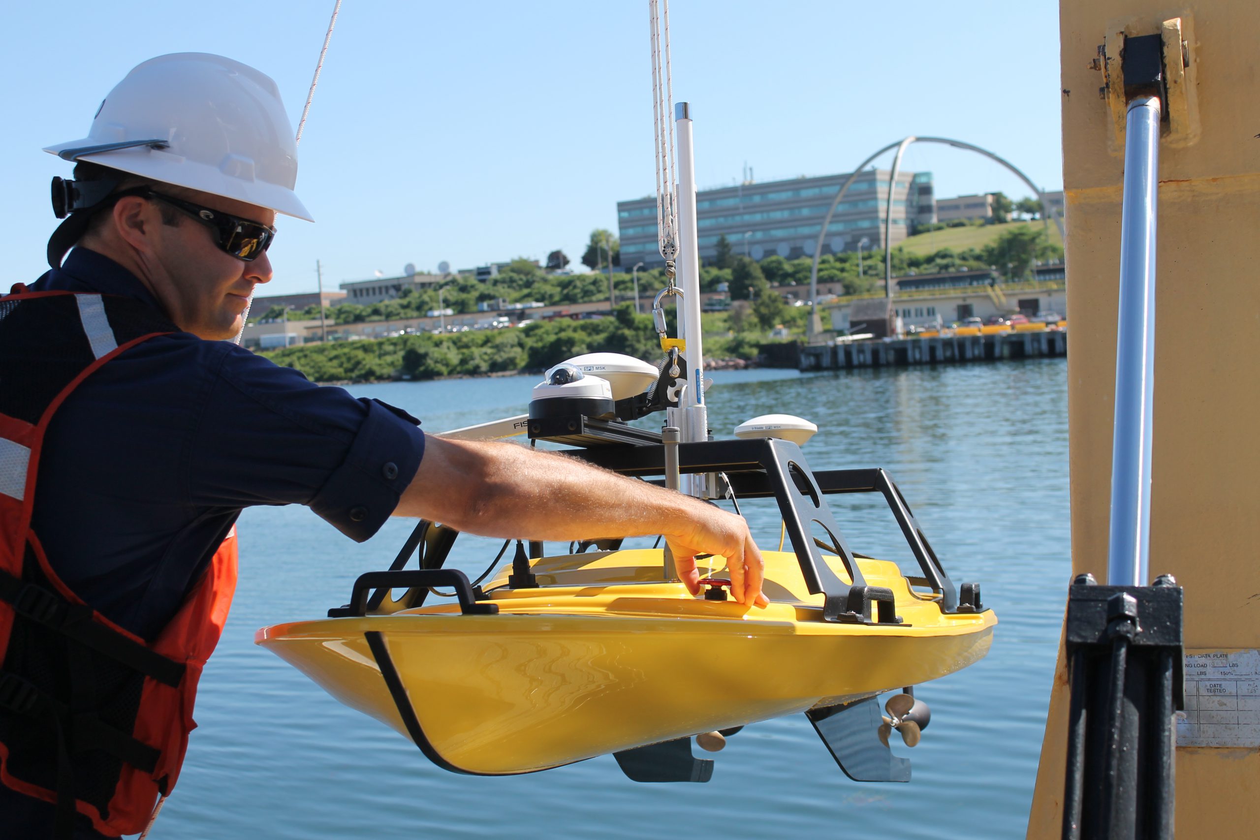
If you look closely at any U.S. coastal nautical chart, you’ll likely find that the areas closest to the shore, shoals, and rocks do not have updated depth measurements. In many areas, safety concerns prohibit the use of NOAA ships or launches to survey the shoalest depths. In many areas, the water is too murky to be mapped with the airborne lidar systems used in clear waters. Now, however, charting those shallow areas is about to get safer, thanks to recent purchases of small, commercial off-the-shelf, unmanned surface vehicles.
This summer, NOAA Ship Thomas Jefferson will deploy a “Z-Boat,” offered by Teledyne Oceanscience out of Carlsbad, California.
Continue reading “New unmanned surface vehicles to deliver shoaler depth measurements for NOAA nautical charts”

Hurricane Katrina: 10 Years Later

Ten years ago this week, Hurricane Katrina devastated the Gulf Coast, affecting millions of lives. This disaster brought together all of Coast Survey’s capabilities on an unprecedented scale to help in response and recovery efforts in the storm’s aftermath. Ten years later, Coast Survey reflects back on the planning and response to Hurricane Katrina, and looks to their progress in developing tools to aid in coastal resilience.
Continue reading “Hurricane Katrina: 10 Years Later”

Coast Survey adds navigation assets to NOAA preparations for Hurricane Danny

Hurricane Danny is churning in the Atlantic. NOAA hurricane models are churning through data, and two NOAA sensor-packed Hurricane Hunters — a Lockheed WP-3D Orion and a Gulfstream IV — are in Barbados, flying into the storm to collect storm data. Over the next few days, scientists on the ground and in the air will help us determine where Danny will go, and how big the hurricane will get.
In the meantime, NOAA Office of Coast Survey is tracking the NOAA forecasts and making initial preparations for deployment of hydrographic survey equipment to Puerto Rico or the U.S. Virgin Islands, if needed.
Continue reading “Coast Survey adds navigation assets to NOAA preparations for Hurricane Danny”

Report from the Arctic: Surveying Kotzebue Sound 2015

By Starla Robinson, project manager in Coast Survey’s Hydrographic Surveys Division
Two hundred years after Otto von Kotzebue and the crew of the Ruiric explored what would later be named Kotzebue Sound, NOAA ships Fairweather and Rainer follow in the same tradition. Two centuries ago they were searching for the Northwest Passage in support of trade. Today, we explore to improve the science and safety of navigation in support of commerce, environmental protection, and local communities. Our bathymetric data and observations will also be used to better inform coastal decision-making.

kotzebue-historical charts
Original chart of Kotzebue Sound (left). 1973 chart of Kotzebue Sound (right). Today’s chart of the project area is not significantly different from that of 1973.

Continue reading “Report from the Arctic: Surveying Kotzebue Sound 2015”

Coast Survey welcomes Guy Funnell from the UK Hydrographic Office

Guy Funnell (left) meets with NOAA-certified print-on-demand chart sub-agent Horizon Nautical.

Hydrographic offices around the world often share expertise and experiences in order to improve products and processes. In that vein, NOAA’s Office of Coast Survey welcomes Guy Funnell, a product manager from the United Kingdom Hydrographic Office who will be working with us in a unique employee exchange.
The exchange will be of immense benefit to Coast Survey, as we continue to explore practices and technologies to improve Coast Survey’s product management.
The UKHO is an equivalent to Coast Survey, but with some major differences. While Coast Survey and the UKHO have a working relationship going back over a century, the UKHO got a jump on us in chart production, producing their first chart (of Quiberon Bay in Brittany) in 1800. We came along a little later, when President Thomas Jefferson signed legislation in 1807, calling for a survey of the coast.
Continue reading “Coast Survey welcomes Guy Funnell from the UK Hydrographic Office”

Coast Survey participates in international Arctic survey project – Part 2

By Edward Owens
In a previous post, Edward shared his initial experience on board the Canadian Coast Guard vessel Louis S. St-Laurent as they traveled from Halifax, Canada, toward Tromsø, Norway. Today, he provides an update as well as a look at some of the features they found on the seafloor along the way.

photo of Edward Owens
Edward Owens on board Canadian Coast Guard vessel Louis S. St-Laurent.

It is a Sunday and our transit across the Atlantic on board Canadian Coast Guard vessel Louis S. St-Laurent  is nearly complete. We’ll arrive in Tromsø, Norway, on Tuesday morning where we’ll rendezvous with a pilot boat to complete the final leg of our internationally coordinated hydrographic mission, as the latest contribution to the Galway Statement on Atlantic Ocean Cooperation.
Continue reading “Coast Survey participates in international Arctic survey project – Part 2”

Coast Survey hosts Hollings Scholar

Valerie in the NOAA Ship Fairweather engine room.
Valerie Rennoll, Coast Survey’s first Hollings Scholar, stands in the NOAA Ship Fairweather engine room.

By, Melissa Volkert
Meet Valerie Rennoll, the Office of Coast Survey’s first Ernest F. Hollings (Hollings) Scholar on a NOAA vessel.
Originally from Glen Rock, Pennsylvania, Valerie discovered the Hollings Scholarship from a professor at American University while working toward her double major in physics and audio technology. She found that the scholarship program aligned well with her interests as she learned of NOAA’s extensive work with underwater acoustics.
Continue reading “Coast Survey hosts Hollings Scholar”