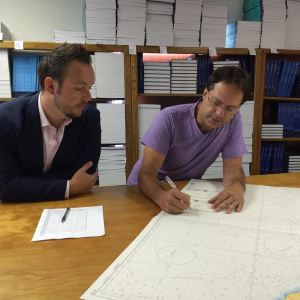
Hydrographic offices around the world often share expertise and experiences in order to improve products and processes. In that vein, NOAA’s Office of Coast Survey welcomes Guy Funnell, a product manager from the United Kingdom Hydrographic Office who will be working with us in a unique employee exchange.
The exchange will be of immense benefit to Coast Survey, as we continue to explore practices and technologies to improve Coast Survey’s product management.
The UKHO is an equivalent to Coast Survey, but with some major differences. While Coast Survey and the UKHO have a working relationship going back over a century, the UKHO got a jump on us in chart production, producing their first chart (of Quiberon Bay in Brittany) in 1800. We came along a little later, when President Thomas Jefferson signed legislation in 1807, calling for a survey of the coast.
The two agencies have developed different nautical chart production and distribution processes.
The UKHO is a part of the Ministry of Defence, operating as a trading fund (a type of government department or agency). It uses the revenue it makes to meet its outgoings, whereas Coast Survey’s funding comes from tax dollars so our products are free to the public. Another difference is in the collection of hydrographic data for application to Admiralty Charts. The UKHO does not have their own fleet of ships and survey equipment, and so they rely on the Royal Navy, the British Maritime and Coastguard Agency, and contractors for charting data; Coast Survey primarily uses NOAA ships and contractors. UKHO makes arrangements with other countries for their nautical charting data; we do not.
The two agencies have a lot to learn from each other. One of Funnell’s challenges will be to learn how the U.S. regulatory shipping environment compares to other parts of the world. For instance, he will look at our tier of federal, state, and local regulations, how the regulations are enforced, what impacts they have on operations, and how users comply and demonstrate that they comply, as well as how they are inspected. Guy also aims to understand the different operational factors for coastal and river traffic, how they compare to the UK, and how they serve the international mariner.
Funnell will also further his understanding of how NOAA operates. In particular, he will examine the integration of navigation products and services to other NOAA services, the collection of data from private or academic sources, our working relationships with ports and terminal operators, and customer feedback for new product development. As Coast Survey continues our move into digital products, synchronicity will also be an important area for exploration.
Upon his arrival in the U.S., one of Funnell’s first stops was in New Orleans, which is the largest complex of ports and the most congested waterway in the U.S. During an early morning, deep-draft ship transit up the Mississippi River to a terminal near Baton Rouge with New Orleans-Baton Rouge Pilots Association’s Jason Ledet, Funnell witnessed first-hand the importance of NOAA’s environmental digital/electronic data and charting resources.

Off the ship, Guy was in consultations and discussions with Louisiana chart agents and distributors of both Admiralty and NOAA products.

Guy Funnell’s stay in the U.S. will last until the end of September. Coast Survey’s Rachel Medley, the acting chief of Navigation Services Division’s Requirements and Products Management Branch, will then join him in the United Kingdom. From October to December, Medley will work at the UKHO Product Management Department, where she will learn the UKHO’s best practices for management of their products. (Watch this space for Medley’s posts about her experiences in the UK!)

News and Updates
