NOAA navigation response team investigates hazardous shoal off Rockaway Point, NY

Recently, NOAA navigation response team 5 (NRT5), responded to a survey request from U.S. Coast Guard (USCG) Sector New York following several groundings near Rockaway Point in Queens, New York. Waves and currents often influence the size and shape of nearshore sandbars, and the USCG was concerned that a sandbar may have expanded beyond the area depicted on the nautical chart. Lt. j.g. Dylan Kosten, Eli Smith, and Michael Bloom traveled from New London, Connecticut, to Jersey City, New Jersey, to launch their vessel and start the survey of the area.
Continue reading “NOAA navigation response team investigates hazardous shoal off Rockaway Point, NY”

NOAA ships Fairweather and Rainier mark 50 years of service and survey

NOAA ships Rainier and Fairweather.

To recognize the successful history of NOAA ships Fairweather and Rainier, as well as the professional mariners, hydrographers, and commissioned officers who have served aboard these ships for the last 50 years, NOAA hosted a ceremony and public ship tours at the Marine Operations Center – Pacific (MOC-P) in Newport, Oregon. Continue reading “NOAA ships Fairweather and Rainier mark 50 years of service and survey”

NOAA quickly updates nautical chart, allowing large ships to dock with confidence in Port Everglades

Change in the slip length reflected in ENC cell US5FL32 and US4FL31.

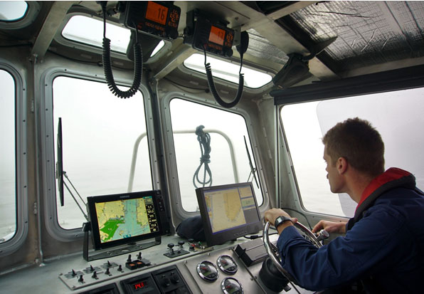
NOAA’s Office of Coast Survey quickly updated NOAA electronic navigational charts (NOAA ENC®) to accurately reflect the 225 foot expansion of a slip in Port Everglades, Florida. Now at a total length of 1,125 feet, the elongated slip allows larger ships to dock with confidence. The Port Everglades Pilots – maritime pilots who maneuver ships through crowded harbors and confined waters – requested the chart update. With ENCs that accurately reflect the slip expansion in their hands, pilots can easily communicate to vessel captains that it is safe to dock their vessels in the slip.
Port Everglades is one of the top three cruise ports in the world, and is among the most active cargo ports in the United States. Every slip is kept in high use, and Coast Survey used a new data process that allowed the most critical and valuable information to be applied quickly and made available to the end user. Continue reading “NOAA quickly updates nautical chart, allowing large ships to dock with confidence in Port Everglades”

NOAA navigation response team locates sunken vessel before nor’easter strikes

Multibeam Imagery of the vessel

On March 12, 2018, NOAA Coast Survey’s navigation response team 5 (NRT5) located the T/V Captain Mackintire, an 80-foot towing vessel that sank off the coast of Kennebunkport, Maine. The U.S. Coast Guard requested assistance finding the vessel, citing concerns of environmental hazards due to an unknown amount of fuel remaining onboard.
Continue reading “NOAA navigation response team locates sunken vessel before nor’easter strikes”

Take a 360 tour of NOAA Ship RAINIER

In celebration of 50 years of survey and service to the nation, NOAA ships Rainier and Fairweather—two of NOAA’s hydrographic survey vessels—will be opening their doors and hosting public ship tours. Since we understand that many of you are unable to be in Newport, Oregon, the afternoon of March 22 to take a tour in person, we are bringing the tour to you! The following 20 images offer a 360 degree view of the interior and exterior of NOAA Ship Rainier. The images were taken last field season on the survey operations mission to Channel Islands, California. From the crew mess and engine room to a view from the bow, we have captured it all.
Continue reading “Take a 360 tour of NOAA Ship RAINIER”

NOAA RNC Tile Service displays first ENC-only product

The Merrimack River, located in Massachusetts, is just south of the New Hampshire border.The single chart tile set is named​ 13274K0000_1.

NOAA Office of Coast Survey released its 1:12,000 electronic navigational chart (NOAA ENC®of the Merrimack River, Massachusetts, in the RNC Tile Service. This is the first time a navigational chart—created solely as ENC product—is included in the tile service. The tile service renders a traditional depiction of the nautical chart for use with GPS-enabled electronic chart systems or other “chart plotter” display systems to provide real-time vessel positioning for recreational mariners. This chart is included in the single chart tile sets and the quilted tile sets both in the online and offline versions. Continue reading “NOAA RNC Tile Service displays first ENC-only product”

NOAA surveys for recreational boat traffic safety in Tampa Bay

Multibeam echo sounder coverage. Credit: NOAA

NOAA’s navigation response team 2 (NRT2), homeported in Fernandina Beach, Florida, conducted a survey around the Sunshine Skyway Bridge, which spans Tampa Bay. The U.S. Coast Guard (USCG) and additional members of the Tampa Bay Harbor Safety Committee requested the work and expressed interest in establishing alternate routes for recreational boating traffic. Alternative routes will alleviate increasing congestion where the main ship channel passes beneath the bridge. This area is naturally restrictive to navigation and, as a result, there have been multiple accidents and near accidents here in the past. Continue reading “NOAA surveys for recreational boat traffic safety in Tampa Bay”