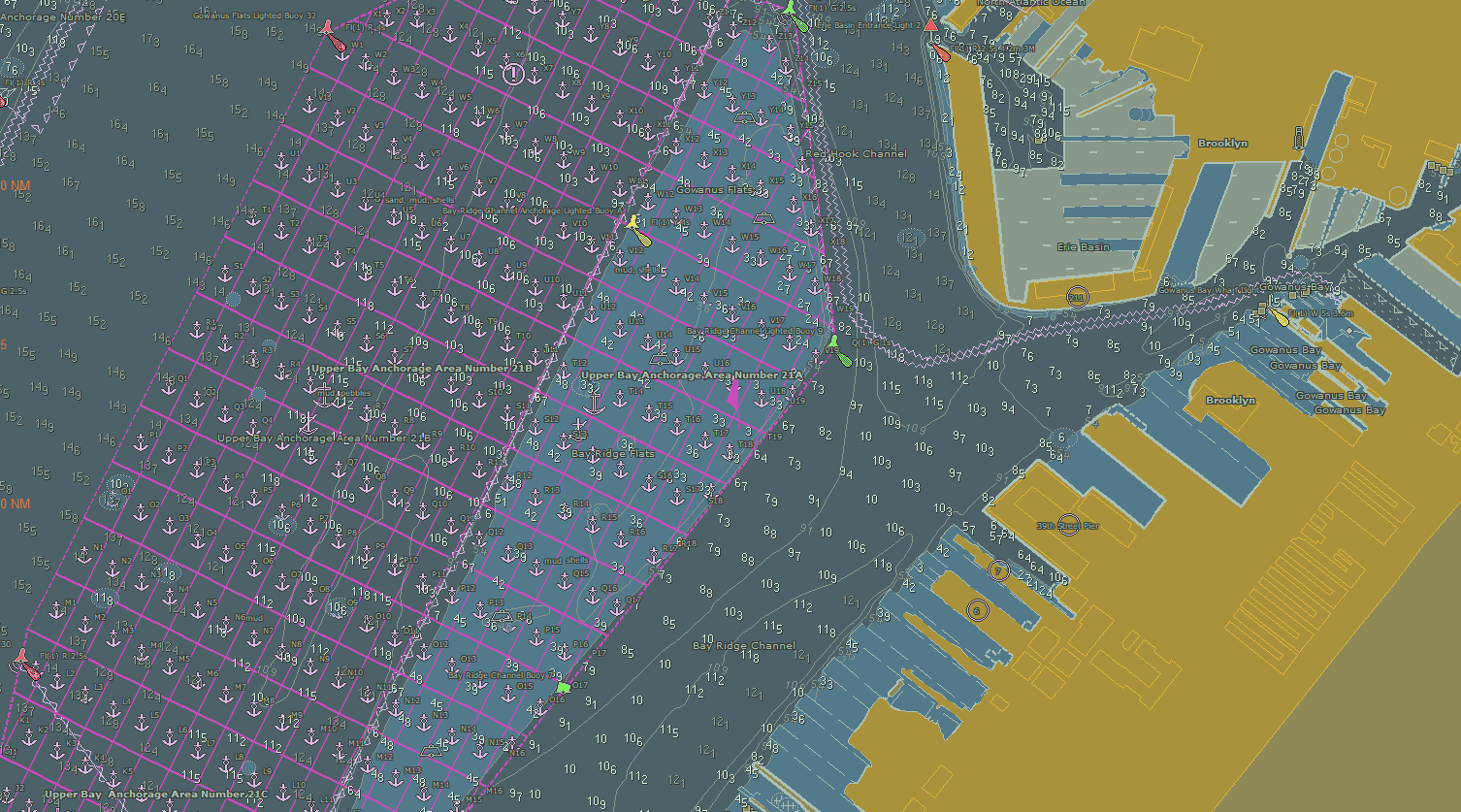
NOAA Coast Survey recently released updates for two NOAA electronic navigational charts (NOAA ENC®) in the Port of New York and New Jersey, which added a permanent grid system overlay to anchorages in Bay Ridge, Graves End, and Stapleton. Coast Survey performed the update at the request of the Harbor Operations Steering Committee and collaborated with the Sandy Hook Pilots Association and U.S. Coast Guard (USCG) Sector New York’s Vessel Traffic Services (VTS).
Continue reading “NOAA adds grid overlay to chart anchorage areas in Port of New York and New Jersey”
Navigating waters before GPS: Why some mariners still refer to Loran-C
by Nick Perugini
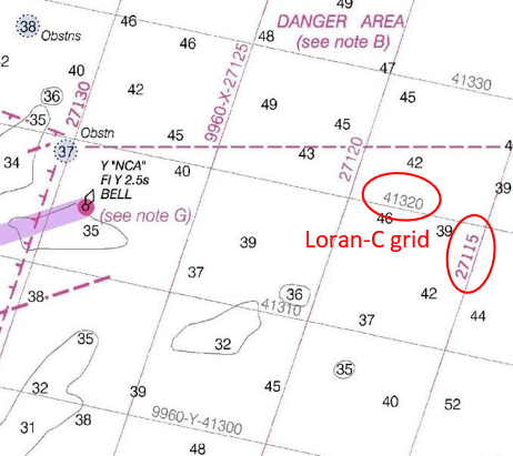
One of the most popular recurring questions received by NOAA’s Office of Coast Survey involves customers – typically fishermen – wanting to obtain a chart with a Loran-C navigation grid on it. Here are a few inquiries from NOAA’s Nautical Inquiry & Comment System:
- Hello, I was wondering if it is still possible to purchase or locate older editions of Lake Huron charts (14862-3-4) with the LORAN-C overlay. Many older wrecks and reported snags are still in Loran and have not been converted to GPS. Artificial algorithms are difficult to use when plotting grids. Any help you can give me is much appreciated.
- Is it possible to access Loran-C charts of New England from prior to 2009 when NOAA stopped published with the LORAN-C lines? THANKS!
- I was wondering if there was a way for me to buy a chart that has LORAN lines and notes on it? I understand that all of the new charts no longer have this information on them. I am most interested in Chart 11520, Cape Hatteras to Charleston. I didn’t know if there might be an archived form of this chart that shows the LORAN features. Any help in finding a chart like this would be greatly appreciated.
Continue reading “Navigating waters before GPS: Why some mariners still refer to Loran-C”
Online NOAA Custom Chart lets boaters create their own charts
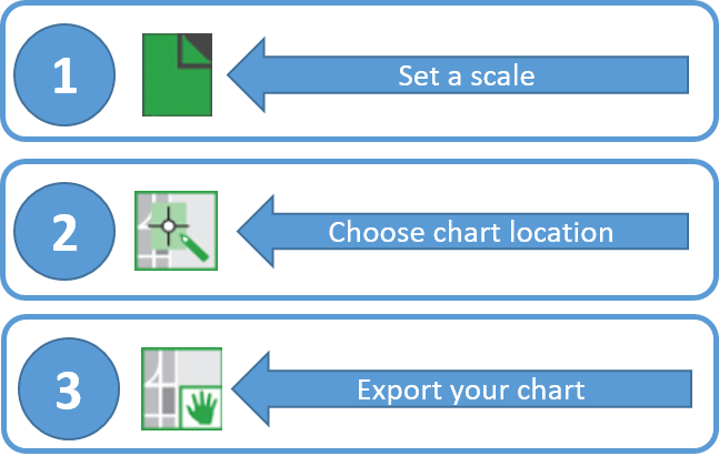
A prototype version of a powerful new online tool, NOAA Custom Chart, is now available for boaters and other nautical chart users. The application enables users to define the scale and paper size of custom-made nautical charts centered on a position of their choosing. Once the functionality of this prototype is fully developed, NOAA Custom Chart will be an easy way for boaters to create a paper or digital back-up for the electronic chart system or other GPS-enabled chart display that they are using on board.
Continue reading “Online NOAA Custom Chart lets boaters create their own charts”
NOAA mobile integrated survey team prepares for hurricane season
NOAA’s Office of Coast Survey is the federal leader in emergency hydrographic response. Consecutive strong storms during the 2017 hurricane season made response efforts challenging, and emphasized the importance of having a well-trained and versatile staff. Coast Survey’s regional navigation managers, navigation response teams (NRTs), and mobile integrated survey team (MIST) worked with partners before and after the storms to quickly and safely reopen ports and waterways.
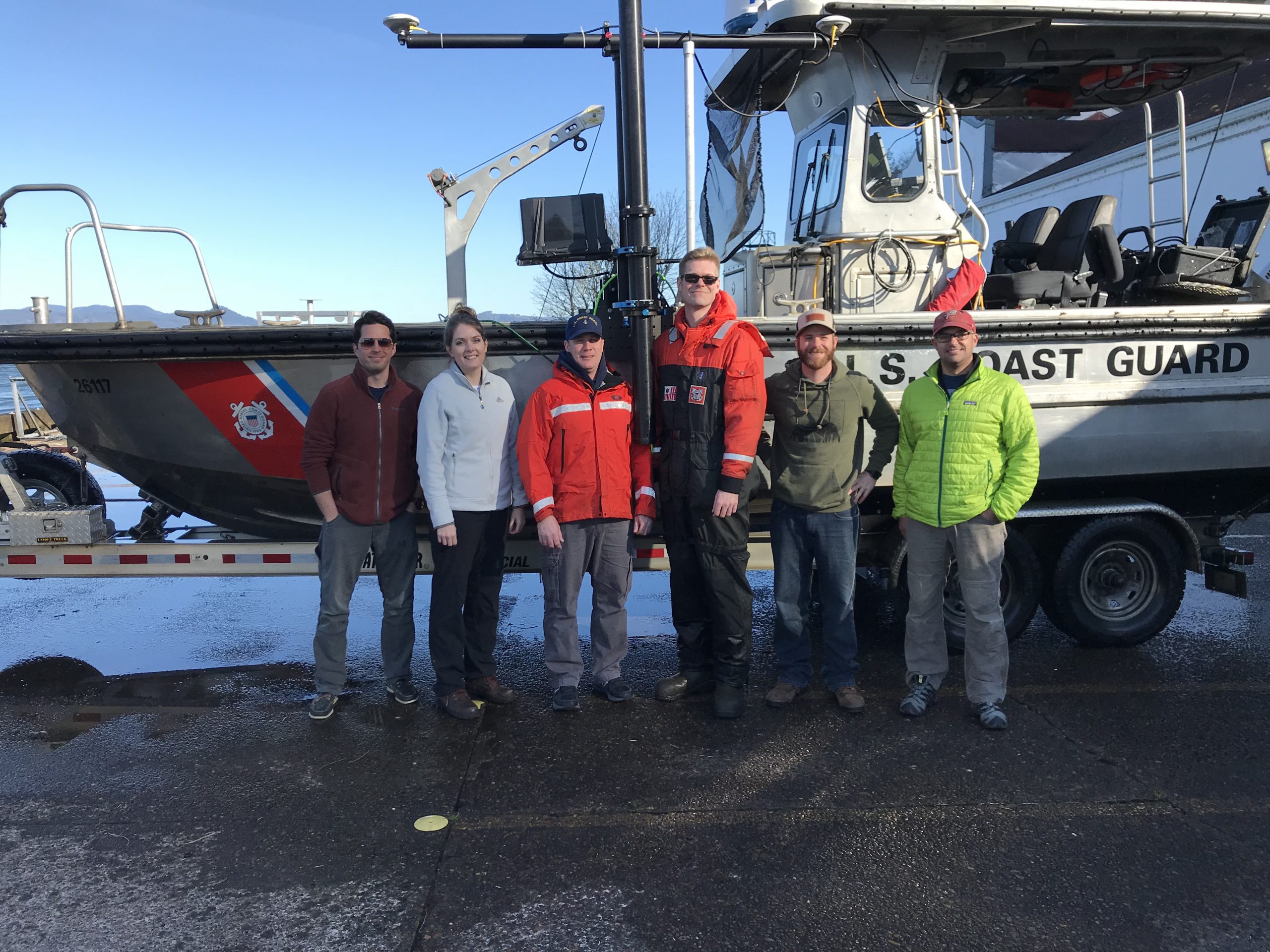
The MIST equipment is a mobile, quick-install side scan and single beam sonar kit that can be quickly set up on a vessel of opportunity. Recently, Coast Survey sent the MIST team to Astoria, Oregon to conduct a hydrographic survey of the Mott Basin area, which the U.S. Coast Guard (USCG) requested to confirm charted depth and obstruction data. Continue reading “NOAA mobile integrated survey team prepares for hurricane season”


