
NOAA’s Office of Coast Survey maintains the nautical charts and publications for U.S. coasts and the Great Lakes. This is over a thousand charts covering 95,000 miles of shoreline and 3.4 million square nautical miles of waters. Measuring depths and determining new dangers to navigation in this large area is a monumental job given the seafloor is constantly changing.
One of NOAA Coast Survey’s biggest tasks during the winter months is to plan hydrographic survey projects for the coming field season. Survey planners consider requests from stakeholders such as marine pilots, local port authorities, the Coast Guard, and the boating community, and also consider other hydrographic priorities in determining where to survey and when. Continue reading “NOAA releases 2017 hydrographic survey season plans”
NOAA helps four ports recover from Hurricane Matthew
Matthew became a hurricane on Thursday, September 29, and it was soon clear that NOAA’s navigation services would be called into action. Coast Survey knew they would be needed for the maritime transportation system’s rapid recovery operations, to search for underwater debris and shoaling. That Saturday, while Hurricane Matthew was still three days away from hitting Haiti, Coast Survey was already ramping up preparations for assisting with reopening U.S. shipping lanes and ports after Matthew’s destruction. By Monday, as NOAA’s National Hurricane Center zeroed in on a major hit to the southeast coast, Coast Survey’s navigation service personnel began moving personnel and survey vessels for rapid deployment. Calling in survey professionals from as far away as Seattle, teams were mobilized to locations outside of the hurricane’s impact zones, so they would be ready to move in and hit the water as soon as weather and ocean conditions allowed.
Continue reading “NOAA helps four ports recover from Hurricane Matthew”
Commerce Secretary Pritzker attends Hassler change of command
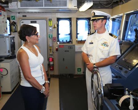
On July 21, U.S. Secretary of Commerce Penny Pritzker attended the change-of-command ceremony for NOAA Ship Ferdinand R. Hassler, one of NOAA’s hydrographic survey vessels that collect data for creating the nation’s nautical charts.
At the ceremony, Lt. Cmdr. Matthew Jaskoski assumed command from Lt. Cmdr. Briana Welton, who served as Hassler’s third commanding officer and will become the chief of Coast Survey’s Atlantic Hydrographic Branch. Jaskoski previously served as executive officer for NOAA Ship Fairweather.
Sec. Pritzker’s remarks highlighted Hassler’s contributions since its commissioning just over four years ago, including its completion of 46 hydrographic surveys and the ship’s contribution to re-opening East Coast sea traffic after Hurricane Sandy. She also reminded the officers and crew of the legacy they honor in their contributions to our nation’s coastal intelligence.
Continue reading “Commerce Secretary Pritzker attends Hassler change of command”
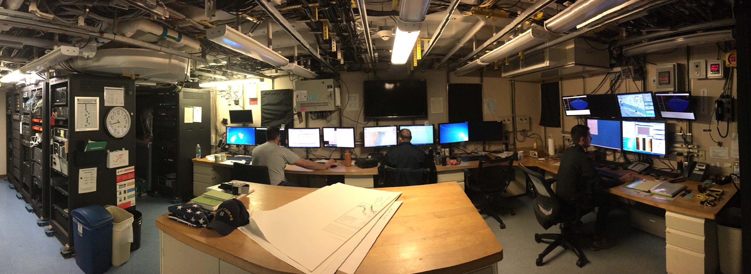
Coast Survey uses unmanned technology to find submerged danger to navigation
Coast Survey has been discovering and marking the locations of underwater dangers since our surveyors took the nation’s first official ocean soundings in 1834. We’ve used or developed all the technological advancements – lead lines, drag lines, single beam echo sounders, towed side scan sonars, and post-1990 multibeam echo sounders – and now we can point to a new major advancement for fast deployment and quick recovery. In February, Coast Survey’s Mobile Integrated Survey Team (MIST) used an autonomous underwater vehicle (AUV) to locate a submerged buoy that was interfering with anchorages in the Chesapeake Bay.
“You and the crew of the HASSLER put us right where we needed to be!” said a confirmation email from the U.S. Coast Guard to NOAA Lt. Ryan Wartick, one of Coast Survey’s navigation managers. “Thanks for the great work!”
Continue reading “Coast Survey uses unmanned technology to find submerged danger to navigation”
Change of command for NOAA Ship Ferdinand Hassler
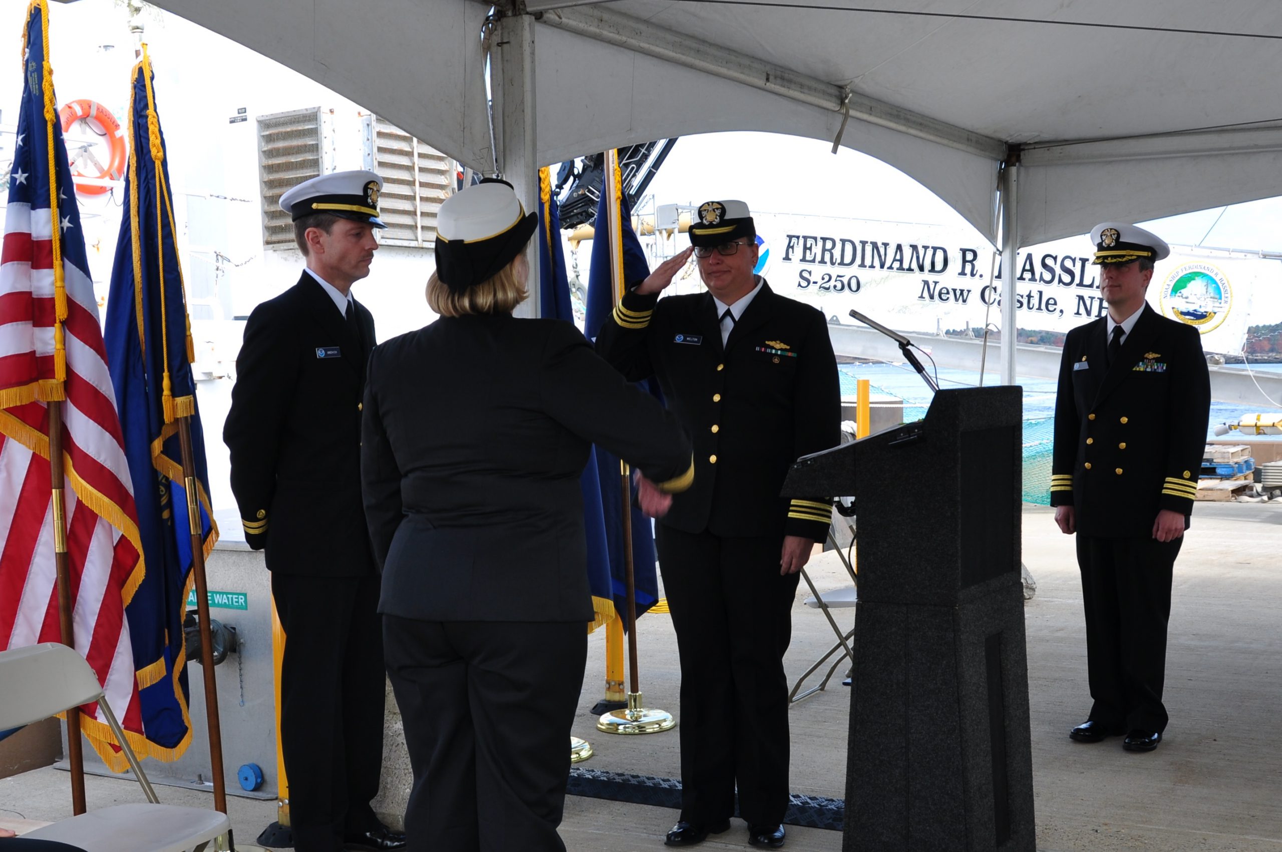
The crew of the NOAA Ship Ferdinand R. Hassler (S-250) hosted a change of command on November 5, while moored at its homeport in New Castle, New Hampshire.
In front of the crew and guests – including Rear Adm. Gerd Glang, director of the Office of Coast Survey, and Capt. Anne Lynch, commanding officer of the Atlantic Marine Operations Center – Lt. Cmdr. Briana Welton accepted command of Hassler, replacing Cmdr. Marc Moser.
Welton is the new survey ship’s third commanding officer.
Continue reading “Change of command for NOAA Ship Ferdinand Hassler”
NOAA hydro field season underway
The 2014 hydrographic survey season is underway, with the NOAA fleet beginning its projects for this year.
Have you ever wondered how Coast Survey goes about determining where to survey and when? Several considerations go into prioritizing survey plans, which are laid out several years in advance. Coast Survey asks specific questions about each potential survey area.
- Is it considered a critical area? If so, how old are the most current survey data?
- Have local pilots or port authorities submitted reports of shoaling, obstructions or other concerns?
- Does the U.S. Coast Guard or other stakeholders from the maritime community (e.g., fisheries, energy, pipelines) need surveys for economic development or ecological protection?
Coast Survey’s 2014 projects reflect these priorities.
Continue reading “NOAA hydro field season underway”
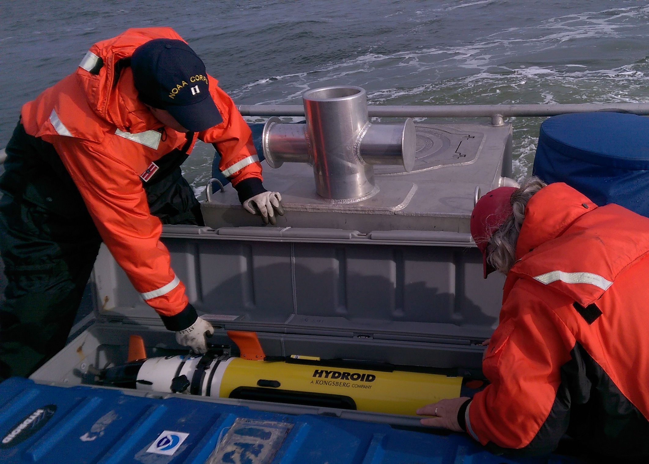
Bathymetric AUV shows promise for NOAA surveying
In a step towards greater efficiency in NOAA’s hydrographic surveying, experts onboard the NOAA Ship Ferdinand R. Hassler just wrapped up the first extended testing of Coast Survey’s new bathymetric mapping autonomous underwater vehicle (AUV). From Sept 3 to 13, the vehicle completed ten missions lasting up to 16 hours during day and night, while the ship continued with its assigned hydrographic surveys in the approaches to Portsmouth, New Hampshire.
This AUV is equipped with high resolution seabed mapping equipment similar to the ship’s, including a high accuracy positioning system and multibeam echosounder capable of producing seamless maps of the seafloor.
Continue reading “Bathymetric AUV shows promise for NOAA surveying”
NOAA Ship Ferdinand R. Hassler starts new phase of operations
NOAA’s newest survey ship, the Ferdinand R. Hassler, arrived at her new homeport of New Castle, New Hampshire, earlier this month, and began her first New Hampshire survey project today. Hassler was commissioned in Norfolk, Va., in June 2012. She has been undergoing sea trials, training, and certification, and responded to Hampton Roads’ request for rapid survey assistance after Hurricane Sandy last year.

Continue reading “NOAA Ship Ferdinand R. Hassler starts new phase of operations”
NOAA hydro survey season underway
Spring is always a noteworthy time at Coast Survey, as the hydrographic season gets underway. This year is no exception, with some neat projects ahead.
On the East Coast, NOAA Ship Thomas Jefferson continues her work with the multi-state, multi-agency Long Island Sound Seafloor Mapping Initiative, as well as acquiring data over 87 square nautical miles in the approaches to New York to update nautical charts. In June, Thomas Jefferson begins some of her summer-long extensive 2013 post-Sandy surveys in Delaware Bay (supported by Title X, Chapter 2, of H.R. 152, the Disaster Relief Appropriations Act, 2013).
As our newest survey vessel, NOAA Ship Ferdinand Hassler, prepares for a long survey career, the crew is taking her through final repairs, upgrades, training, and inspection this spring. If all goes well, Hassler will then survey approaches to Chesapeake Bay in July, before heading to her new homeport in New Castle, New Hampshire. Once there, Hassler plans to survey approaches to New Hampshire and conduct some tests and evaluations of a new autonomous underwater vehicle (AUV) for surveying.
Continue reading “NOAA hydro survey season underway”
NOAA’s navigation assets complete primary post-Sandy assignments, remain available to assist
NOAA continues to work in partnership with other federal, state, and local partners in response to the devastation of Hurricane Sandy. NOAA’s efforts are focused on navigation surveys to restore maritime commerce; aerial surveys to assist in those efforts and to aid on-the-ground responders from FEMA and local authorities; and in oil spill cleanup and damage assessment. NOAA’s National Weather Service is also keeping authorities aware of changing weather conditions that could impact recovery and response efforts.
NOAA’s hydrographic survey vessels, including two three-person navigation response teams (NRTs) and the NOAA Ship Thomas Jefferson with her two survey launches, have completed surveys of the Port of New York and New Jersey. Working over the past five days, the high-tech vessels searched approximately 20 square nautical miles of shipping lanes, channels, and terminals to search for dangers to navigation.

Continue reading “NOAA’s navigation assets complete primary post-Sandy assignments, remain available to assist”