NOAA Ship Rainier concludes it’s 2017 survey of Deer Passage, Alaska

The total area surveyed by Rainier in the Cold Bay and King Cove Vicinity during the 2017 Field Season, complied by Hydrographic Senior Survey Technician Gahlinger.

NOAA Ship Rainier has been diligently surveying Deer Passage in the vicinity of Cold Bay and King Cove, Alaska, for the past month.
This navigationally significant area between Unga Strait and Sanak Island provides the only protected route for vessels transiting between the Gulf of Alaska, the very busy Unimak Passage, and the Bering Sea beyond. Deer Passage is heavily trafficked by fishing vessels, coastal freight traffic, and Alaska Marine Highway System ferries, and serves as an alternate route for deep-draft vessels on Trans-Pacific routes between North America and Asia. While in the area, Rainier observed particularly heavy use of the waterway by vessels engaged in local and Bering Sea fisheries, and towing vessels supporting remote Alaskan communities with barge service.
Continue reading “NOAA Ship Rainier concludes it’s 2017 survey of Deer Passage, Alaska”

NOAA Ship Rainier holds change of command ceremony

by ENS Michelle Levano

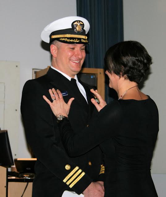
On July 22, 2017, the crew of NOAA Ship Rainier hosted a change of command while at United States Coast Guard Base Kodiak, Alaska.
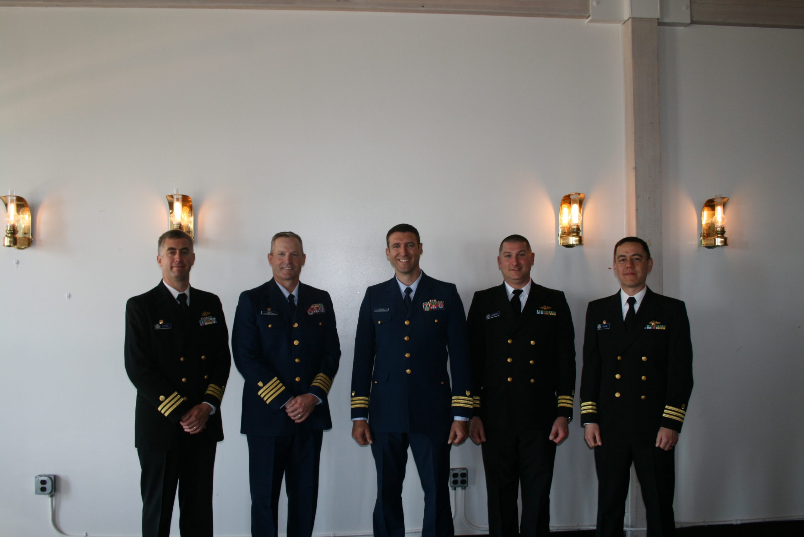
Commander Benjamin Evans accepted command of Rainier, relieving Commander John Lomnicky in a ceremony led by Captain Keith Roberts, commanding officer of NOAA’s Office of Marine and Aviation Operations (OMAO) Marine Operations Center-Pacific. Distinguished guests included Captain Richard Brennan, chief of NOAA Office of Coast Survey’s Hydrographic Surveys Division, Mr. Greg Kaplan, Military and Veterans Affairs liaison for Senator Lisa Murkowski, Captain Jeffery Good, commanding officer United States Coast Guard (USCG) Base Kodiak, Commander Michael Levine, commanding officer of NOAA Ship Oscar Dyson, and Commander Daniel Rogers, executive officer of United States Coast Guard Base Kodiak. Continue reading “NOAA Ship Rainier holds change of command ceremony”

Surveying, rescue drills, and an open house—NOAA Ship Rainier has been busy!

by ENS Michelle Levano

NOAA Ship Rainier continues hydrographic survey operations in Chiniak Bay, near Kodiak, Alaska. As of June 1, 2017, Rainier and her survey launches have surveyed 2,025 nautical miles in the Spruce Island, Long Island, Middle Bay, Kalsin Bay, Isthmus Bay, and offshore Cape Chiniak areas. The total distance surveyed is about as long as the Mississippi River. Continue reading “Surveying, rescue drills, and an open house—NOAA Ship Rainier has been busy!”

NOAA Ship Fairweather uses new technology to improve survey efficiency

Area surveyed by Fairweather May 30- June 10, 2017.
By ENS Peter Siegenthaler

Following the scheduled winter repair period, Fairweather is kicking off the 2017 field season in Tlevak Strait; the waterway between Dall Island and Prince of Wales Island in Southeast Alaska. This area was last surveyed between 1900 and 1939, and the lead-lines used at the time to determine depths were susceptible to omission of rocks and other features in an area. Using the latest innovations in hydrographic technology, Fairweather will be resurveying these areas with complete coverage multibeam echo sounder bathymetry. This allows Fairweather to identify any rocks or shoal features missed in prior surveys, increasing the safety for local communities, whose economies and livelihoods are dependent on maritime transportation of goods. Continue reading “NOAA Ship Fairweather uses new technology to improve survey efficiency”

NOAA Ship Rainier surveys the waters around Kodiak Island

by ENS Michelle Levano

Kodiak Island is the 2nd largest island in the United States; it is part of the Kodiak Island Archipelago, a group of islands roughly the size of Connecticut. Due to the island’s location in the Gulf of Alaska and North Pacific Ocean, Kodiak is ranked as third in commercial fishing ports in the U.S. in terms of value of seafood landed. In 2015, the Port of Kodiak was responsible for 514 million pounds of fish and $138 million of product. More than one-third of the jobs in Kodiak are related to the fishing industry.
The Port of Kodiak is home to more than 700 commercial fishing vessels, and has more than 650 boat slips and three commercial piers that can dock vessels up to 1,000 feet. In addition to fishing, Kodiak is the hub of the Gulf of Alaska container logistics system, serving the southwest Alaskan communities with consumer goods and outbound access to the world’s fish markets. Continue reading “NOAA Ship Rainier surveys the waters around Kodiak Island”

NOAA releases 2017 hydrographic survey season plans

NOAA’s Office of Coast Survey maintains the nautical charts and publications for U.S. coasts and the Great Lakes. This is over a thousand charts covering 95,000 miles of shoreline and 3.4 million square nautical miles of waters. Measuring depths and determining new dangers to navigation in this large area is a monumental job given the seafloor is constantly changing.
One of NOAA Coast Survey’s biggest tasks during the winter months is to plan hydrographic survey projects for the coming field season. Survey planners consider requests from stakeholders such as marine pilots, local port authorities, the Coast Guard, and the boating community, and also consider other hydrographic priorities in determining where to survey and when. Continue reading “NOAA releases 2017 hydrographic survey season plans”

Change of command for NOAA Ship Rainier

Cmdr. John Lomnicky

The crew of NOAA Ship Rainier (S-221) hosted a change of command on January 12 while moored in its homeport of Newport, Oregon.
Cmdr. John Lomnicky accepted command of Rainer, replacing Capt. Edward Van Den Ameele in a ceremony with crew and guests in attendance, including Rear Adm. Shepard Smith, director of NOAA’s Office of Coast Survey; Capt. Todd Bridgeman, director of Marine Operations, OMAO; Mayor Sandra Roumagoux, Newport, Oregon; and Cmdr. Brian Parker, commanding officer of Pacific Marine Operations Center. Continue reading “Change of command for NOAA Ship Rainier”

“Ordinary people, called on to do the extraordinary” in the search for TWA Flight #800

On this date in 1996, twenty years ago, the crew of NOAA Ship Rude completed her special mission and headed back to regular survey duties. Throughout the previous two weeks, Rude’s officers and crew were pivotal in finding the wreckage of – and helping to bring closure to – one of the worst aviation disasters in U.S. history.
From a 1996 report by then-Cmdr. Nick Perugini, NOAA’s Office of Coast Survey, we have this description:

“When TWA Flight 800 exploded out of the sky this summer, NOAA hydrographic survey vessel Rude began a dramatic journey which would test to the limit skills and resources of its officers and crew, and bring to national attention the agency’s hydrographic capabilities.

Continue reading ““Ordinary people, called on to do the extraordinary” in the search for TWA Flight #800”