
NOAA’s Office of Coast Survey maintains the nautical charts and publications for U.S. coasts and the Great Lakes. This is over a thousand charts covering 95,000 miles of shoreline and 3.4 million square nautical miles of waters. Measuring depths and determining new dangers to navigation in this large area is a monumental job given the seafloor is constantly changing.
One of NOAA Coast Survey’s biggest tasks during the winter months is to plan hydrographic survey projects for the coming field season. Survey planners consider requests from stakeholders such as marine pilots, local port authorities, the Coast Guard, and the boating community, and also consider other hydrographic priorities in determining where to survey and when. Continue reading “NOAA releases 2017 hydrographic survey season plans”
Change of command for NOAA Ship Rainier
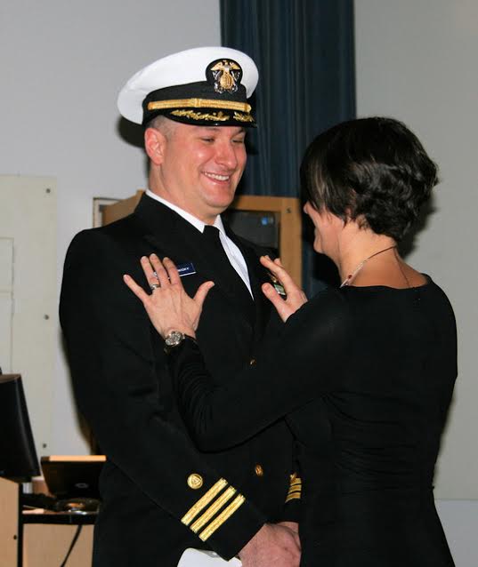
The crew of NOAA Ship Rainier (S-221) hosted a change of command on January 12 while moored in its homeport of Newport, Oregon.
Cmdr. John Lomnicky accepted command of Rainer, replacing Capt. Edward Van Den Ameele in a ceremony with crew and guests in attendance, including Rear Adm. Shepard Smith, director of NOAA’s Office of Coast Survey; Capt. Todd Bridgeman, director of Marine Operations, OMAO; Mayor Sandra Roumagoux, Newport, Oregon; and Cmdr. Brian Parker, commanding officer of Pacific Marine Operations Center. Continue reading “Change of command for NOAA Ship Rainier”
NOAA Ship Rainier surveys Uganik Bay
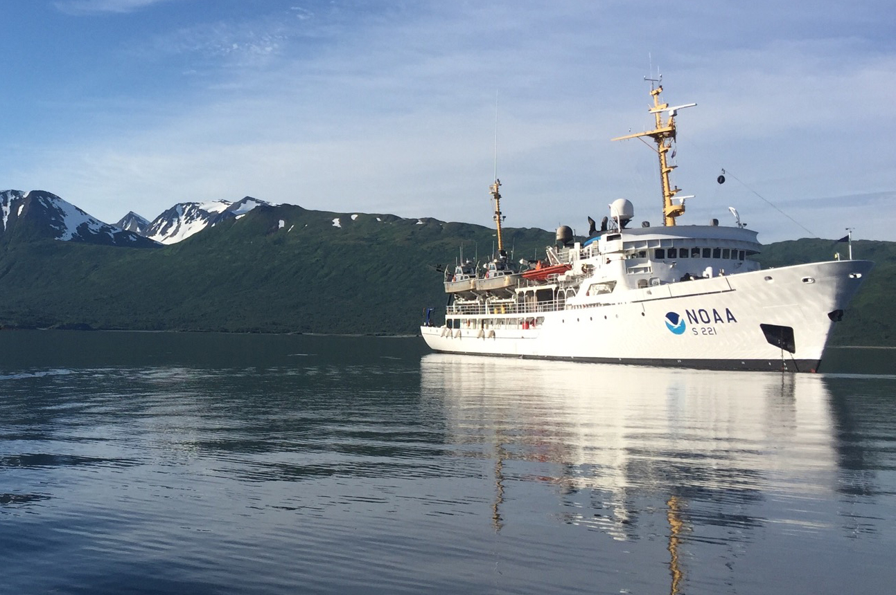
By Ensign Michelle Levano
NOAA Ship Rainier recently arrived in Uganik Bay, off of northwest Kodiak Island, to complete hydrographic survey operations in Uganik Passage and Uganik Bay, including the Northeast Arm, North Arm, and South Arm. Rainier has spent 2013 through 2016 surveying areas around North Kodiak Island, including Kizhuyak Bay, Whale and Afognak Passes, Kupreanof Strait, and Viekoda and Terror Bays. The ship will remain in Uganik Bay until the end of October.

Continue reading “NOAA Ship Rainier surveys Uganik Bay”
NOAA Ship Rainier surveying the waters off Washington
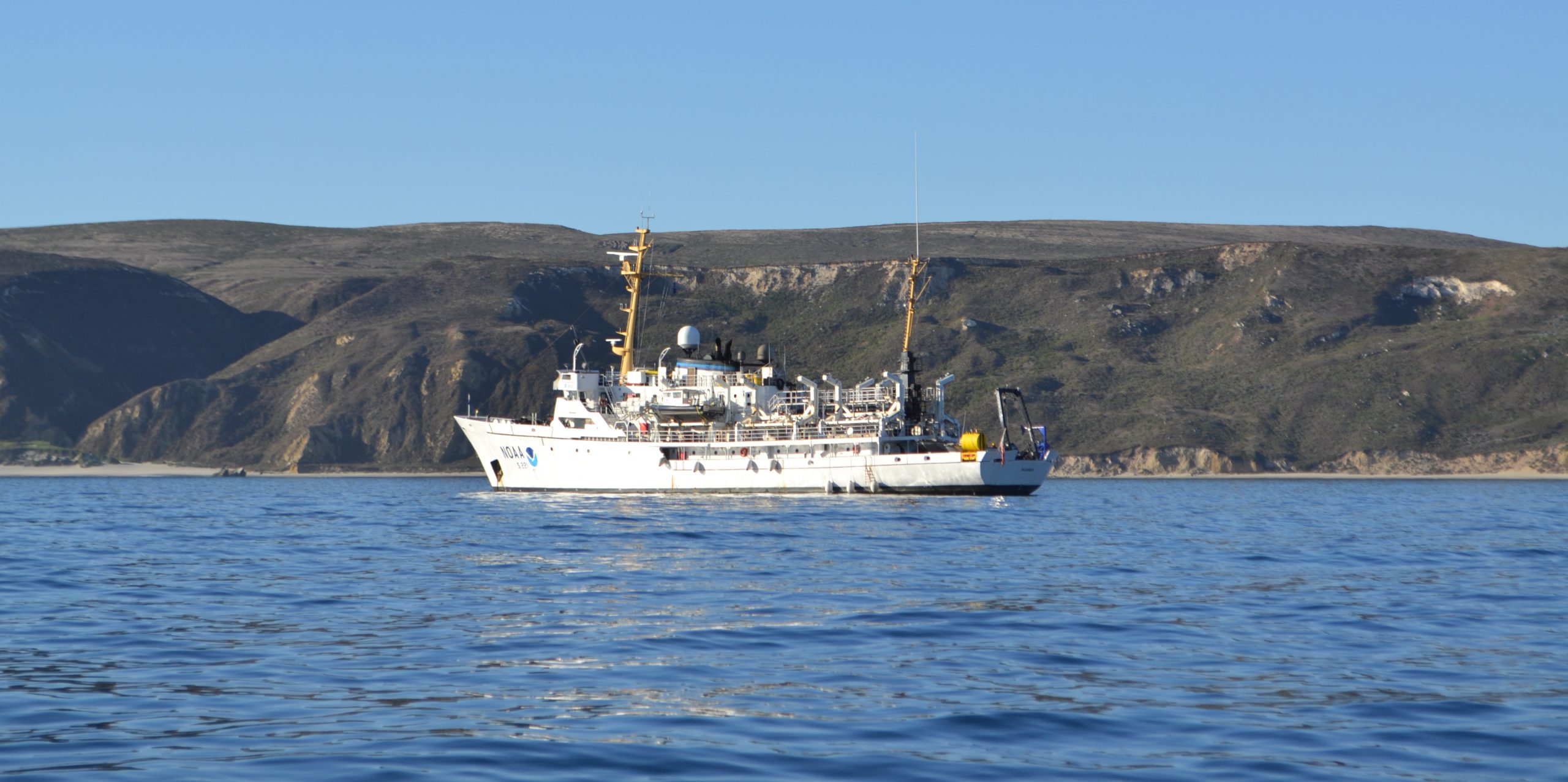
A NOAA ship plying the waters off the coast often inspires public curiosity. This is especially true when boaters and others see the ship or her launches just go back and forth, back and forth, all day. It’s not a surprise, then, that NOAA Ship Rainier’s latest project is generating questions from the areas around Protection Island and Lopez Island, Washington.
Don’t worry, there is no problem! NOAA’s Office of Coast Survey is collecting bathymetric data to update nautical charts that are currently displaying depth measurements acquired from surveys conducted from 1940 to 1969. Survey vessels go back and forth, in a maneuver that is similar to mowing the lawn, as they use multibeam echo sounders to measure the depths and to “see” the ocean floor. If any of the vessels discover a danger to navigation – an uncharted wreck or other obstruction, for instance – Coast Survey will immediately inform the U.S. Coast Guard and the information will be relayed to ships and boaters through a Local Notice to Mariners.
Continue reading “NOAA Ship Rainier surveying the waters off Washington”
Correcting chart discrepancies at Alaska’s Whale Passage
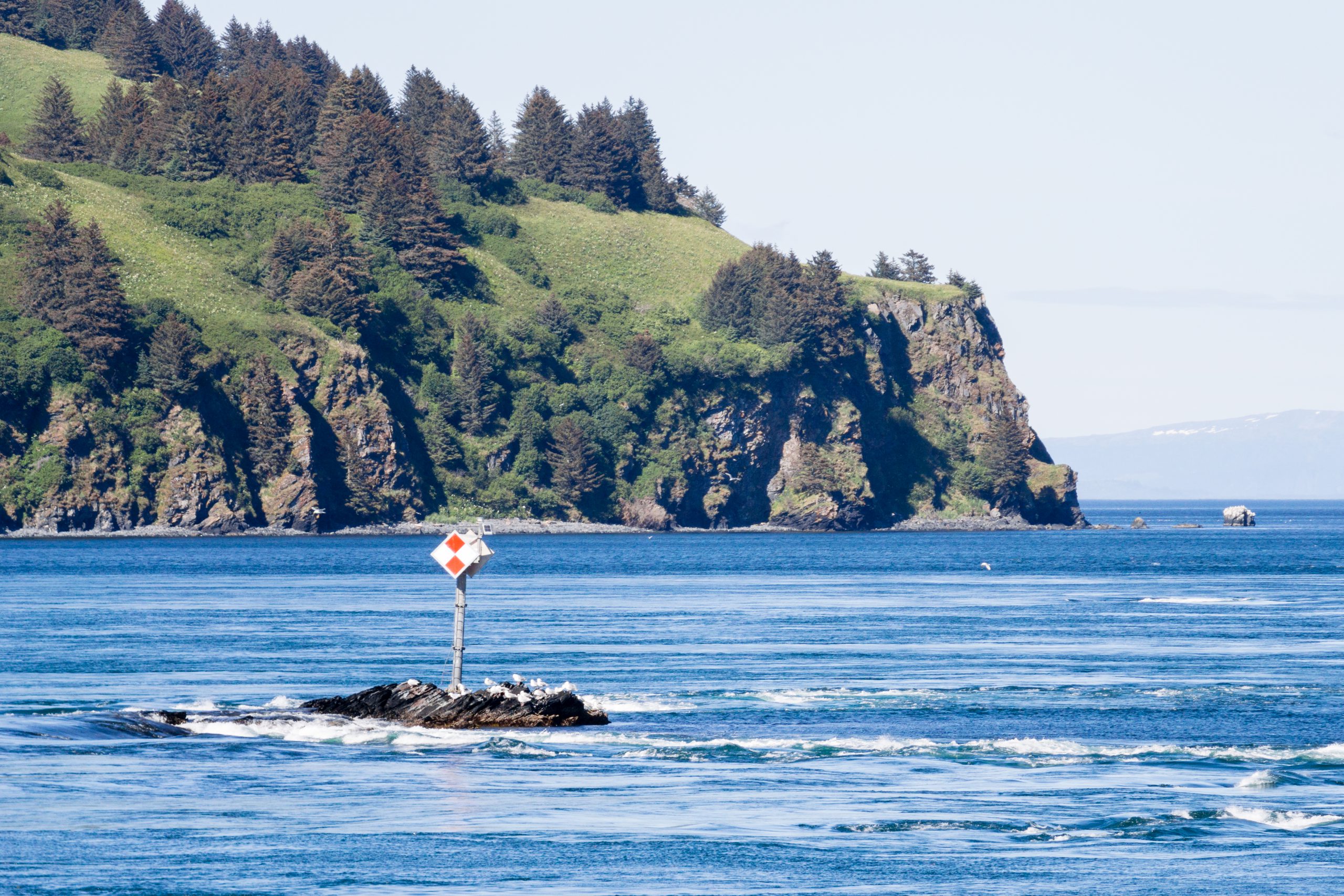
by Ensign Sarah Chappel, NOAA Ship Rainier
NOAA Ship Rainier recently surveyed Whale Passage, which separates Whale Island from Kodiak Island, Alaska. The area has never been surveyed with modern full bottom coverage methods, and some project areas were last surveyed by lead lines around a hundred years ago. The area frequently experiences 7 knot currents, making rocky or shoal areas particularly treacherous. Whale Passage is a high traffic area for fishing vessels, U.S. Coast Guard cutters, barges, ferries, and small boats, which is why updating the area’s nautical charts is so important.
Continue reading “Correcting chart discrepancies at Alaska’s Whale Passage”
NOAA hydro field season underway
The 2014 hydrographic survey season is underway, with the NOAA fleet beginning its projects for this year.
Have you ever wondered how Coast Survey goes about determining where to survey and when? Several considerations go into prioritizing survey plans, which are laid out several years in advance. Coast Survey asks specific questions about each potential survey area.
- Is it considered a critical area? If so, how old are the most current survey data?
- Have local pilots or port authorities submitted reports of shoaling, obstructions or other concerns?
- Does the U.S. Coast Guard or other stakeholders from the maritime community (e.g., fisheries, energy, pipelines) need surveys for economic development or ecological protection?
Coast Survey’s 2014 projects reflect these priorities.
Continue reading “NOAA hydro field season underway”
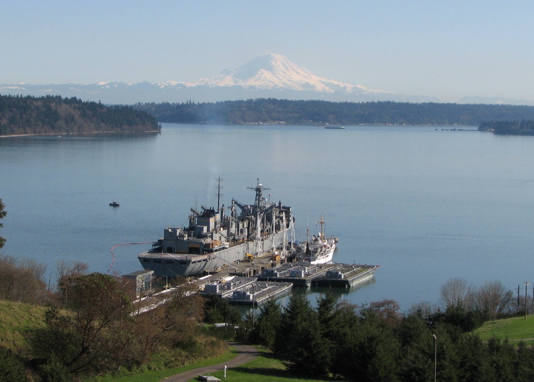
Rainier beauty X 3
NOAA Ship Rainier had the wonderful fortune of cool, clear weather on March 13 as they fueled at the Navy Fuel Depot in Manchester, WA. This provided a clear view of Mount Rainier. However, it is even more rare that you would have three “Rainiers” all in view at once! At the pier you can see USNS RAINIER (on the left side of the pier), NOAA Ship Rainier (on the right side of the pier), and the iconic Mount Rainier in the background. Absolutely beautiful.
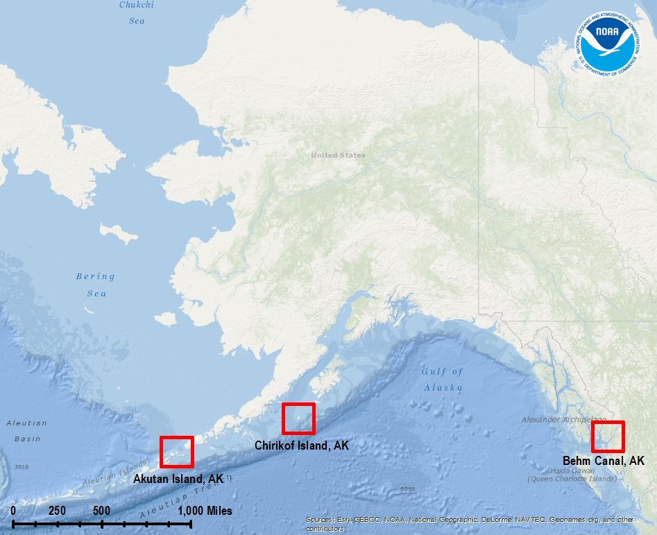
Beyond the charts: geological highlights from NOAA’s 2013 hydrographic field season in Alaska
–By Christy Fandel, Coast Survey physical scientist
Have you ever wondered what lies beneath the charted soundings on a nautical chart? While surveying Alaskan waters during the 2013 hydrographic field season, collecting bathymetry to update NOAA’s nautical charts, hydrographers revealed many interesting geologic features on the seafloor.
NOAA focuses a significant portion of our ocean mapping effort along the Alaskan coast. The Alaskan coastline represents over 50% of the United States coastline and dated nautical charts are inadequate for the increasing vessel traffic in this region. NOAA surveys are essential for providing reliable charts to the area’s commercial shippers, passenger vessels, and fishing fleets.
This past season, NOAA-funded hydrographic surveys in Alaska revealed many interesting geological features on the seafloor. Three surveys, in particular, took place in southeastern Alaska in the Behm Canal, along the Aleutian Chain within the coastal waters surrounding Akutan Island, and around Chirikof Island.
Continue reading “Beyond the charts: geological highlights from NOAA’s 2013 hydrographic field season in Alaska”
NOAA Ship Rainier + enthusiastic students = future hydrographers?
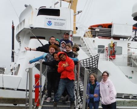
On September 13, NOAA Ship Rainier began surveying Cold Bay, its fourth project of the summer. Cold Bay is a small town on the Aleutian Peninsula approximately 540 miles southwest of Anchorage, Alaska. The town currently has approximately 88 full-time residents and boasts an airport with one of the longest runways in Alaska.
Continue reading “NOAA Ship Rainier + enthusiastic students = future hydrographers?”
A picture is worth a thousand words – about updating Alaska charts
In late May, NOAA Ship Rainier officially started her Chatham Strait hydrographic survey project in southeast Alaska. It’s often difficult to imagine the age of many of the depth measurements depicted on Alaskan charts, but this short animation brings it home.
The older picture is U.S. Coast and Geodetic Survey Steamer Patterson and her steam-powered launch Cosmos, surveying Gut Bay in 1897. (The USC&GS is one of NOAA’s predecessor agencies, and a direct predecessor of the Office of Coast Survey.) We juxtaposed Patterson with the Rainier, who is finally able to update the bathymetry — at the exact same location — 116 years later.
Continue reading “A picture is worth a thousand words – about updating Alaska charts”