This summer, the Coastal and Marine Geology Program of the U.S. Geological Survey (USGS) and NOAA’s Office of Coast Survey together ran an interagency ocean mapping project across several large portions of the Cascadia Margin, offshore of California, Oregon, and Washington states. This collaboration, conducted aboard the NOAA Ship Rainier, used hydrographic surveying equipment to collect swath bathymetry, backscatter intensity data, and full water column data within the project areas. The high-resolution geospatial data acquired will provide key baseline data for targeted USGS studies to improve hazard assessment and forecasting for marine geohazards offshore of northern California, Oregon, and Washington. NOAA will also use the data to update nautical charts for safe navigation in the region.
By Cmdr. Mark Van Waes, former commanding officer of NOAA Ship Fairweather
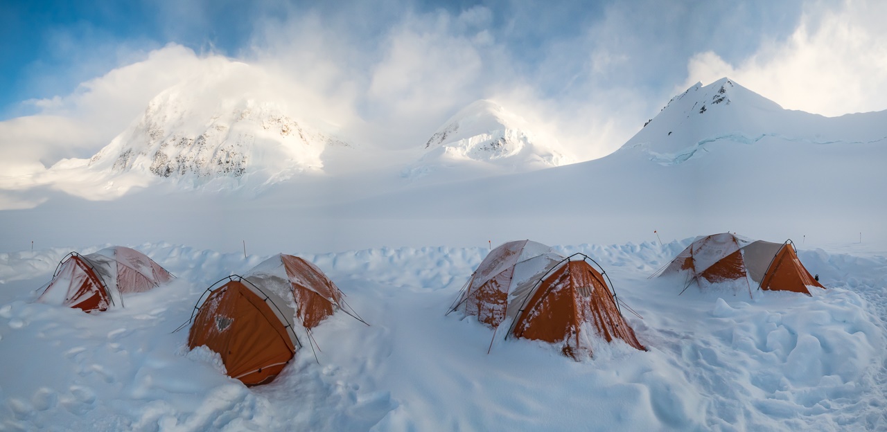
Mount Fairweather stands tall above Glacier Bay National Park and Preserve, dominating the skyline for miles around (when weather permits visibility). Only about 12 miles inshore from the Gulf of Alaska and soaring to 15,325 feet, it is one of the highest coastal peaks in the world.
RA-6 in Elliott Bay, downtown Seattle. Photo Credit: Lt. Andrew Clos
As NOAA Ship Rainier underwent repairs in South Seattle, the ship’s survey launches and their crews carried out a project to update nautical charts around the Port of Everett and its approaches in Possession Sound. The boats used state-of-the-art positioning and multibeam echo sounder systems to achieve full bottom coverage of the seafloor.
The ports of Seattle, Tacoma, and Everett have experienced an increase in vessel traffic and capacity within the last decade. The Port of Everett serves as an international shipping port bringing jobs, trade, and recreational opportunities to the city. Across Possession Sound, Naval Station Everett is the homeport for five guided-missile destroyers, and two U.S. Coast Guard cutters. The data collected from this project will support additional military traffic transiting to and from Naval Submarine Base Bangor in addition to the Washington State Ferries’ Mukilteo/Clinton ferry route, commercial and tribal fishing, and recreational boating in the area. Continue reading “Crew of NOAA Ship Rainier surveys Everett, Washington, to update charts”
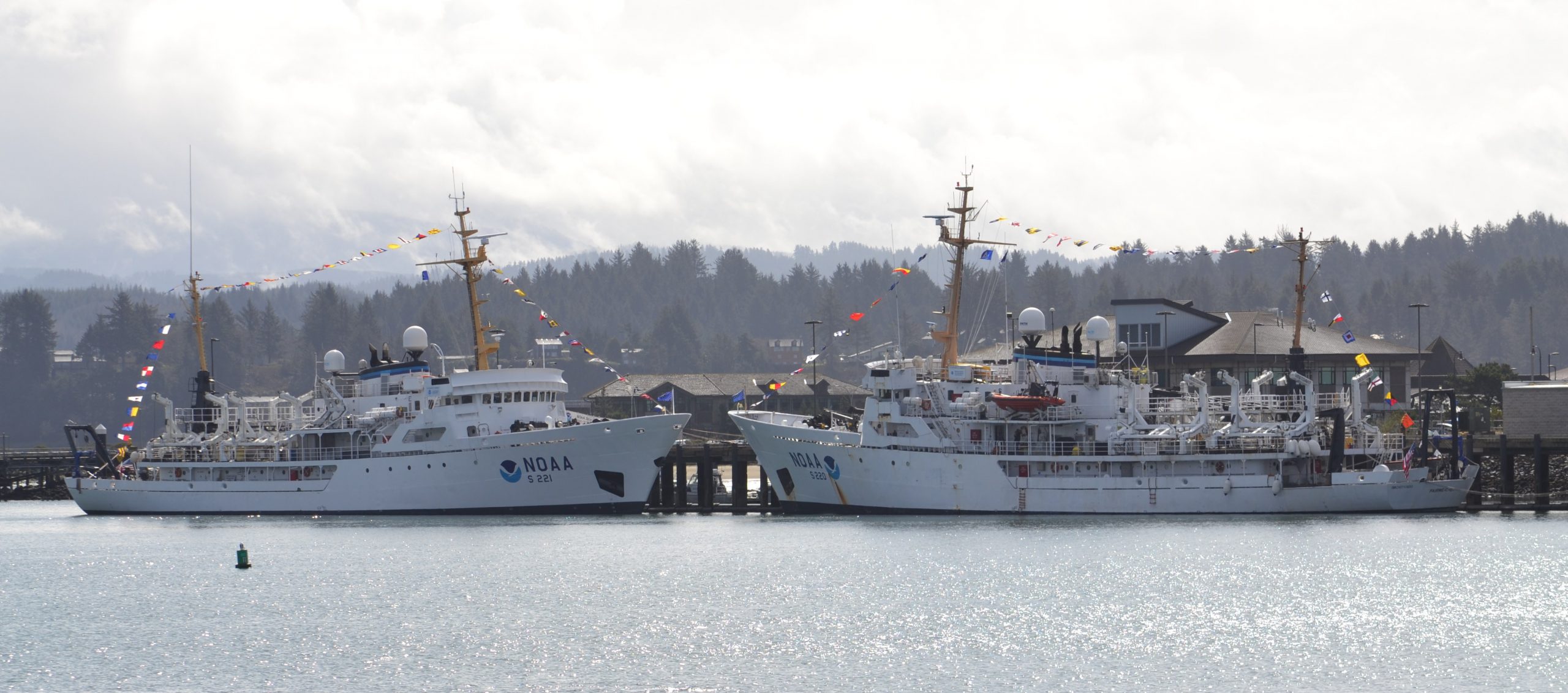
To recognize the successful history of NOAA ships Fairweatherand Rainier, as well as the professional mariners, hydrographers, and commissioned officers who have served aboard these ships for the last 50 years, NOAA hosted a ceremony and public ship tours at the Marine Operations Center – Pacific (MOC-P) in Newport, Oregon.
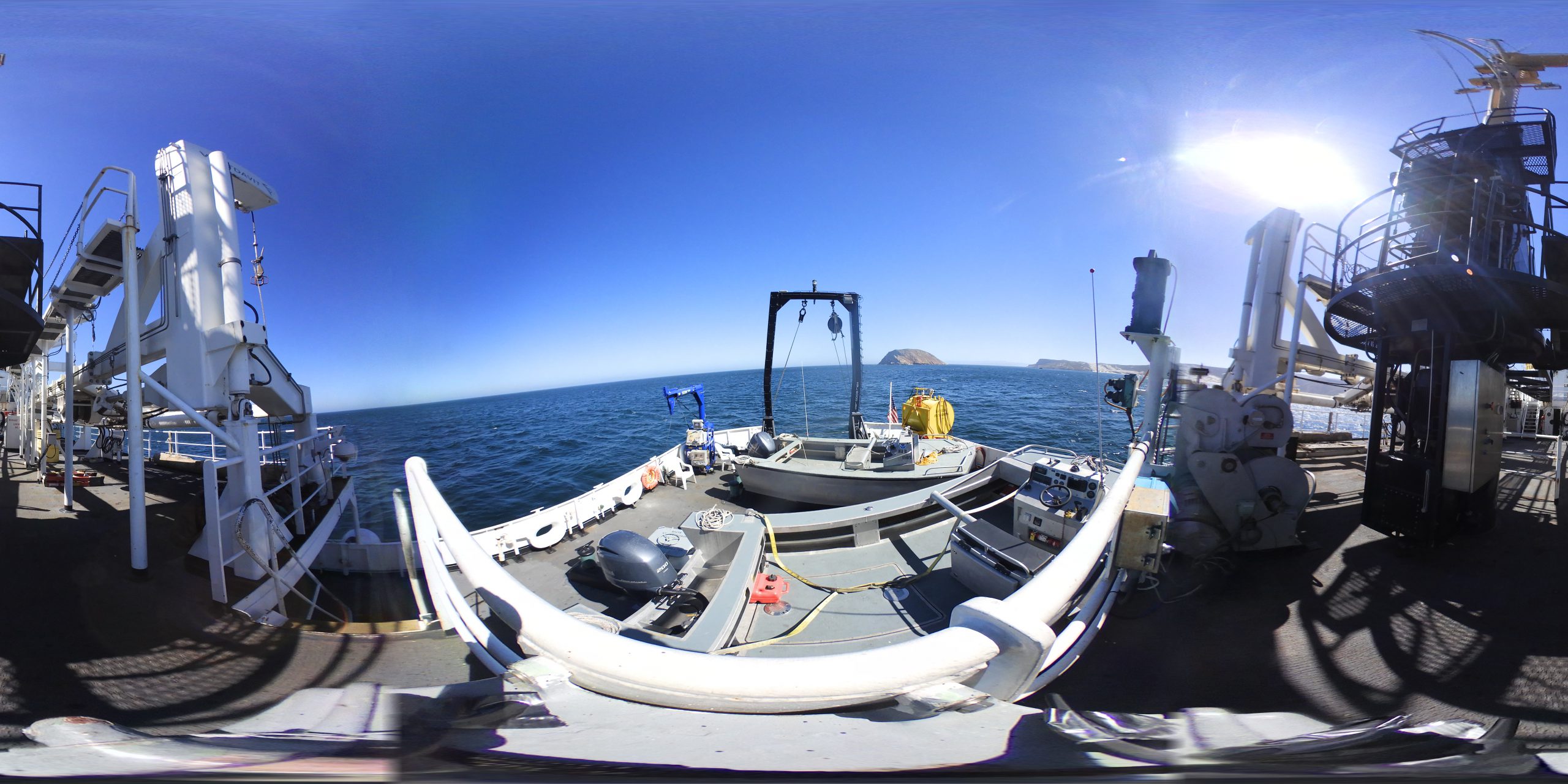
In celebration of 50 years of survey and service to the nation, NOAA ships Rainier and Fairweather—two of NOAA’s hydrographic survey vessels—will be opening their doors and hosting public ship tours. Since we understand that many of you are unable to be in Newport, Oregon, the afternoon of March 22 to take a tour in person, we are bringing the tour to you! The following 20 images offer a 360 degree view of the interior and exterior of NOAA Ship Rainier. The images were taken last field season on the survey operations mission to Channel Islands, California. From the crew mess and engine room to a view from the bow, we have captured it all.
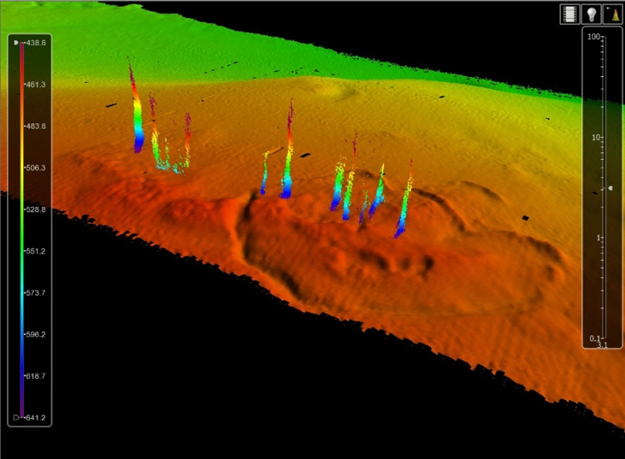
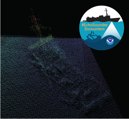
In late spring, while surveying off the coast of Long Island in Kodiak, Alaska, NOAA Ship Rainier found an uncharted shipwreck. Although rocks around the shipwreck were previously charted, this sunken vessel is a new feature. What made the find unique was how the top of wreck’s mast resembled a yellow light at the water’s surface. The Rainier crew fondly nicknamed it “ET’s finger.”
Mast of the sunken vessel found during the survey of Kodiak Island, AK, OPR-P136-RA-17. It was discovered by HAST Michael Bloom while on the NOAA Ship Rainier, in May 2017.
During the survey, Rainier was able to sail close enough to get multibeam echo sounder data over the shipwreck and record a shoal depth.
Multibeam echo sounder data depicting the shipwreck found off the coast of Long Island in Kodiak, Alaska.
Long Island was once the home ofFort Tidball, a World War II coastal fort established in 1941 and abandoned in 1946. NOAA received permission from the Alaska State Historic Preservation Office to share information about this shipwreck and is currently working to identify the ship.
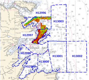
Why is NOAA surveying around Kodiak Island? The area of Chiniak Bay supports the second busiest and third richest fisheries port in Alaska. In 2015, the Port of Kodiak was responsible for 514 million pounds of fish and $138 million of product. Chiniak Bay is the gateway to Kodiak and has a survey vintage of 1933. This area has seen many groundings and near misses due to the number of dangers to navigation and pinnacles that exist in this area. The navigation of this area is further complicated by the number vessels trying to enter and exit the Port of Kodiak via a choke point located at the channel entrance buoy. In recent years, a number of groundings in and around the area have occurred, the most famous being a 174-foot Army landing craft that was outbound to deliver goods to a remote village in western Alaska in 2012.
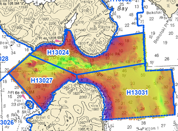
NOAA Ship Rainierhas been diligently surveying Deer Passage in the vicinity of Cold Bay and King Cove, Alaska, for the past month.
This navigationally significant area between Unga Strait and Sanak Island provides the only protected route for vessels transiting between the Gulf of Alaska, the very busy Unimak Passage, and the Bering Sea beyond. Deer Passage is heavily trafficked by fishing vessels, coastal freight traffic, and Alaska Marine Highway System ferries, and serves as an alternate route for deep-draft vessels on Trans-Pacific routes between North America and Asia. While in the area, Rainier observed particularly heavy use of the waterway by vessels engaged in local and Bering Sea fisheries, and towing vessels supporting remote Alaskan communities with barge service.
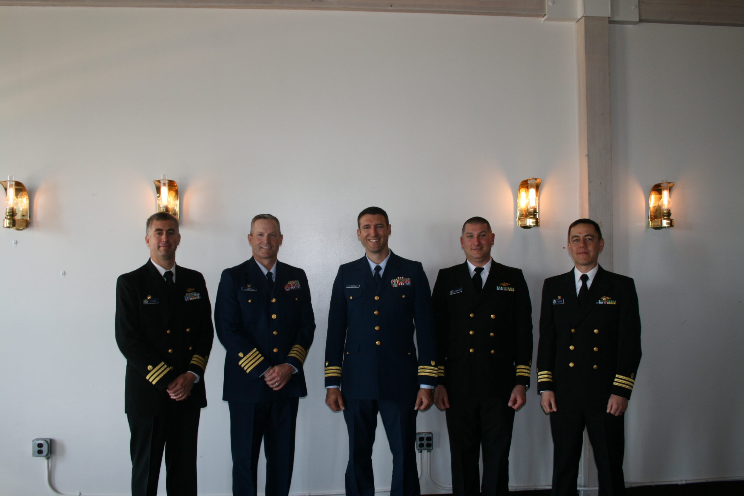
On July 22, 2017, the crew of NOAA Ship Rainier hosted a change of command while at United States Coast Guard Base Kodiak, Alaska.
Commander Benjamin Evans accepted command of Rainier, relieving Commander John Lomnicky in a ceremony led by Captain Keith Roberts, commanding officer of NOAA’s Office of Marine and Aviation Operations (OMAO) Marine Operations Center-Pacific. Distinguished guests included Captain Richard Brennan, chief of NOAA Office of Coast Survey’s Hydrographic Surveys Division, Mr. Greg Kaplan, Military and Veterans Affairs liaison for Senator Lisa Murkowski, Captain Jeffery Good, commanding officer United States Coast Guard (USCG) Base Kodiak, Commander Michael Levine, commanding officer of NOAA Ship Oscar Dyson, and Commander Daniel Rogers, executive officer of United States Coast Guard Base Kodiak. Continue reading “NOAA Ship Rainier holds change of command ceremony”
NOAA Ship Rainier continues hydrographic survey operations in Chiniak Bay, near Kodiak, Alaska. As of June 1, 2017, Rainier and her survey launches have surveyed 2,025 nautical miles in the Spruce Island, Long Island, Middle Bay, Kalsin Bay, Isthmus Bay, and offshore Cape Chiniak areas. The total distance surveyed is about as long as the Mississippi River.
Kodiak Island is the 2nd largest island in the United States; it is part of the Kodiak Island Archipelago, a group of islands roughly the size of Connecticut. Due to the island’s location in the Gulf of Alaska and North Pacific Ocean, Kodiak is ranked as third in commercial fishing ports in the U.S. in terms of value of seafood landed. In 2015, the Port of Kodiak was responsible for 514 million pounds of fish and $138 million of product. More than one-third of the jobs in Kodiak are related to the fishing industry. The Port of Kodiak is home to more than 700 commercial fishing vessels, and has more than 650 boat slips and three commercial piers that can dock vessels up to 1,000 feet. In addition to fishing, Kodiak is the hub of the Gulf of Alaska container logistics system, serving the southwest Alaskan communities with consumer goods and outbound access to the world’s fish markets.