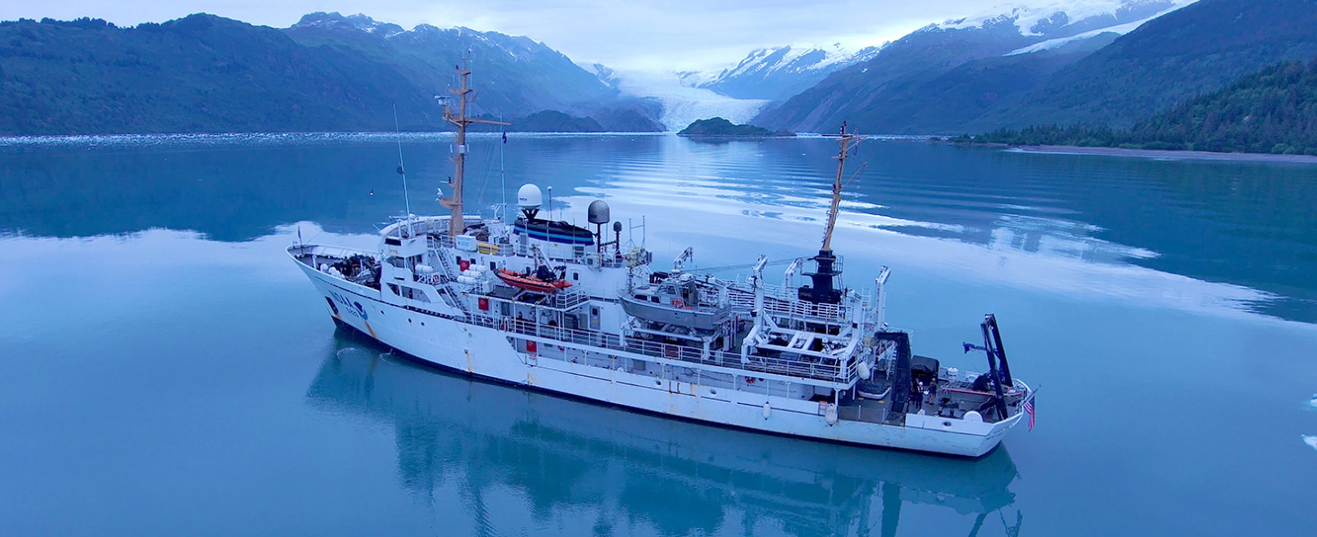
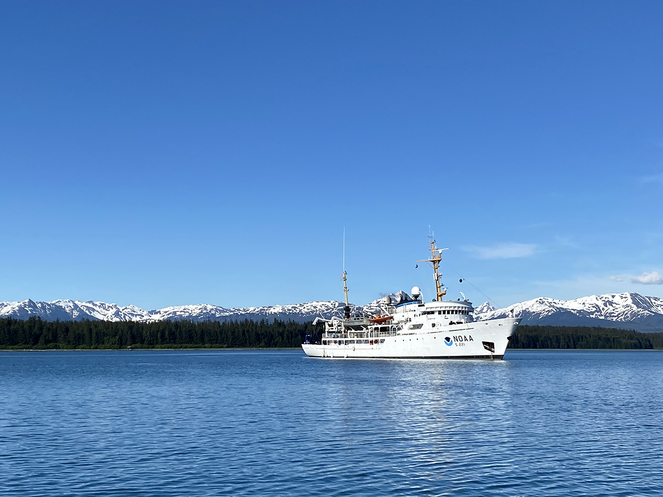
NOAA hydrographic survey ships, navigation response teams, and contractors are preparing for the 2023 hydrographic survey season. The ships and survey vessels collect bathymetric data (i.e. map the seafloor) to support nautical charting, modeling, and research, but also collect other environmental data to support a variety of ecosystem sciences. NOAA considers hydrographic survey requests from stakeholders such as marine pilots, local port authorities, the Coast Guard, and the boating community, and also considers other hydrographic and NOAA science priorities in determining where to survey and when. Visit our “living” ArcGIS StoryMap to find out more about our mapping projects and if a hydrographic vessel will be in your area this year!
Continue reading “NOAA releases 2023 hydrographic survey season plans”NOAA contributes to Empowering Women in Hydrography through at-sea experience, part 1
The Empowering Women in Hydrography project is a global effort led by the International Hydrographic Organization and Canada that seeks to initiate, organize, and track a series of activities and initiatives which will enable more women to participate equitably in the field of hydrography and to assume leadership roles within the hydrographic community. NOAA is contributing to the project via an ‘at-sea experience’ on NOAA hydrographic ships for three women each year over the four year lifespan of the project. After a global call for nominations, three women were selected to join NOAA ships for the 2022 survey season. Sub-Lieutenant Mercy Modupe Ogungbamila from the Nigerian Navy joined NOAA Ship Rainier from July 5 to 15, 2022 while surveying from Guam to Saipan.
Continue reading “NOAA contributes to Empowering Women in Hydrography through at-sea experience, part 1”NOAA ocean mapping and reef surveys in the Mariana Islands
On March 26, NOAA Ship Rainier set sail from Honolulu, Hawaii on a 3,307-nautical mile expedition to the Western Pacific. Originally planned for 2020, this will be the ship’s first multidisciplinary expedition to Guam and the Commonwealth of the Northern Mariana Islands. This collaborative mission between NOAA’s National Ocean Service and National Marine Fisheries Service will deliver high‐quality data, data products, and tools to the region including a seamless map linking hilltops to underwater depths and integrated data on the surrounding coral reef ecosystems. These data can provide information for countless users to make critical management decisions within disciplines such as habitat management and restoration, tsunami modeling, monitoring, and marine resource management.
Continue reading “NOAA ocean mapping and reef surveys in the Mariana Islands”
NOAA releases 2022 hydrographic survey season plans
NOAA hydrographic survey ships and contractors are preparing for the 2022 hydrographic survey season in U.S. coastal waters and beyond. The ships collect bathymetric data (i.e. map the seafloor) to support nautical charting, modeling, and research, but also collect other environmental data to support a variety of ecosystem sciences. NOAA considers hydrographic survey requests from stakeholders such as marine pilots, local port authorities, the Coast Guard, and the boating community, and also considers other hydrographic and NOAA science priorities in determining where to survey and when. Visit our “living” story map to find out more about our mapping projects and if a hydrographic vessel will be in your area this year!
Continue reading “NOAA releases 2022 hydrographic survey season plans”Deep fiords and hydrographic history in Glacier Bay National Park
By Ensign Alice Beittel and Ensign Karl Wagner
Throughout the spring and summer of 2021, NOAA Ship Rainier surveyed numerous bays and inlets of Alaska’s Glacier Bay National Park and Preserve. As one of the largest national wilderness systems and a United Nations designated World Heritage Site, Glacier Bay National Park includes over 2.7 million acres of marine, terrestrial, and freshwater ecosystems. This dynamic landscape is a living example of a never-ending cycle of geological and ecological change and adaptation. With up to 20-foot tide ranges, seasonal migrations of humpback whales and salmon, and glaciers in flux, the resilient ecosystem attracts millions of visitors each year. This year, Rainier surveyed the Beardslee Islands, Geikie Inlet, Berg Bay, Muir Inlet, Bartlett Cove, Pleasant Island, Taylor Bay, and Dundas Bay. Each survey area revealing several changes in seafloor bathymetry and bottom type. High-resolution seafloor bathymetry will be used to update nautical charts for safe navigation and serve as baseline data to support further research of this culturally and ecologically significant marine environment.
Continue reading “Deep fiords and hydrographic history in Glacier Bay National Park”New hydrographic surveying matching fund announced
Update (2/19/21) – Notes and slides from the January 28, 2021, webinar on the NOAA Coast Survey Matching Fund Opportunity are now available.
NOAA’s Office of Coast Survey recently announced a new pilot program for a Hydrographic Surveying Matching Fund opportunity through a Federal Register Notice. The purpose of this notice is to encourage non-federal entities to partner with NOAA on jointly-funded hydrographic surveying, mapping, and related activities of mutual interest. The pilot program relates directly to Coast Survey’s Ocean Mapping Plan and a goal to expand U.S. EEZ mapping by also expanding use of Coast Survey’s hydrographic services contract vehicle.
Continue reading “New hydrographic surveying matching fund announced”NOAA Coast Survey’s new strategy supports charting mandates and broader seafloor mapping
This week, NOAA’s Office of Coast Survey released the Mapping U.S. Marine and Great Lakes Waters: Office of Coast Survey Contributions to a National Ocean Mapping Strategy. This report is part of NOAA’s ongoing commitment to meet core surveying and nautical charting mandates while supporting broader needs to fill gaps in seafloor mapping and environmental sciences.
Continue reading “NOAA Coast Survey’s new strategy supports charting mandates and broader seafloor mapping”Capturing scenes from hydrographic surveying
There are many benefits to working on a hydrographic survey project for NOAA’s Office of Coast Survey. Some would say having the opportunity to visit amazing landscapes, work with talented people, and collect important environmental data are just a few of them. Recently, Coast Survey’s Hydrographic Surveys Division hosted an internal photo contest inviting employees and contractors to submit images in the categories of Ships and Boats, Landscapes, People, and Data. On this Earth Day 2020, we thought we would share our contest winners with you.
Continue reading “Capturing scenes from hydrographic surveying”NOAA ship readies for historic deployment to the Western Pacific to map the oceans
In three weeks, NOAA Ship Rainier will depart on the farthest journey of its 52-year history as it embarks on a multidisciplinary mapping trip to the Western Pacific. Rainier and a diverse team of scientists on board will map the waters from shore to almost 2000 meters deep around Guam and the Commonwealth of the Northern Mariana Islands including Saipan, Rota, and Tinian. The data and observations collected will support safe navigation, coral habitat and fisheries conservation, and storm surge and tsunamis modeling. The data will also be made available to those at the local level and contribute to the larger national and global initiatives regarding comprehensive seafloor mapping.
Continue reading “NOAA ship readies for historic deployment to the Western Pacific to map the oceans”NOAA releases 2020 hydrographic survey season plans
NOAA hydrographic survey ships and contractors are preparing for the 2020 hydrographic survey season. The ships collect bathymetric data (i.e. map the seafloor) to support nautical charting, modeling, and research, but also collect other environmental data to support a variety of ecosystem sciences. NOAA considers hydrographic survey requests from stakeholders such as marine pilots, local port authorities, the Coast Guard, and the boating community, and also consider other hydrographic and NOAA science priorities in determining where to survey and when. Visit our “living” story map to find out more about our mapping projects and if a hydrographic vessel will be in your area this year!
Continue reading “NOAA releases 2020 hydrographic survey season plans”