
On September 13, NOAA Ship Rainier began surveying Cold Bay, its fourth project of the summer. Cold Bay is a small town on the Aleutian Peninsula approximately 540 miles southwest of Anchorage, Alaska. The town currently has approximately 88 full-time residents and boasts an airport with one of the longest runways in Alaska.
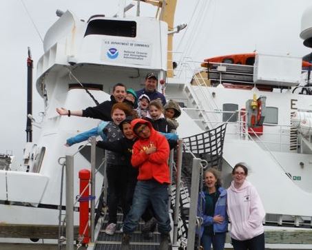
On September 19, after deploying her launches for the day, officers and crew welcomed aboard the entire Cold Bay Elementary School – all eight students, teaching assistant Mrs. Lyons, and their teacher, Mrs. Burkhardt. The students are currently between fourth and seventh grade and go to school in a state-of-the-art, two-room school-house.
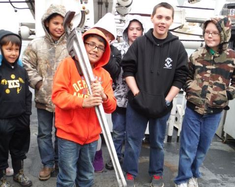
During the tour, the students learned about driving the ship and making nautical charts. They saw how sonars work, and they even used a sediment sampler to determine the seafloor composition.
The students were full of questions and enjoyed learning about life on a ship. They also captured the admiration of Rainier‘s commanding officer. “When Cold Bay residents describe their town, they can also boast of wonderful elementary school students who have a desire to explore new things,” explained Cmdr. Rick Brennan. “One of the great things about working on a NOAA ship is the opportunity to meet students like this. Combining our love of the sea with their enthusiasm for learning — that’s where America’s future hydrography starts.”


- Cmdr. Brennan with friends — and potential future hydrographers.

When I was in Cold Bay in September 1965, as part of a four-pronged effort to perform geodetic reconnaissance (Point Barrow, St. Lawrence Island [Nome], Cold Bay, and Shemya) to establish piers for mounting the BC-4 camera for satellite triangulation (North American and world-wide network of stations) for that upcoming winter’s occupation, I found that of the total population of that place (cannot remember the number, off hand) 100% of the adults were employed in one way or the other by the federal government. As I was dependent (as a party of one) on hiring local help to assist with mixing cement, pouring the cement to form five foot piers (I carried the form and requisite bolts to tie down the camera support to the pier), this presented a bit of a dilemma as it was not “legal” to hire another government employee to perform such work.
This was the year of the formation of USESSA, a folding together of the USC&GS, the U.S. Weather Bureau and a portion of the Bureau of Standards in Boulder, CO. The solution to this enigma came through my liaison with the Chief Observer for the Cold Bay Weather Bureau station when I learned that he had a teen-age son who was more than pleased to pick up a few bucks by assisting me with that task. I wonder what percentage of adults today work for the U.S, Government in that place?