NOAA Ship Thomas Jefferson successfully tests new wireless system that aids remote vessel operation

By Lt. Charles Wisotzkey, NOAA

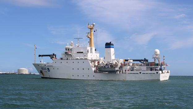
NOAA Ship Thomas Jefferson successfully tested a new wireless networking system while working in the Approaches to Houston/Galveston and around Puerto Rico during the 2018 field season. This new system connects the ship and its two hydrographic survey launches, providing a level of wireless connectivity previously unobtainable with traditional wireless communications systems. NOAA anticipates this will increase unmanned system productivity while conducting hydrographic surveys. Continue reading “NOAA Ship Thomas Jefferson successfully tests new wireless system that aids remote vessel operation”

NOAA Ship Thomas Jefferson presents survey work to Puerto Rico South Coast stakeholders

By Cmdr. Chris van Westendorp, Commanding Officer of NOAA Ship Thomas Jefferson

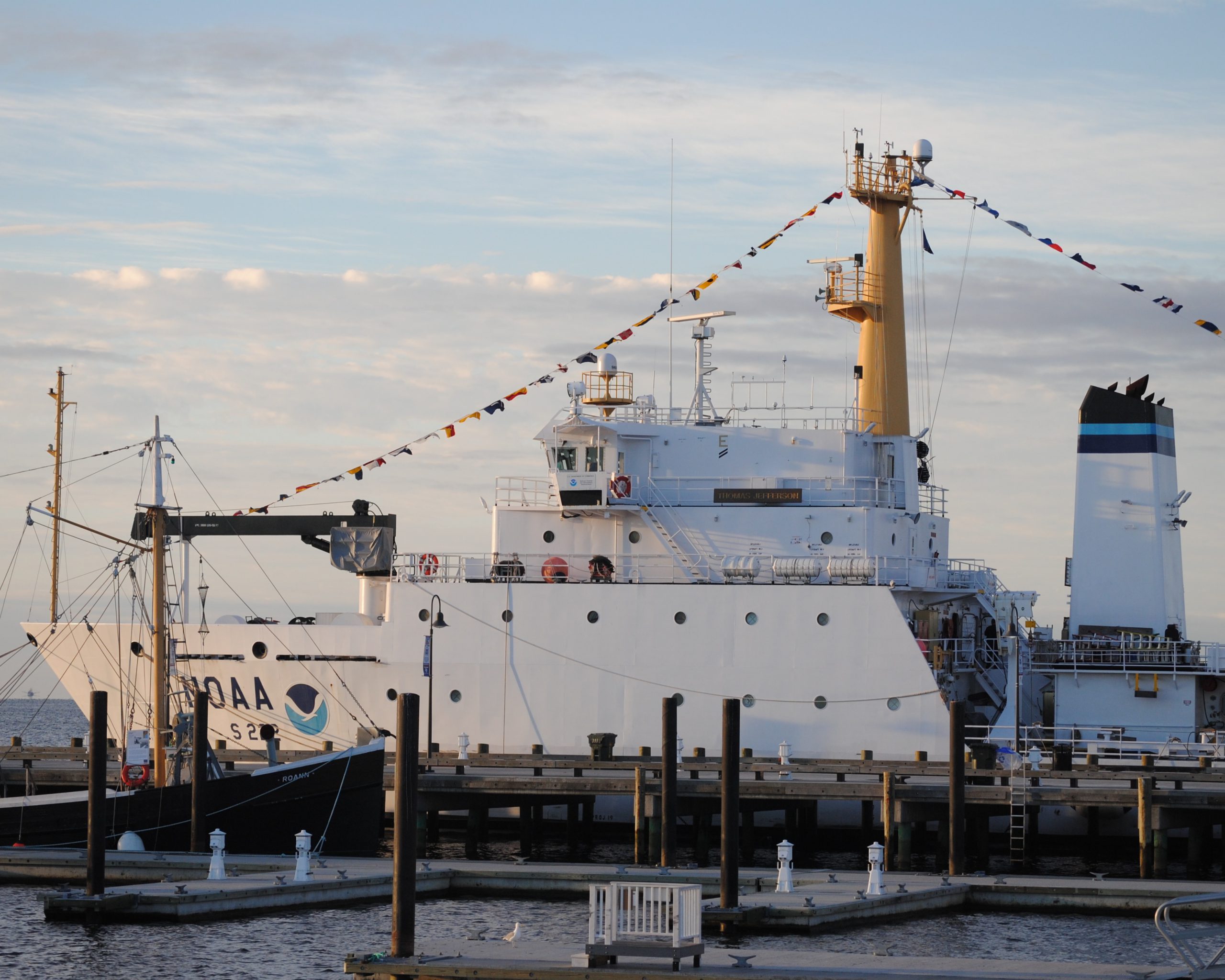
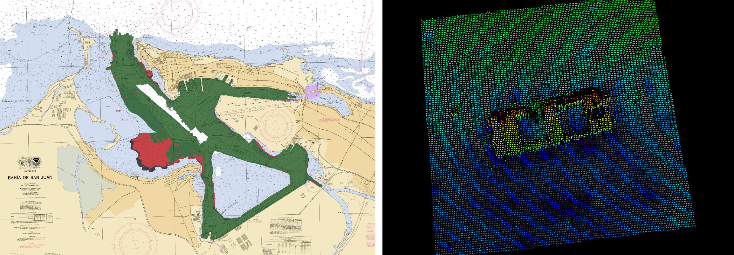
Almost one year following the passage and destruction of Hurricane Maria, NOAA Ship Thomas Jefferson has returned to Puerto Rico. Following the storm, Thomas Jefferson deployed in September 2017 for hydrographic hurricane response work in Puerto Rico and the U.S. Virgin Islands (PR/USVI). The ship and crew surveyed 18 individual port facilities to ensure safety of navigation and help re-open the region for maritime commerce. Thomas Jefferson’s second major project of 2018 has brought the ship back to Puerto Rico from August to November, conducting follow-up survey work along the north and south coasts. Continue reading “NOAA Ship Thomas Jefferson presents survey work to Puerto Rico South Coast stakeholders”

NOAA Office of Coast Survey wraps up a busy 2017 hurricane season

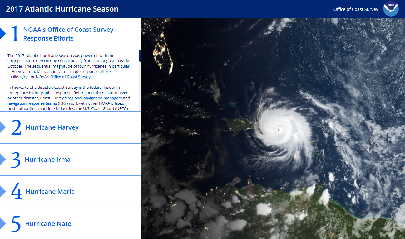
The 2017 Atlantic hurricane season was powerful, with the strongest storms occurring consecutively from late August to early October. The sequential magnitude of four hurricanes in particular—Harvey, Irma, Maria, and Nate—made response efforts challenging for NOAA’s Office of Coast Survey. Coast Survey summarized this season’s response efforts along with the efforts of NOAA Ship Thomas Jefferson (operated by NOAA’s Office of Marine and Aviation Operations) in the following story map. Continue reading “NOAA Office of Coast Survey wraps up a busy 2017 hurricane season”

NOAA releases 2017 hydrographic survey season plans

NOAA’s Office of Coast Survey maintains the nautical charts and publications for U.S. coasts and the Great Lakes. This is over a thousand charts covering 95,000 miles of shoreline and 3.4 million square nautical miles of waters. Measuring depths and determining new dangers to navigation in this large area is a monumental job given the seafloor is constantly changing.
One of NOAA Coast Survey’s biggest tasks during the winter months is to plan hydrographic survey projects for the coming field season. Survey planners consider requests from stakeholders such as marine pilots, local port authorities, the Coast Guard, and the boating community, and also consider other hydrographic priorities in determining where to survey and when. Continue reading “NOAA releases 2017 hydrographic survey season plans”

Nigerian naval officer augments on NOAA survey ship

by Ensign Kaitlyn Seberger, Junior Officer, NOAA Ship Thomas Jefferson
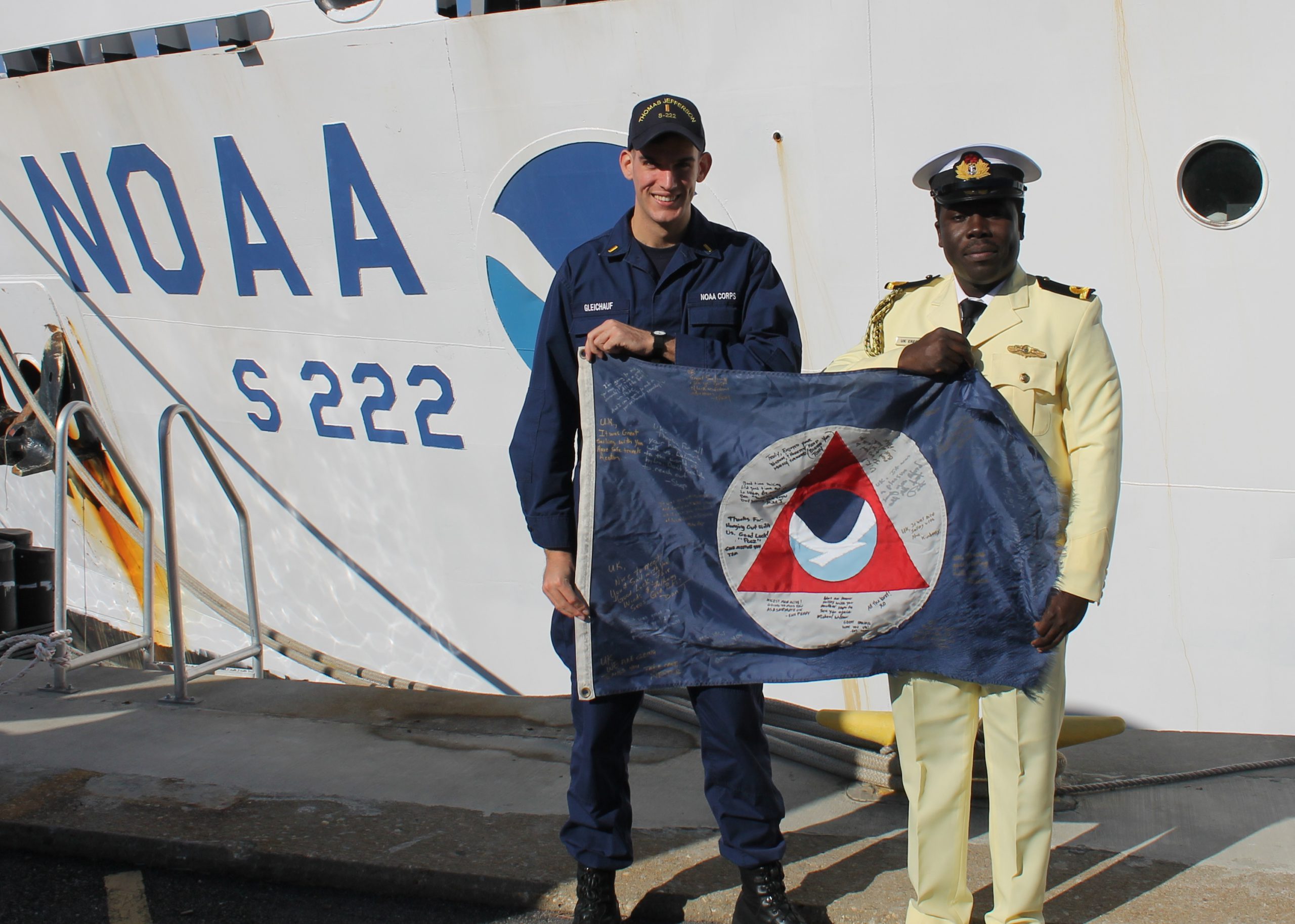
This fall, NOAA Ship Thomas Jefferson has had the pleasure of hosting Sub-Lieutenant Uchechukwu Erege. Sub-Lieutenant Erege, known to the ship’s crew as “UK,” is a hydrographer in the Nigerian Navy Hydrographic Office. The Nigerian Navy Hydrographic Office is the national hydrographic authority for the country and is responsible for conducting hydrographic surveys in territorial waters, ensuring nautical charts are up-to-date, processing bathymetric data, and providing Notice to Mariners for hazards to navigation.
UK joined the Nigerian Navy in 2012 after graduating with distinction from the University of Lagos with a bachelor’s and master’s degree in geoinformatics. He then completed a 10-month training program at the Nigerian Defense Academy before transitioning to his current position in the hydrography branch.
Continue reading “Nigerian naval officer augments on NOAA survey ship”

NOAA Ship Thomas Jefferson celebrates survey success with maritime community

NOAA Ship Thomas Jefferson

by Ensign Diane Perry, onboard NOAA Ship Thomas Jefferson
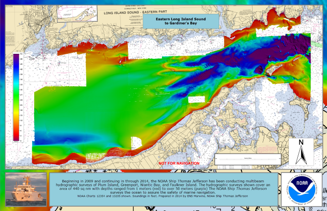
From 2005 through today, NOAA Ship Thomas Jefferson has been surveying Long Island Sound, one project area at a time. Some of the area was last surveyed between the late 1800s and 1939. For the 2014 field season, Thomas Jefferson was assigned her final Long Island Sound project, 89 square nautical miles of Eastern Long Island Sound, Fisher Island Sound, and Western Block Island Sound. When this project is complete, we will have resurveyed over 95% of Long Island Sound and all of Block Island Sound with modern survey technology that allows for a complete picture of the seafloor and highly accurate soundings.

This image depicts Thomas Jefferson's bathymetry from eastern Long Island Sound to Gardiner's Bay.
This image depicts Thomas Jefferson‘s bathymetry from eastern Long Island Sound to Gardiner’s Bay.

Continue reading “NOAA Ship Thomas Jefferson celebrates survey success with maritime community”

NOAA hydro field season underway

The 2014 hydrographic survey season is underway, with the NOAA fleet beginning its projects for this year.
Have you ever wondered how Coast Survey goes about determining where to survey and when? Several considerations go into prioritizing survey plans, which are laid out several years in advance. Coast Survey asks specific questions about each potential survey area.

  • Is it considered a critical area? If so, how old are the most current survey data?
  • Have local pilots or port authorities submitted reports of shoaling, obstructions or other concerns?
  • Does the U.S. Coast Guard or other stakeholders from the maritime community (e.g., fisheries, energy, pipelines) need surveys for economic development or ecological protection?

Coast Survey’s 2014 projects reflect these priorities.
Continue reading “NOAA hydro field season underway”

NOAA observes World Hydrography Day by honoring lost crew members of the Robert J. Walker

Today, June 21, is World Hydrography Day. Hydrographic offices in over 80 maritime nations observe this day every year, since 2005. It is our special day to tell the public what hydrography is, and how it is employed to make navigation safer. Simply, hydrography is the science we use to obtain the data needed to create nautical charts. NOAA’s 200-year history is proof positive that those charts – and therefore hydrography – are a national investment that pays off daily with navigation safety, efficiency, and coastal protection from accidents at sea.
But today’s observation of World Hydrography Day is more profound. It is personal to every person who works in or supports hydrography in the United States.
Continue reading “NOAA observes World Hydrography Day by honoring lost crew members of the Robert J. Walker”

NOAA hydro survey season underway

Spring is always a noteworthy time at Coast Survey, as the hydrographic season gets underway. This year is no exception, with some neat projects ahead.
On the East Coast, NOAA Ship Thomas Jefferson continues her work with the multi-state, multi-agency Long Island Sound Seafloor Mapping Initiative, as well as acquiring data over 87 square nautical miles in the approaches to New York to update nautical charts. In June, Thomas Jefferson begins some of her summer-long extensive 2013 post-Sandy surveys in Delaware Bay (supported by Title X, Chapter 2, of H.R. 152, the Disaster Relief Appropriations Act, 2013).
As our newest survey vessel, NOAA Ship Ferdinand Hassler, prepares for a long survey career, the crew is taking her through final repairs, upgrades, training, and inspection this spring. If all goes well, Hassler will then survey approaches to Chesapeake Bay in July, before heading to her new homeport in New Castle, New Hampshire. Once there, Hassler plans to survey approaches to New Hampshire and conduct some tests and evaluations of a new autonomous underwater vehicle (AUV) for surveying.
Continue reading “NOAA hydro survey season underway”

NOAA Ship Thomas Jefferson prepared for 2013 survey season

By Ensign Brittany Anderson, Junior Officer, NOAA Ship Thomas Jefferson
After a quiet winter at home port, the NOAA Ship Thomas Jefferson completed her sea trials this week in preparation for the 2013 field season.
Each year, prior to departing for working grounds, the Thomas Jefferson transits to the Chesapeake Bay to perform tests on the ship’s and launches’ systems and hydrographic survey equipment. Crews conduct numerous tests to check the accuracy and precision of multibeam echosounders, side scan sonar, and the sophisticated suite of programs that process all the data. Additionally, this is an opportunity to ensure the safety of the vessel and her crew by performing numerous safety drills and readdressing safety standards and operating procedures.

Screen grab of sonar images
This is a screen capture of the simultaneous multibeam and side scan coverage of an obstruction used to verify the NOAA Ship Thomas Jefferson’s imaging and bathymetric sonars.

Continue reading “NOAA Ship Thomas Jefferson prepared for 2013 survey season”